File:Longwang 2005-09-27 0350Z.jpg
来自Wikimedia Commons
跳转到导航
跳转到搜索

本预览的尺寸:600 × 600像素。 其他分辨率:240 × 240像素 | 480 × 480像素 | 768 × 768像素 | 1,024 × 1,024像素 | 2,048 × 2,048像素 | 5,000 × 5,000像素。
原始文件 (5,000 × 5,000像素,文件大小:4.21 MB,MIME类型:image/jpeg)
文件信息
结构化数据
说明
说明
添加一行文字以描述该文件所表现的内容
摘要[编辑]
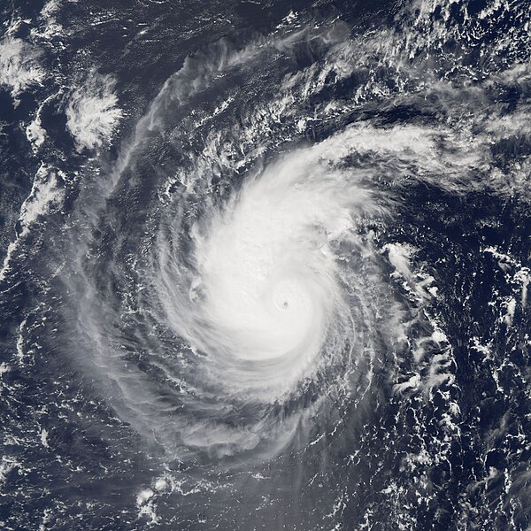
| 描述Longwang 2005-09-27 0350Z.jpg | Typhoon Longwang was a small but well-organized and powerful storm system when the Moderate Resolution Imaging Spectroradiometer (MODIS) on NASA’s Aqua satellite captured this image at 12:50 p.m. local time, on September 27, 2005. At the time of this MODIS observation, Longwang was 1,000 kilometers (600 miles) from Saipan in the Northern Mariana Islands, and well away from any significant land mass. It was travelling roughly westward towards the Chinese coast on a track that would take it through the southern fringe of the Japanese islands. Typhoon Longwang had sustained winds of 180 kilometers per hour (115 miles per hour) near the storm’s center, and it was projected to become significantly stronger in the following days. | ||||||
| 日期 | |||||||
| 来源 | http://earthobservatory.nasa.gov/NaturalHazards/natural_hazards_v2.php3?img_id=13164 | ||||||
| 作者 | NASA image created by Jesse Allen, Earth Observatory, using data courtesy of the MODIS Rapid Response team. | ||||||
| 授权 (二次使用本文件) |
|
文件历史
点击某个日期/时间查看对应时刻的文件。
| 日期/时间 | 缩略图 | 大小 | 用户 | 备注 | |
|---|---|---|---|---|---|
| 当前 | 2006年11月19日 (日) 16:31 |  | 5,000 × 5,000(4.21 MB) | Good kitty(留言 | 贡献) | == Summary == {{Information |Description=Typhoon Longwang was a small but well-organized and powerful storm system when the Moderate Resolution Imaging Spectroradiometer (MODIS) on NASA’s Aqua satellite captured this image at 12:50 p.m. local time, on S |
您不可以覆盖此文件。
文件用途
以下页面使用本文件:

