File:Lower Mainland of British Columbia, 2012.jpg
跳转到导航
跳转到搜索

本预览的尺寸:800 × 419像素。 其他分辨率:320 × 168像素 | 640 × 335像素 | 1,024 × 536像素 | 1,280 × 670像素 | 2,560 × 1,341像素 | 4,200 × 2,200像素。
原始文件 (4,200 × 2,200像素,文件大小:3.01 MB,MIME类型:image/jpeg)
说明
说明
添加一行文字以描述该文件所表现的内容
BC's southern region
摘要
[编辑]
| 描述 |
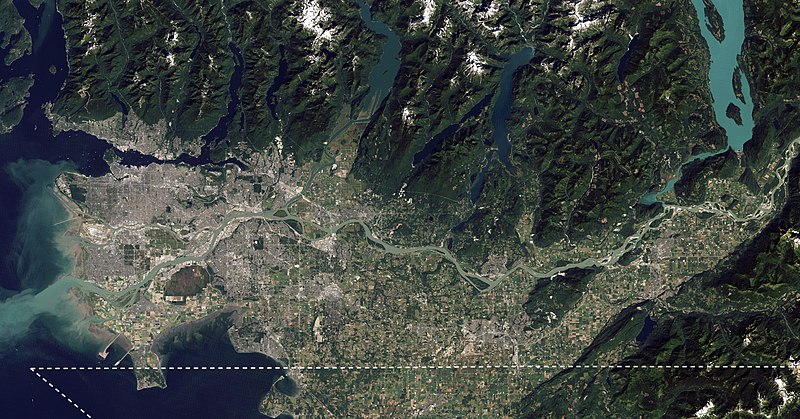
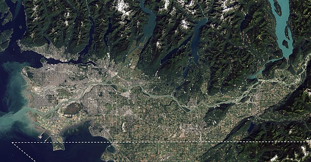
English: I took NASA's beautiful satellite image of the Fraser Lowland from 2012 and cropped into the core area of the Lower Mainland. I also added an approximate Canada-US border line meant for visual reference. This image is meant to replace an older satellite image that outlining the Lower Mainland in red. |
| 日期 | |
| 来源 | The Big Muddy, Western Edition |
| 作者 | NASA Goddard Space Flight Center from Greenbelt, MD, USA |
| 其他版本 |
.jpg) |
许可协议
[编辑]
| This image, originally posted to Flickr, was reviewed on 6 September 2020 by the administrator or reviewer Leoboudv, who confirmed that it was available on Flickr under the stated license on that date. |
| 注解 | 该图片含有注解:在维基媒体共享资源上查看注解 |
文件历史
点击某个日期/时间查看对应时刻的文件。
| 日期/时间 | 缩略图 | 大小 | 用户 | 备注 | |
|---|---|---|---|---|---|
| 当前 | 2020年9月4日 (五) 23:14 | | 4,200 × 2,200(3.01 MB) | Ponderosapine210(留言 | 贡献) | Uploaded a work by [https://www.flickr.com/people/24662369@N07 NASA Goddard Space Flight Center] from Greenbelt, MD, USA from [https://www.flickr.com/photos/gsfc/6987590721/ The Big Muddy, Western Edition] with UploadWizard |
您不可以覆盖此文件。
文件用途
以下3个页面使用本文件:
全域文件用途
以下其他wiki使用此文件:
- ca.wikipedia.org上的用途
- en.wikipedia.org上的用途
- eo.wikipedia.org上的用途
- es.wikipedia.org上的用途
- fa.wikipedia.org上的用途
- fy.wikipedia.org上的用途
- it.wikivoyage.org上的用途
- te.wikipedia.org上的用途
- uk.wikipedia.org上的用途
- www.wikidata.org上的用途
- zh.wikipedia.org上的用途