File:Luftbild Flugplatz Weimar-Lindenberg um 1919.jpg
Jump to navigation
Jump to search
Size of this preview: 800 × 555 pixels. Other resolutions: 320 × 222 pixels | 640 × 444 pixels | 1,024 × 711 pixels | 1,280 × 888 pixels | 2,560 × 1,776 pixels | 3,995 × 2,772 pixels.
Original file (3,995 × 2,772 pixels, file size: 6.23 MB, MIME type: image/jpeg)
Captions
Captions
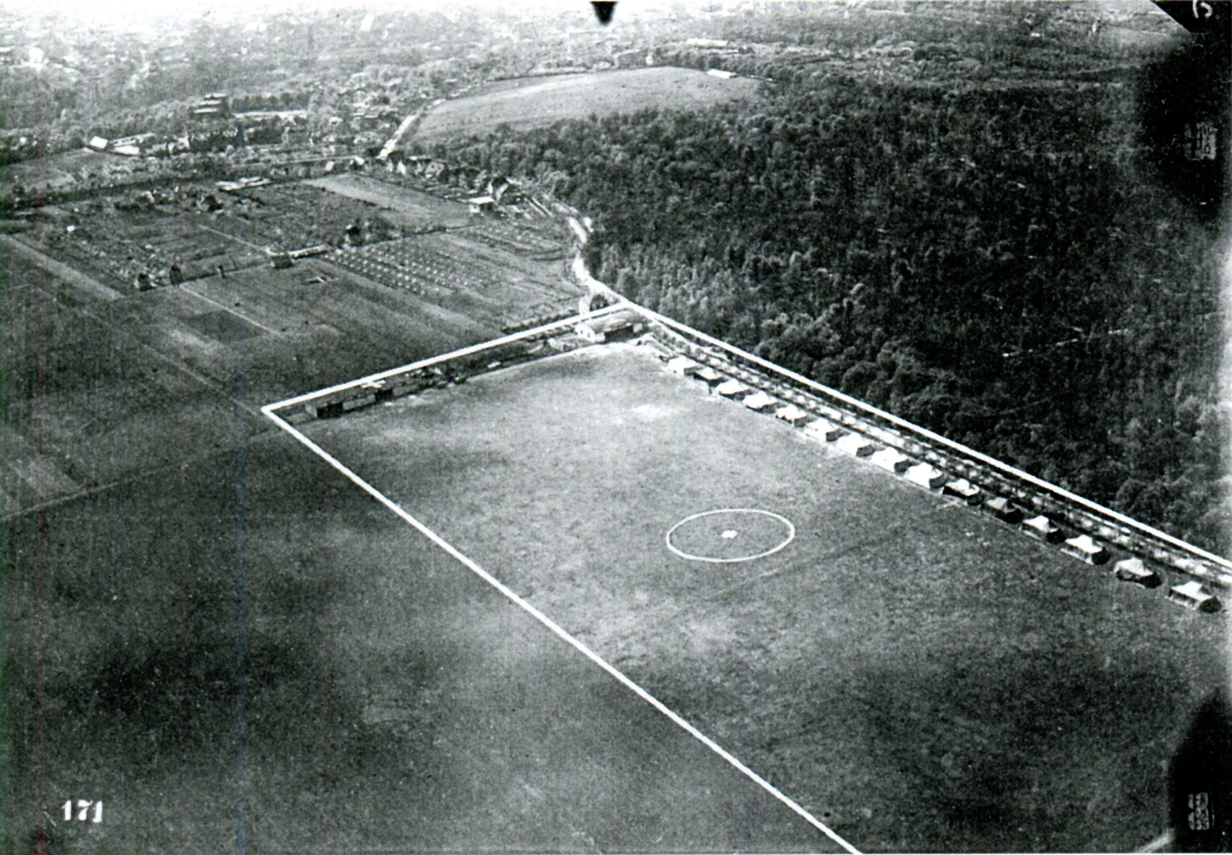
Aerial view Airfield Weimar-Lindenberg around 1919
Summary[edit]
| Description |
Deutsch: Luftbild Flugplatz Weimar-Lindenberg um 1919 mit Flugzeughallen und Zelten
English: Aerial view Airfield Weimar-Lindenberg around 1919 with hangars and tents |
| Date | |
| Source | Das Propellerblatt Nr. 47 - Sammlung Leonhard Rempe |
| Author | unbekannt |
| Camera location | | View this and other nearby images on: OpenStreetMap |
|---|
Licensing[edit]
|
This work is in the public domain in its country of origin and other countries and areas where the copyright term is the author's life plus 70 years or fewer. This work is in the public domain in the United States because it was published (or registered with the U.S. Copyright Office) before January 1, 1929. | |
| This file has been identified as being free of known restrictions under copyright law, including all related and neighboring rights. | |
File history
Click on a date/time to view the file as it appeared at that time.
| Date/Time | Thumbnail | Dimensions | User | Comment | |
|---|---|---|---|---|---|
| current | 15:38, 1 August 2023 | | 3,995 × 2,772 (6.23 MB) | G7 (talk | contribs) | Uploaded a work by unbekannt from Das Propellerblatt Nr. 47 - Sammlung Leonhard Rempe with UploadWizard |
You cannot overwrite this file.
File usage on Commons
The following page uses this file:
File usage on other wikis
The following other wikis use this file:
- Usage on de.wikipedia.org
- Usage on eo.wikipedia.org
- Usage on www.wikidata.org