File:Lunar south pole.jpg
跳至導覽
跳至搜尋
預覽大小:562 × 599 像素。 其他解析度:225 × 240 像素 | 450 × 480 像素 | 720 × 768 像素 | 960 × 1,024 像素 | 1,920 × 2,048 像素 | 2,999 × 3,199 像素。
原始檔案 (2,999 × 3,199 像素,檔案大小:932 KB,MIME 類型:image/jpeg)
說明
說明
添加單行說明來描述出檔案所代表的內容
摘要
[編輯]
| 描述 |
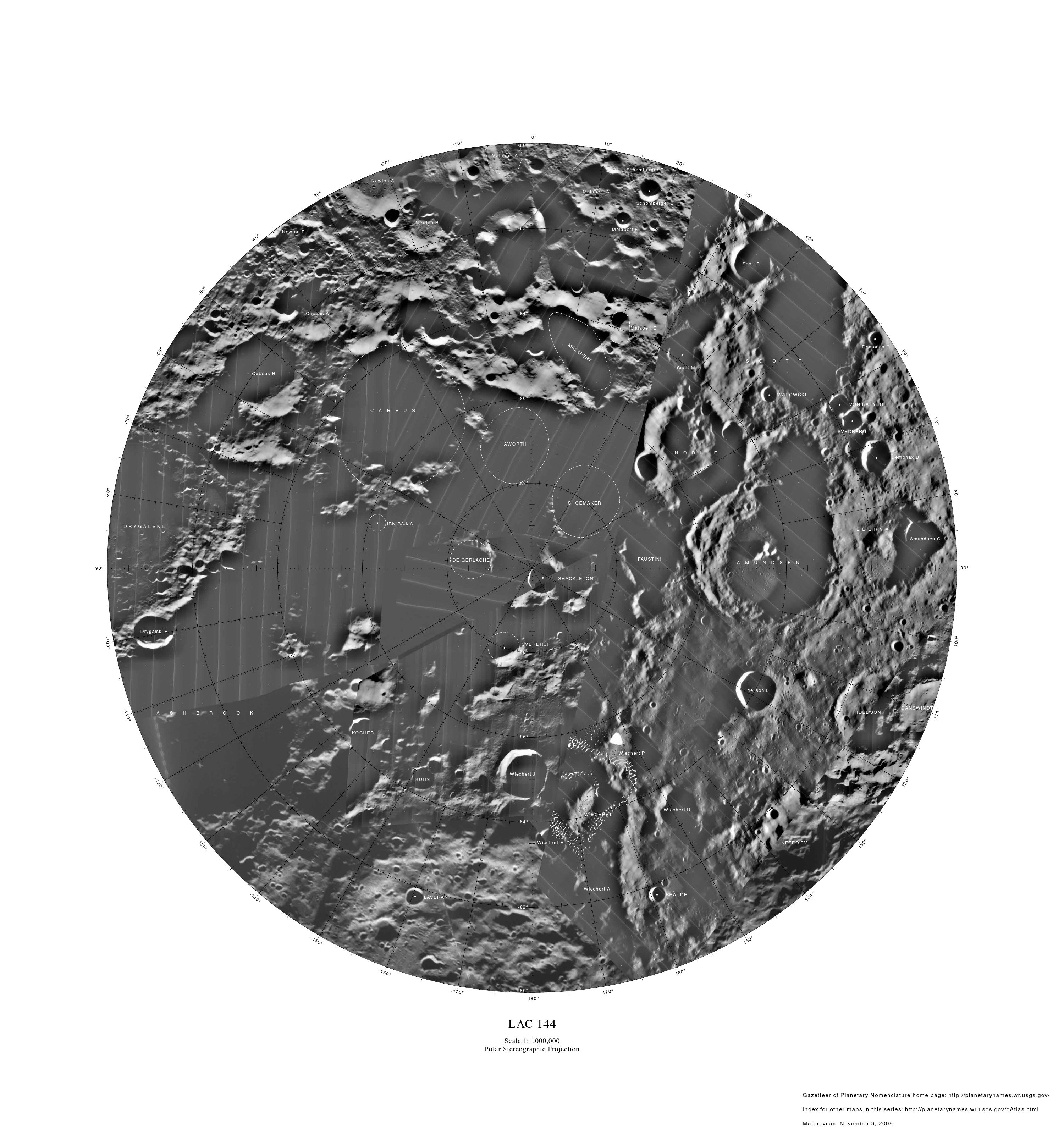
English: Lunar map depicting craters on the south pole of the moon. LAC 144. Polar Stereographic Projection. Map revised November 9, 2009. Index for other maps in this series: http://planetarynames.wr.usgs.gov/dAtlas.html. |
| 日期 | |
| 來源 | http://planetarynames.wr.usgs.gov/images/Lunar/lac_144_lo.pdf |
| 作者 | USGS |
授權條款
[編輯]
|
|
檔案歷史
點選日期/時間以檢視該時間的檔案版本。
| 日期/時間 | 縮圖 | 尺寸 | 用戶 | 備註 | |
|---|---|---|---|---|---|
| 目前 | 2011年1月10日 (一) 03:46 | | 2,999 × 3,199(932 KB) | LobStoR(對話 | 貢獻) | increased quality, reduced palette from 24-bit RGB to 8-bit greyscale |
| 2010年3月4日 (四) 08:21 |  | 3,000 × 3,200(398 KB) | J6naspeg(對話 | 貢獻) | {{Information |Description={{en|1=Lunar south pole map. LAC 144. Polar Stereographic Projection. Map revised November 9, 2009. Index for other maps in this series: http://planetarynames.wr.usgs.gov/dAtlas.html. }} |Source=http://planetarynames.wr.usgs.gov |
無法覆蓋此檔案。
檔案用途
下列頁面有用到此檔案:
全域檔案使用狀況
以下其他 wiki 使用了這個檔案:
- bg.wikipedia.org 的使用狀況
- en.wikipedia.org 的使用狀況
- fr.wikipedia.org 的使用狀況
- it.wikipedia.org 的使用狀況
- ro.wikipedia.org 的使用狀況
- ru.wikipedia.org 的使用狀況
- uk.wikipedia.org 的使用狀況
- zh.wikipedia.org 的使用狀況