File:MANIPUR district map-gu.svg
Jump to navigation
Jump to search

Size of this PNG preview of this SVG file: 537 × 600 pixels. Other resolutions: 215 × 240 pixels | 430 × 480 pixels | 687 × 768 pixels | 917 × 1,024 pixels | 1,833 × 2,048 pixels | 640 × 715 pixels.
Original file (SVG file, nominally 640 × 715 pixels, file size: 167 KB)
Captions
Captions
Add a one-line explanation of what this file represents
Summary[edit]
| Description |
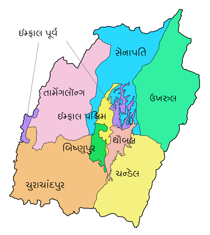
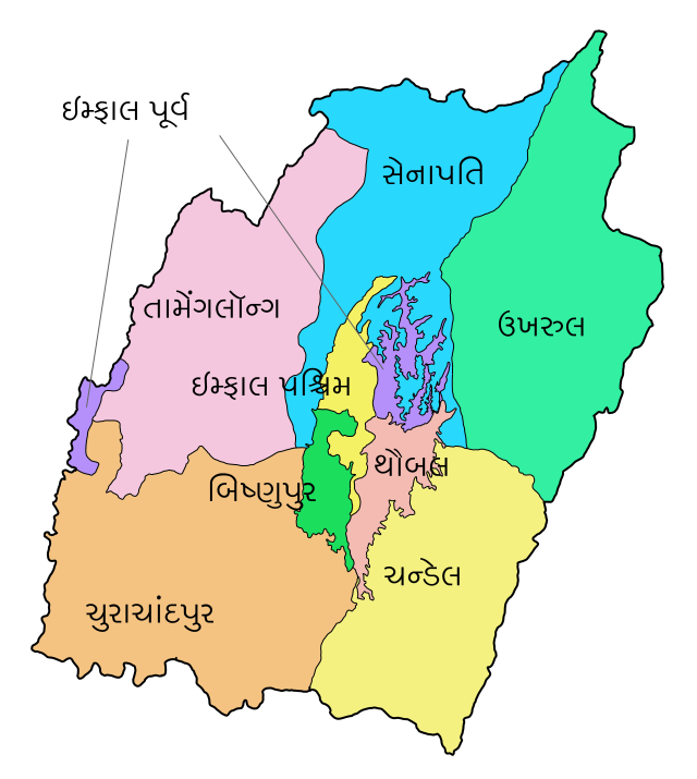
English: District map of Manipur in 2011
ગુજરાતી: ૨૦૧૧ માં મણિપુરનો જીલ્લા નકશો |
| Date | |
| Source | File:MANIPUR district map.svg |
| Author | Translated by User:jayesh.gohel, originally by User:Furfur |
| Other versions |
[]
|


Licensing[edit]
This file is licensed under the Creative Commons Attribution-Share Alike 4.0 International license.
- You are free:
- to share – to copy, distribute and transmit the work
- to remix – to adapt the work
- Under the following conditions:
- attribution – You must give appropriate credit, provide a link to the license, and indicate if changes were made. You may do so in any reasonable manner, but not in any way that suggests the licensor endorses you or your use.
- share alike – If you remix, transform, or build upon the material, you must distribute your contributions under the same or compatible license as the original.
File history
Click on a date/time to view the file as it appeared at that time.
| Date/Time | Thumbnail | Dimensions | User | Comment | |
|---|---|---|---|---|---|
| current | 17:55, 28 February 2019 | | 640 × 715 (167 KB) | Jayesh.gohel (talk | contribs) | User created page with UploadWizard |
You cannot overwrite this file.
File usage on Commons
The following 12 pages use this file:
- File:MANIPUR district map-bh.svg
- File:MANIPUR district map-bn.svg
- File:MANIPUR district map-gu.svg
- File:MANIPUR district map-hi.svg
- File:MANIPUR district map-kn.svg
- File:MANIPUR district map-mr.svg
- File:MANIPUR district map-pa.svg
- File:MANIPUR district map-te.svg
- File:MANIPUR district map.svg
- File:MANIPUR district map as.svg
- File:Manipur districts as.png
- Template:Other versions/MANIPUR district map.svg
File usage on other wikis
The following other wikis use this file:
- Usage on gu.wikipedia.org