File:MANIPUR district map-te.svg
Jump to navigation
Jump to search

Size of this PNG preview of this SVG file: 537 × 600 pixels. Other resolutions: 215 × 240 pixels | 430 × 480 pixels | 687 × 768 pixels | 917 × 1,024 pixels | 1,833 × 2,048 pixels | 640 × 715 pixels.
Original file (SVG file, nominally 640 × 715 pixels, file size: 233 KB)
Captions
Captions
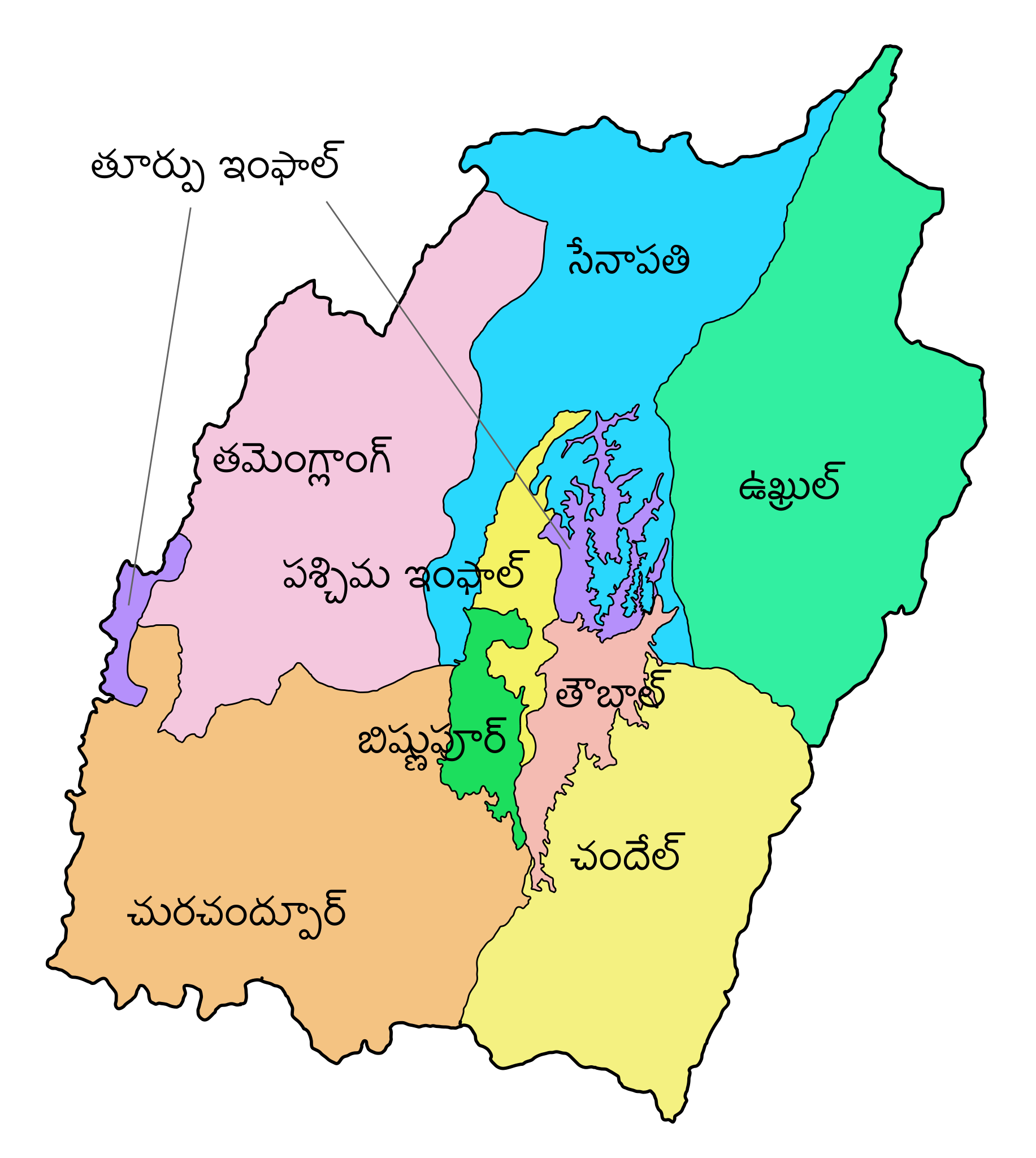
District map of Manipur in 2011.
Summary[edit]
| Description |
English: District map of Manipur in 2011. |
| Date | |
| Source | derived from various maps of the Indian election commission and administrative maps by User:Furfur |
| Author | Translated into Telugu by User:Mekala Harika |
| Other versions |
[]
|


Licensing[edit]
| This file is made available under the Creative Commons CC0 1.0 Universal Public Domain Dedication. | |
| The person who associated a work with this deed has dedicated the work to the public domain by waiving all of their rights to the work worldwide under copyright law, including all related and neighboring rights, to the extent allowed by law. You can copy, modify, distribute and perform the work, even for commercial purposes, all without asking permission.
|
File history
Click on a date/time to view the file as it appeared at that time.
| Date/Time | Thumbnail | Dimensions | User | Comment | |
|---|---|---|---|---|---|
| current | 14:03, 4 March 2019 | | 640 × 715 (233 KB) | Mekala Harika (talk | contribs) | User created page with UploadWizard |
You cannot overwrite this file.
File usage on Commons
The following 12 pages use this file:
- File:MANIPUR district map-bh.svg
- File:MANIPUR district map-bn.svg
- File:MANIPUR district map-gu.svg
- File:MANIPUR district map-hi.svg
- File:MANIPUR district map-kn.svg
- File:MANIPUR district map-mr.svg
- File:MANIPUR district map-pa.svg
- File:MANIPUR district map-te.svg
- File:MANIPUR district map.svg
- File:MANIPUR district map as.svg
- File:Manipur districts as.png
- Template:Other versions/MANIPUR district map.svg