File:MH370 bathymetric survey progress 23-Dec-2014.jpg
Jump to navigation
Jump to search
Size of this preview: 800 × 566 pixels. Other resolutions: 320 × 226 pixels | 640 × 453 pixels | 1,024 × 724 pixels | 1,280 × 905 pixels | 1,500 × 1,061 pixels.
Original file (1,500 × 1,061 pixels, file size: 545 KB, MIME type: image/jpeg)
Captions
Captions
Add a one-line explanation of what this file represents
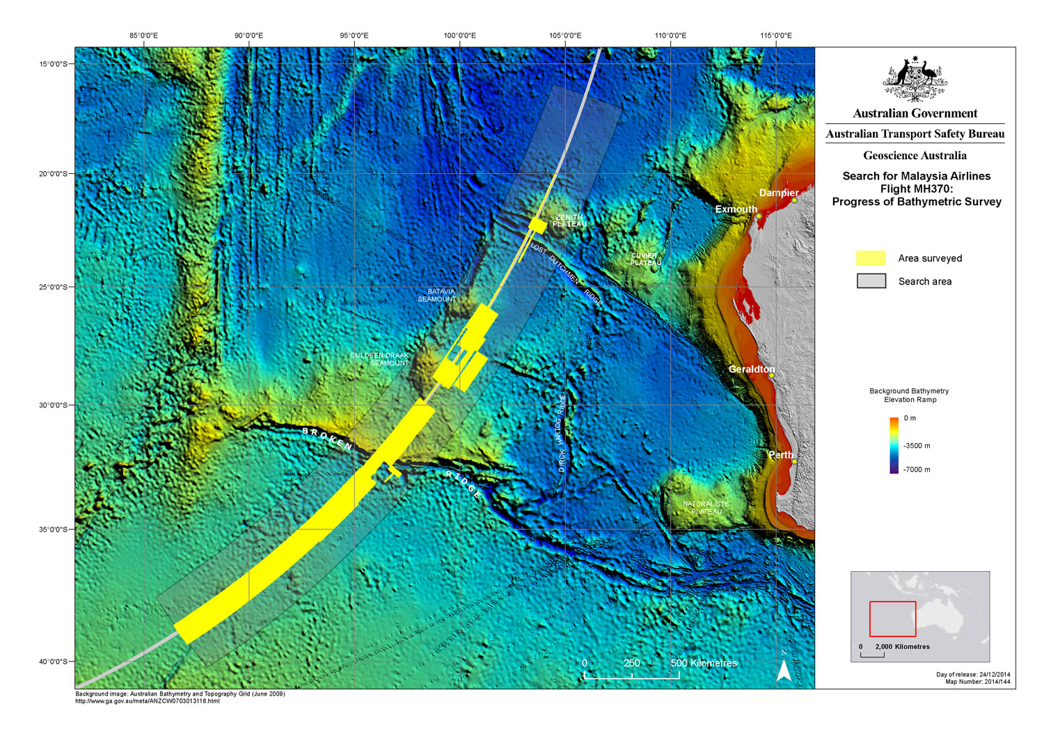
| Description | Areas where a bathymetric survey has been carried out, as of 23 December 2014, as part of the search for Malaysia Airlines Flight 370. The survey was necessary because some of the equipment to be operated in the underwater search (search area highlighted in grey) for w:Malaysia Airlines Flight 370 needs to operate close to the seafloor and previous bathymetric data for the area is of low resolution (primarily from satellite measurements). MV Fugro Equator suspended bathymetric survey work on 17 December 2014 to return to port in Freemantle to be equipped to return to the search area and participate in the underwater search. |
| Date | |
| Source | JACC-Maps (image link) |
| Author | Australian Transport Safety Bureau |
| Permission (Reusing this file) |
This file is licensed under the Creative Commons Attribution 3.0 Australia license.
 |
File history
Click on a date/time to view the file as it appeared at that time.
| Date/Time | Thumbnail | Dimensions | User | Comment | |
|---|---|---|---|---|---|
| current | 21:03, 13 January 2015 | | 1,500 × 1,061 (545 KB) | AHeneen (talk | contribs) | {{Information |Description=Areas where a bathymetric survey has been carried out, as of 23 December 2014, as part of the w:search for Malaysia Airlines Flight 370. The survey was necessary because some of the equipment to be operated in the under... |
You cannot overwrite this file.
File usage on Commons
The following page uses this file:
File usage on other wikis
The following other wikis use this file:
- Usage on de.wikipedia.org
- Usage on en.wikipedia.org
- Usage on tr.wikipedia.org