File:MT-Shin Suma Station-Aerial photography.png
Jump to navigation
Jump to search
Size of this preview: 800 × 556 pixels. Other resolutions: 320 × 223 pixels | 640 × 445 pixels | 1,024 × 712 pixels | 1,159 × 806 pixels.
Original file (1,159 × 806 pixels, file size: 1.51 MB, MIME type: image/png)
Captions
Captions
Add a one-line explanation of what this file represents
Summary
[edit]
| Description |
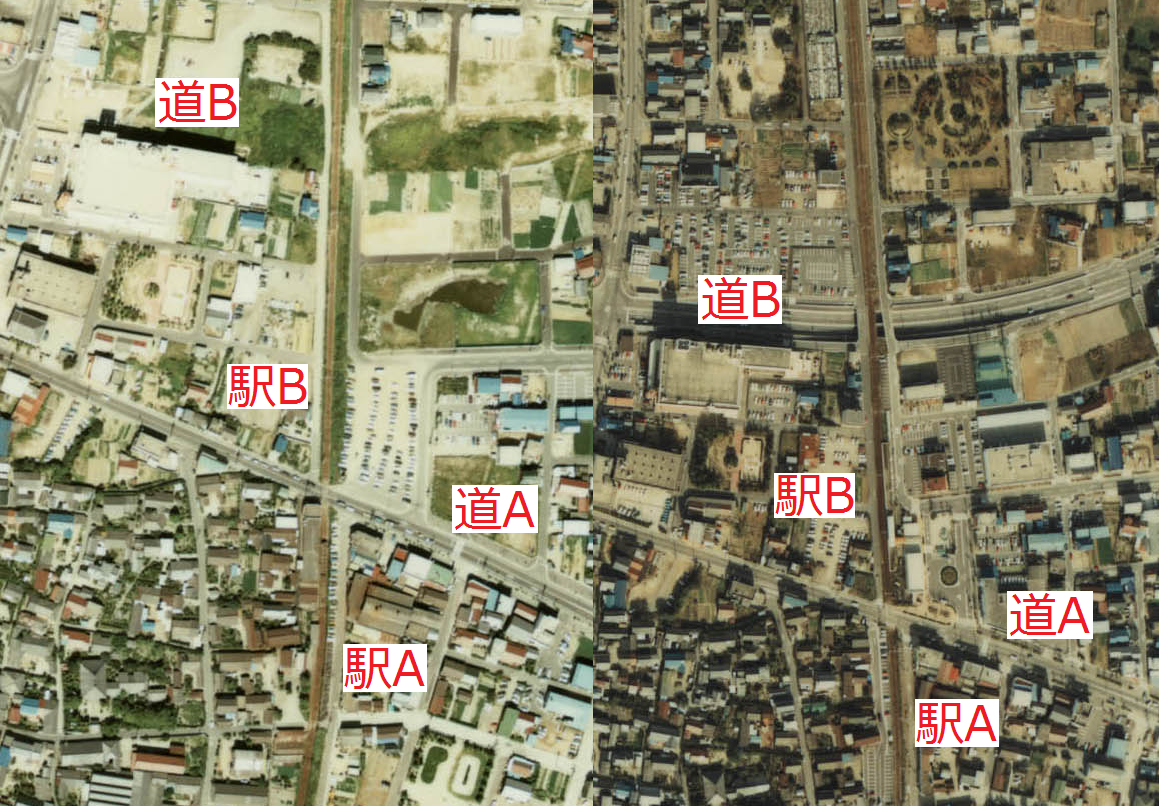
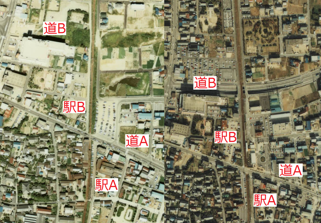
English: Around the Nagoya Railroad Mikwa Line Hekinan Chūō Station.Left is Japan Fiscal Year 1977's photo, right is Japan Fiscal Year 1982's photo.
日本語:名古屋鉄道 三河線 碧南中央駅周辺。左側が昭和52年度、右側が昭和57年度。
|
| Date | |
| Source | 国土交通省 / Ministry of Land, Infrastructure, Transport and Tourism (Japan) |
| Author | ButuCC |
Licensing
[edit]

|
The copyright holder of this file, the Ministry of Land, Infrastructure, Transport and Tourism of Japan, allows anyone to use it for any purpose, provided that the copyright holder is properly attributed. Redistribution, derivative work, commercial use, and all other use is permitted. |
Attribution:
Copyright © National Land Image Information (Color Aerial Photographs), Ministry of Land, Infrastructure, Transport and Tourism
|
 |
This image is copyrighted by the Ministry of Land, Infrastructure, Transport and Tourism of Japan. For terms of use, see the stipulation to use of National Land Information (in Japanese) and message from MLIT (in Japanese and English). When you display this image on an article, include the following phrase in the description: "Made based on National Land Image Information (Color Aerial Photographs), Ministry of Land, Infrastructure, Transport and Tourism".
|
File history
Click on a date/time to view the file as it appeared at that time.
| Date/Time | Thumbnail | Dimensions | User | Comment | |
|---|---|---|---|---|---|
| current | 17:18, 21 March 2010 | | 1,159 × 806 (1.51 MB) | ButuCC (talk | contribs) | {{Information |Description={{en|1=Around the Nagoya Railroad Mikwa Line Hekinan Chūō Station.Left is Japan Fiscal Year 1977's photo, right is Japan Fiscal Year 1982's photo. *"駅A" is Shin Suma Station (1915-1981) *"駅B" is Hekinan Chūō Station. *"� |
You cannot overwrite this file.
File usage on Commons
The following page uses this file: