File:Macun.jpg
Jump to navigation
Jump to search

Size of this preview: 800 × 600 pixels. Other resolutions: 320 × 240 pixels | 640 × 480 pixels | 1,024 × 768 pixels | 1,200 × 900 pixels.
Original file (1,200 × 900 pixels, file size: 814 KB, MIME type: image/jpeg)
Captions
Captions
Add a one-line explanation of what this file represents
Summary
[edit]
| Description |
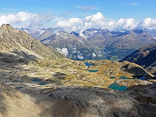
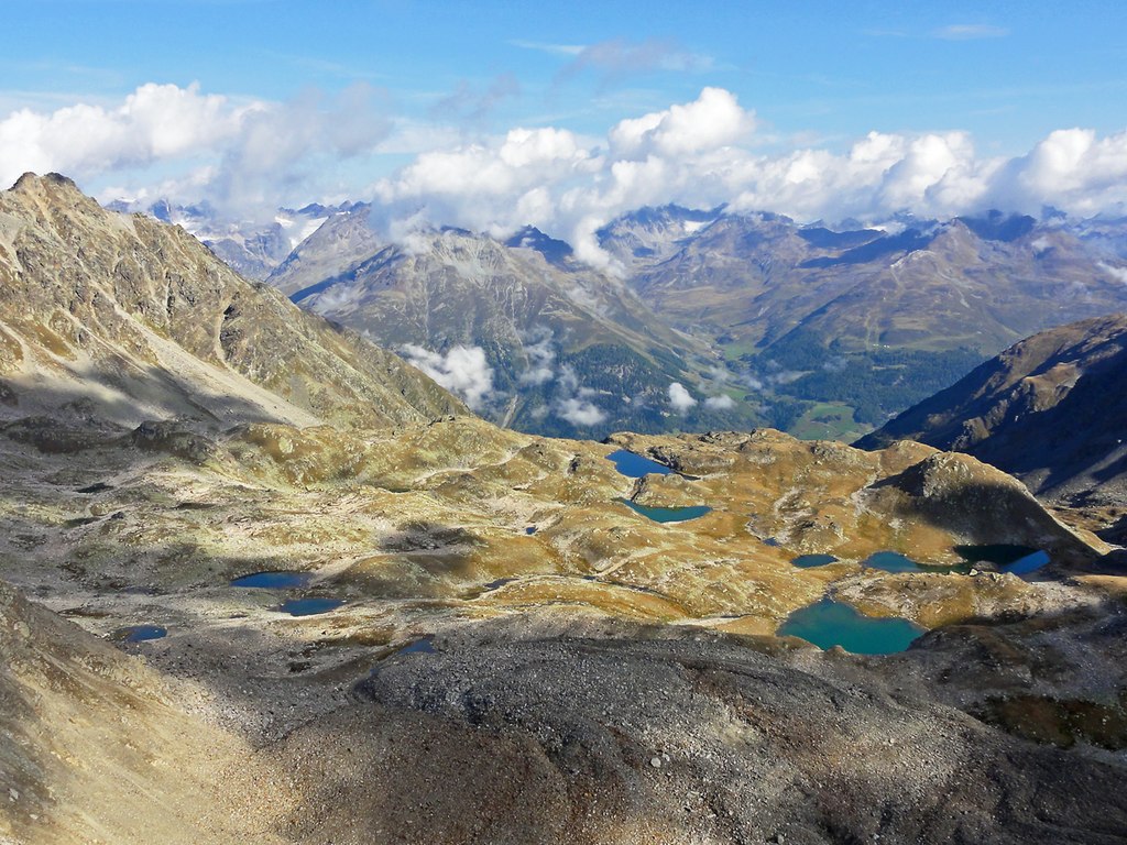
Deutsch: Lais da Macun, von Süden |
| Date | |
| Source | Niculin Meyer, CH-7550 Scuol |
| Author | Niculin Meyer, CH-7550 Scuol |
| Permission (Reusing this file) |
| Camera location | | View this and other nearby images on: OpenStreetMap |
|---|
Licensing
[edit]
| I, the copyright holder of this work, release this work into the public domain. This applies worldwide. In some countries this may not be legally possible; if so: I grant anyone the right to use this work for any purpose, without any conditions, unless such conditions are required by law. |
Original upload log
[edit]
Transferred from de.wikipedia to Commons by Krd using CommonsHelper.
The original description page was here. All following user names refer to de.wikipedia.
- 2012-08-02 13:41 Panda17 1200×900× (833624 bytes) {{Information |Beschreibung = Lais da Macun, von Süden |Quelle = |Urheber = Niculin Meyer |Datum = 17.09.2011 |Genehmigung = Ja. |Andere Versionen = |Anmerkungen = }}
File history
Click on a date/time to view the file as it appeared at that time.
| Date/Time | Thumbnail | Dimensions | User | Comment | |
|---|---|---|---|---|---|
| current | 17:12, 7 August 2012 | | 1,200 × 900 (814 KB) | File Upload Bot (Magnus Manske) (talk | contribs) | Transfered from de.wikipedia by User:Krd using CommonsHelper |
You cannot overwrite this file.
File usage on Commons
The following 2 pages use this file:
File usage on other wikis
The following other wikis use this file:
- Usage on arz.wikipedia.org
- Usage on ceb.wikipedia.org
- Usage on de.wikipedia.org
- Usage on en.wikipedia.org
- Usage on en.wikivoyage.org
- Usage on fr.wikipedia.org
- Usage on fr.wiktionary.org
- Usage on lld.wikipedia.org
- Usage on nn.wikipedia.org
- Usage on pl.wikipedia.org
- Usage on sv.wikipedia.org
- Usage on www.wikidata.org
- Usage on zh.wikipedia.org