File:MandingoMap-1906 with color.png
跳至導覽
跳至搜尋
無更高解析度可提供。
MandingoMap-1906_with_color.png (743 × 477 像素,檔案大小:493 KB,MIME 類型:image/png)
說明
說明
添加單行說明來描述出檔案所代表的內容
摘要
[編輯]
| 描述 |
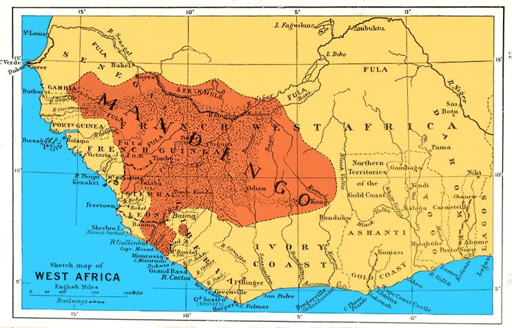
English: Sketch map of West Africa to show area of Mandingo peoples, languages and influence. Coloring with File:MandingoMap-1906.jpg. |
||
| 日期 | |||
| 來源 | New York Public Library [1], from Liberia by Sir Harry Johnston ; with an appendix on the flora of Liberia by Dr. Otto Stapf ; 28 coloured illustrations by Sir Harry Johnston, 24 botanical drawings by Miss Matilda Smith... | ||
| 作者 | by the author and J. W. Addison (not in copyright [2]) | ||
| 授權許可 (重用此檔案) |
|
||
| 其他版本 |
 |
授權條款
[編輯]
|
本作品在其來源國以及其他版權期限是作者逝世後70年或以下的國家與地區屬於公有領域。
| |
| 此作品無已知的著作權限制,亦不受所有相關和鄰接的權利限制。 | |
檔案歷史
點選日期/時間以檢視該時間的檔案版本。
| 日期/時間 | 縮圖 | 尺寸 | 用戶 | 備註 | |
|---|---|---|---|---|---|
| 目前 | 2016年8月28日 (日) 11:18 | | 743 × 477(493 KB) | Was a bee(對話 | 貢獻) | == {{int:filedesc}} == {{Information |Description={{en|1=Sketch map of West Africa to show area of Mandingo peoples, languages and influence. Coloring with File:MandingoMap-1906.jpg.}} |Source=New York Public Library [http://digitalgallery.nypl.or... |
無法覆蓋此檔案。
檔案用途
下列2個頁面有用到此檔案:
全域檔案使用狀況
以下其他 wiki 使用了這個檔案:
- en.wikipedia.org 的使用狀況
- ko.wikipedia.org 的使用狀況
- nn.wikipedia.org 的使用狀況
- no.wikipedia.org 的使用狀況
- nqo.wikipedia.org 的使用狀況
- pt.wikipedia.org 的使用狀況
- zh.wikipedia.org 的使用狀況