File:Manduca dilucida MHNT CUT 2010 0 274 Nuevo X-càn Quintana Roo Mexico male.jpg
Jump to navigation
Jump to search

Size of this preview: 590 × 599 pixels. Other resolutions: 236 × 240 pixels | 472 × 480 pixels | 756 × 768 pixels | 1,008 × 1,024 pixels | 2,016 × 2,048 pixels | 7,724 × 7,848 pixels.
Original file (7,724 × 7,848 pixels, file size: 24.41 MB, MIME type: image/jpeg)
Captions
Captions
Add a one-line explanation of what this file represents
|
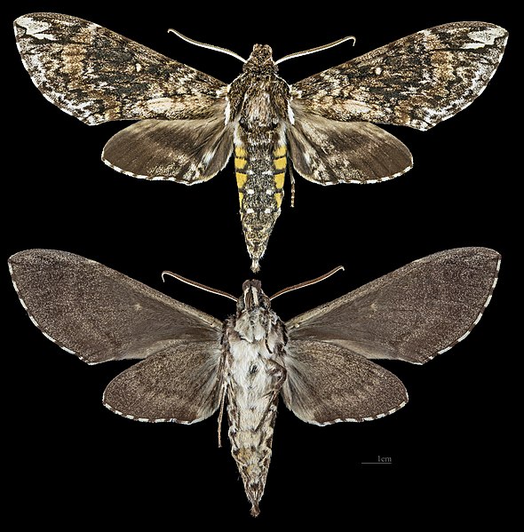
Manduca dilucida (Edwards, 1887) |
| Photographer | ||||||||||||||||||||||||
| Description |
Français : Manduca dilucida - Deux vues du même spécimen
|
|||||||||||||||||||||||
| Gender | Male | |||||||||||||||||||||||
| Place of discovery |
|
|||||||||||||||||||||||
| Date | Taken on 3 October 2018 | |||||||||||||||||||||||
| Collection |
|
|||||||||||||||||||||||
| Accession number |
MHNT.CUT.2010.0.274 |
|||||||||||||||||||||||
| Source | Own work | |||||||||||||||||||||||
| Permission (Reusing this file) |
I, the copyright holder of this work, hereby publish it under the following license: This file is licensed under the Creative Commons Attribution-Share Alike 4.0 International license.
|
|||||||||||||||||||||||
| Other versions |
| |||||||||||||||||||||||
| Processing | Focus stacking of 4 pictures. | |||||||||||||||||||||||


| Camera location | | View this and other nearby images on: OpenStreetMap |
|---|

|
This document was made as part of the Projet Phoebus.
|
File history
Click on a date/time to view the file as it appeared at that time.
| Date/Time | Thumbnail | Dimensions | User | Comment | |
|---|---|---|---|---|---|
| current | 07:00, 26 October 2018 | | 7,724 × 7,848 (24.41 MB) | Archaeodontosaurus (talk | contribs) | {{Information |description ={{en|1=dds}} |date = |source ={{own}} |author =User:Archaeodontosaurus }} |
You cannot overwrite this file.
File usage on Commons
The following 5 pages use this file:
- Manduca dilucida
- User:Paris 16/Recent uploads/2018 October 26-28
- File:Manduca dilucida MHNT CUT 2010 0 274 Nuevo X-càn Quintana Roo Mexico male.jpg
- File:Manduca dilucida MHNT CUT 2010 0 274 Nuevo X-càn Quintana Roo Mexico male dorsal.jpg
- File:Manduca dilucida MHNT CUT 2010 0 274 Nuevo X-càn Quintana Roo Mexico male ventral.jpg
File usage on other wikis
The following other wikis use this file: