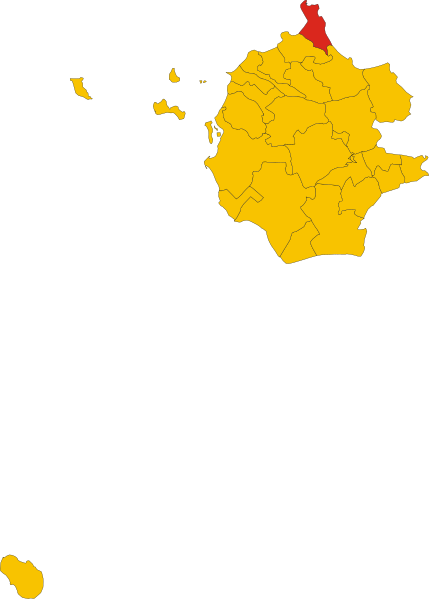
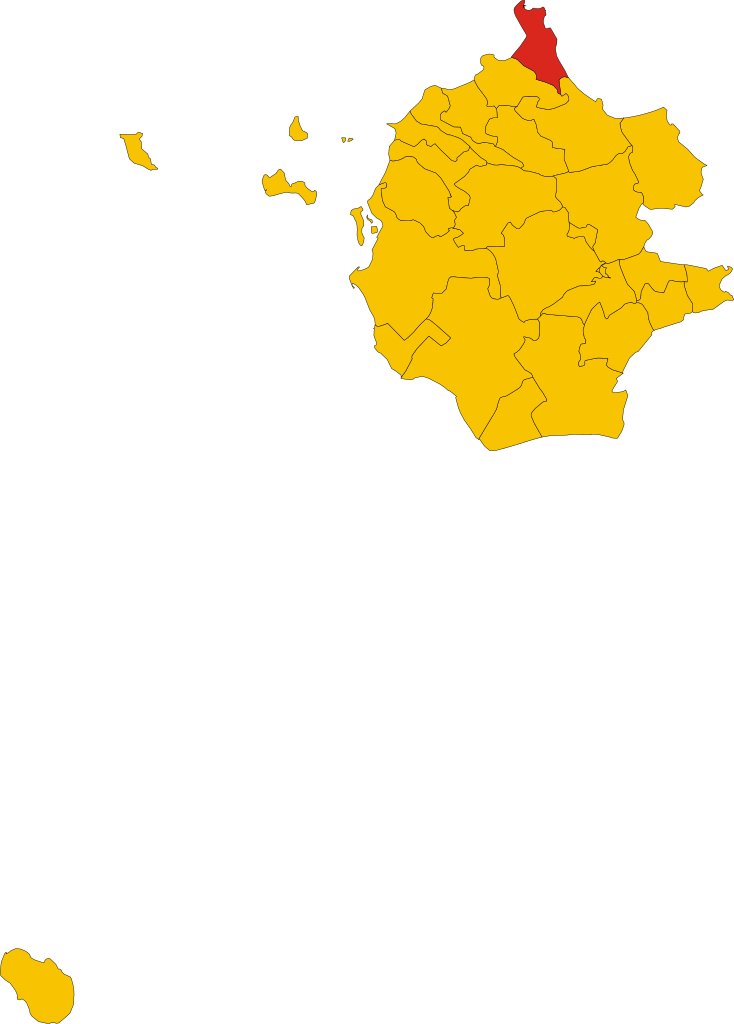
File:Map of comune of San Vito Lo Capo (province of Trapani, region Sicily, Italy).svg
Jump to navigation
Jump to search

Size of this PNG preview of this SVG file: 429 × 599 pixels. Other resolutions: 172 × 240 pixels | 344 × 480 pixels | 550 × 768 pixels | 734 × 1,024 pixels | 1,467 × 2,048 pixels | 5,289 × 7,381 pixels.
Original file (SVG file, nominally 5,289 × 7,381 pixels, file size: 76 KB)
Captions
Captions
Add a one-line explanation of what this file represents
Summary[edit]
.svg&action=edit§ion=1)
| Description | |
| Date | |
| Source | Own work |
| Author | Vonvikken |
W3C-validity not checked.
Licensing[edit]
.svg&action=edit§ion=2)
| This work has been released into the public domain by its author, Vonvikken. This applies worldwide. In some countries this may not be legally possible; if so: |
File history
Click on a date/time to view the file as it appeared at that time.
| Date/Time | Thumbnail | Dimensions | User | Comment | |
|---|---|---|---|---|---|
| current | 12:05, 18 April 2021 | | 5,289 × 7,381 (76 KB) | Gb89.2 (talk | contribs) | new map, due to the creation of Misiliscemi |
| 10:56, 5 September 2010 |  | 4,840 × 7,507 (76 KB) | File Upload Bot (Vonvikken) (talk | contribs) | == {{int:filedesc}} == {{Information |Description={{DescrMapComuneItaly|San Vito Lo Capo|||TP}} |Source={{own}} |Author=Vonvikken |Date=2010-09-05 |Permission= }} {{Valid SVG}} == {{int:license}} == {{PD-user|Vonvikken}} |
You cannot overwrite this file.
File usage on Commons
The following 3 pages use this file:
File usage on other wikis
The following other wikis use this file:
- Usage on ar.wikipedia.org
- Usage on bg.wikipedia.org
- Usage on ca.wikipedia.org
- Usage on ceb.wikipedia.org
- Usage on es.wikipedia.org
- Usage on eu.wikipedia.org
- Usage on fr.wikipedia.org
- Usage on hu.wikipedia.org
- Usage on ia.wikipedia.org
- Usage on it.wikipedia.org
- Usage on ja.wikipedia.org
- Usage on la.wikipedia.org
- Usage on lmo.wikipedia.org
- Usage on nl.wikipedia.org
- Usage on ro.wikipedia.org
- Usage on sv.wikipedia.org
- Usage on tt.wikipedia.org
- Usage on www.wikidata.org
- Usage on zh-min-nan.wikipedia.org
.svg&oldid=553644630)