File:Map-WR-Wuerttemberg.svg

Archivo original (archivo SVG, nominalmente 1185 × 1007 píxeles, tamaño de archivo: 541 kB)
Leyendas
Leyendas
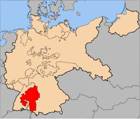
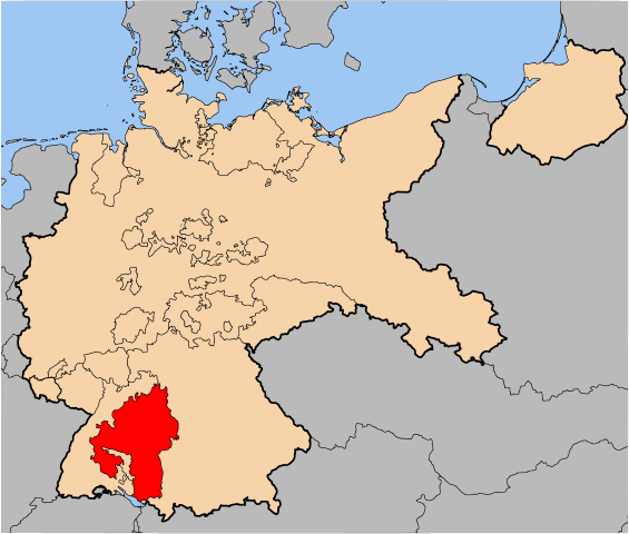
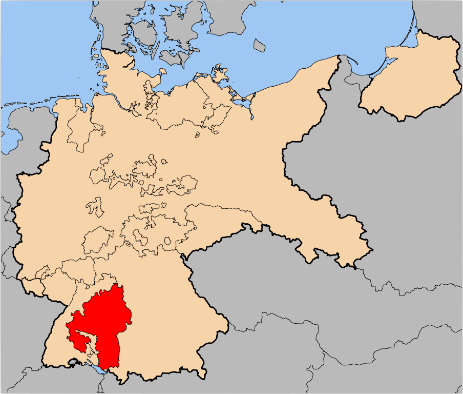
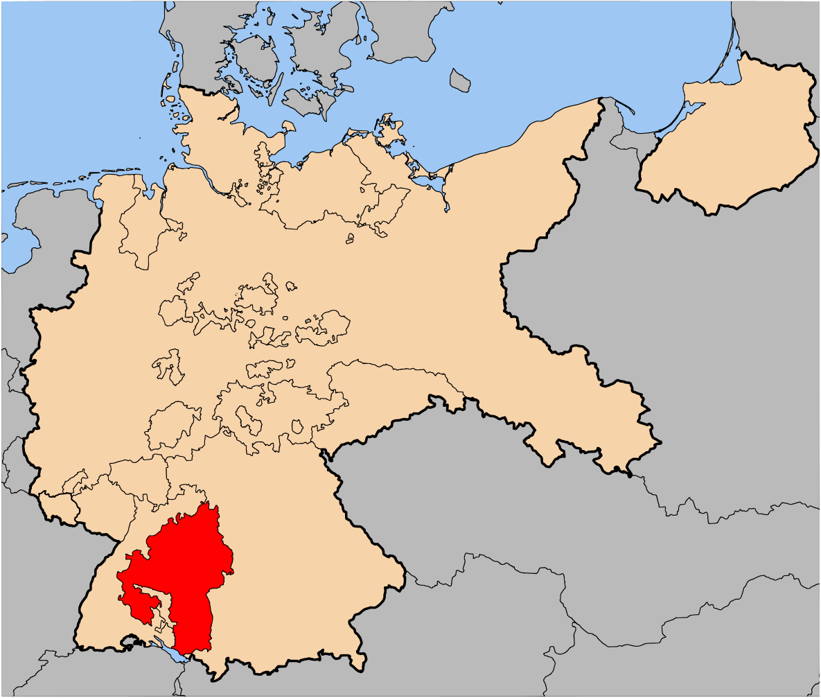
| Descripción | The Free Peoples' State of Württemberg (Freier Volksstaat Württemberg) within Germany at the time of the Weimar Republic | |||||||||||
| Fecha | ||||||||||||
| Fuente | Based on map data of the IEG-Maps project (Andreas Kunz, B. Johnen and Joachim Robert Moeschl: University of Mainz) - http://www.ieg-maps.uni-mainz.de | |||||||||||
| Autor | User:52 Pickup | |||||||||||
| Permiso (Reutilización de este archivo) |
Este archivo se encuentra bajo la licencia Creative Commons Genérica de Atribución/Compartir-Igual 2.5.
|

Historial del archivo
Haz clic sobre una fecha y hora para ver el archivo tal como apareció en ese momento.
| Fecha y hora | Miniatura | Dimensiones | Usuario | Comentario | |
|---|---|---|---|---|---|
| actual | 22:01 8 may 2007 | | 1185 × 1007 (541 kB) | 52 Pickup (discusión | contribs.) | {{Information| |Description= The Free Peoples' State of Württemberg (Freier Volksstaat Württemberg) within Germany at the time of the [[:en:Weimar Republic|Weimar Republi |
No puedes sobrescribir este archivo.
Usos del archivo
No hay páginas que enlacen a este archivo.
Uso global del archivo
Las wikis siguientes utilizan este archivo: