File:Map LUKLA airport.jpg
Jump to navigation
Jump to search
No higher resolution available.
Map_LUKLA_airport.jpg (800 × 566 pixels, file size: 78 KB, MIME type: image/jpeg)
Captions
Captions
Add a one-line explanation of what this file represents
Summary
[edit]
| Description |
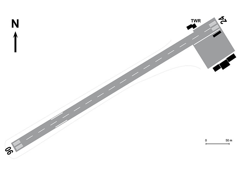
Italiano: Planimetria dell'aeroporto Tenzing-Hillary di Lukla (Nepal) |
| Date | |
| Source | Own work |
| Author | Enryonthecloud |
Licensing
[edit]
| I, the copyright holder of this work, release this work into the public domain. This applies worldwide. In some countries this may not be legally possible; if so: I grant anyone the right to use this work for any purpose, without any conditions, unless such conditions are required by law. |
File history
Click on a date/time to view the file as it appeared at that time.
| Date/Time | Thumbnail | Dimensions | User | Comment | |
|---|---|---|---|---|---|
| current | 15:47, 12 December 2013 | | 800 × 566 (78 KB) | Enryonthecloud (talk | contribs) | Modifiche alla struttura della torre di controllo |
| 09:07, 12 December 2013 |  | 3,508 × 2,480 (369 KB) | Enryonthecloud (talk | contribs) | {{Informazioni file |Descrizione = Planimetria dell'aeroporto Tenzing-Hillary di Lukla (Nepal) |Fonte = opera propria |Data = dicembre 2013 |Autore = Enryonthecloud |Licenza = vedi sotto |Detentore copyright = vedi sotto |EDP = |Altre versioni = }} |
You cannot overwrite this file.
File usage on Commons
There are no pages that use this file.
File usage on other wikis
The following other wikis use this file:
- Usage on it.wikipedia.org