File:Map Macedonia 336 BC-ce.svg
Jump to navigation
Jump to search

Size of this PNG preview of this SVG file: 749 × 600 pixels. Other resolutions: 300 × 240 pixels | 600 × 480 pixels | 960 × 768 pixels | 1,279 × 1,024 pixels | 2,559 × 2,048 pixels | 992 × 794 pixels.
Original file (SVG file, nominally 992 × 794 pixels, file size: 3.41 MB)
Captions
Captions
Add a one-line explanation of what this file represents
Summary[edit]
| Description |
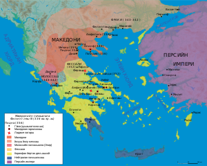
Français : Carte du royaume de Philippe II de Macédoine à sa mort (336 av. J.-C.) |
| Date | |
| Source | |
| Creator |
|
| Geotemporal data | |
| Map location | Macedonian Empire |
| Georeferencing | If inappropriate please set warp_status = skip to hide. |
| Bibliographic data | |
| Language | Chechen |
| Other versions |
[]
|


Licensing[edit]
I, the copyright holder of this work, hereby publish it under the following license:
This file is licensed under the Creative Commons Attribution-Share Alike 4.0 International license.
- You are free:
- to share – to copy, distribute and transmit the work
- to remix – to adapt the work
- Under the following conditions:
- attribution – You must give appropriate credit, provide a link to the license, and indicate if changes were made. You may do so in any reasonable manner, but not in any way that suggests the licensor endorses you or your use.
- share alike – If you remix, transform, or build upon the material, you must distribute your contributions under the same or compatible license as the original.
File history
Click on a date/time to view the file as it appeared at that time.
| Date/Time | Thumbnail | Dimensions | User | Comment | |
|---|---|---|---|---|---|
| current | 17:52, 23 May 2019 | | 992 × 794 (3.41 MB) | Takhirgeran Umar (talk | contribs) | нисдар |
| 16:45, 23 May 2019 |  | 992 × 794 (3.41 MB) | Takhirgeran Umar (talk | contribs) | User created page with UploadWizard |
You cannot overwrite this file.
File usage on Commons
The following 17 pages use this file:
- File:Karte Makedonien 336 vC-de.svg
- File:Map Macedonia 336 BC-ar.svg
- File:Map Macedonia 336 BC-bg.svg
- File:Map Macedonia 336 BC-ce.svg
- File:Map Macedonia 336 BC-de.svg
- File:Map Macedonia 336 BC-en.svg
- File:Map Macedonia 336 BC-es.svg
- File:Map Macedonia 336 BC-fr.svg
- File:Map Macedonia 336 BC-he-2.svg
- File:Map Macedonia 336 BC-he.svg
- File:Map Macedonia 336 BC-it.svg
- File:Map Macedonia 336 BC-ka.svg
- File:Map Macedonia 336 BC-pt.svg
- File:Map Macedonia 336 BC-ru.svg
- File:Map Macedonia 336 BC-zh.svg
- File:மாசிடோனியா கி. மு. 336.svg
- Template:Other versions/Map Macedonia 336 BC
File usage on other wikis
The following other wikis use this file:
- Usage on ce.wikipedia.org