File:Map Montpellier.jpg
Jump to navigation
Jump to search

Size of this preview: 685 × 600 pixels. Other resolutions: 274 × 240 pixels | 548 × 480 pixels | 877 × 768 pixels | 1,170 × 1,024 pixels | 2,106 × 1,844 pixels.
Original file (2,106 × 1,844 pixels, file size: 3.96 MB, MIME type: image/jpeg)
Captions
Captions
Add a one-line explanation of what this file represents
Summary
[edit]
| Description |
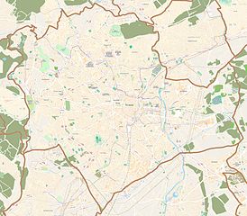
English: Map of Montpellier, France
Français : Carte de Montpellier, France |
||||||||||||
| Date | |||||||||||||
| Source |
|
||||||||||||
| Author | OpenStreetMap contributors |
Licensing
[edit]
This file is licensed under the Creative Commons Attribution-Share Alike 3.0 Unported license.
- You are free:
- to share – to copy, distribute and transmit the work
- to remix – to adapt the work
- Under the following conditions:
- attribution – You must give appropriate credit, provide a link to the license, and indicate if changes were made. You may do so in any reasonable manner, but not in any way that suggests the licensor endorses you or your use.
- share alike – If you remix, transform, or build upon the material, you must distribute your contributions under the same or compatible license as the original.
File history
Click on a date/time to view the file as it appeared at that time.
| Date/Time | Thumbnail | Dimensions | User | Comment | |
|---|---|---|---|---|---|
| current | 08:48, 23 October 2011 | | 2,106 × 1,844 (3.96 MB) | XIIIfromTOKYO (talk | contribs) | Better colors |
| 08:01, 23 October 2011 |  | 2,106 × 1,844 (1.2 MB) | XIIIfromTOKYO (talk | contribs) | {{Information |Description ={{en|1=Map of Montpellier, France}} {{fr|1=Carte de Montpellier, France}} |Source ={{openstreetmap}} |Author =OpenStreetMap contributors |Date =2011-10-23 |Permission = |other_versions = }} [[C |
You cannot overwrite this file.
File usage on Commons
There are no pages that use this file.
File usage on other wikis
The following other wikis use this file:
- Usage on ar.wikipedia.org
- Usage on ca.wikipedia.org
- Usage on ceb.wikipedia.org
- Usage on da.wikipedia.org
- Usage on es.wikipedia.org
- Usage on fa.wikipedia.org
- Usage on fr.wikipedia.org
- École nationale supérieure agronomique de Montpellier
- Université Montpellier-II
- Corum (Montpellier)
- Tour Le Triangle
- Stade Richter
- Parc des Sports de l'avenue du Pont Juvénal
- Université Montpellier-I
- Hôtel Saint-Côme
- Promenade du Peyrou
- Hôtel de ville de Montpellier
- Sud de France Arena
- Palais des sports Pierre-de-Coubertin
- Stade Sabathé
- Porte du Pila Saint Gély
- Porte de la Blanquerie
- Hôtel de Griffy
- Cimetière Saint-Lazare (Montpellier)
- Hôtel de Ginestous
- Tour d'Assas
- Hôtel de Montcalm
- Hôtel de Lunas
- Hôtel de Ricard (Montpellier)
- Hôtel Bardy
- Hôtel de Varennes
- Hôtel Rey
- Hôtel Baschy-du-Cayla
- Hôtel de Joubert (Montpellier)
- Hôtel de Baudon de Mauny
- Hôtel Duffau
- Faculté de droit et science politique de Montpellier
- Module:Carte/données/montpellier
- Hôtel de Guidais
- Hôtel d'Uston
- MO.CO. Esba
- Cimetière protestant de Montpellier
- Statue équestre de Louis XIV (Montpellier)
- Stade Louis-Nicollin
- Université du tiers temps de Montpellier
- Hôtel de Fizes
View more global usage of this file.