File:Map Trans-Siberian railway.png
跳至導覽
跳至搜尋
預覽大小:800 × 566 像素。 其他解析度:320 × 226 像素 | 640 × 452 像素 | 1,000 × 707 像素。
原始檔案 (1,000 × 707 像素,檔案大小:288 KB,MIME 類型:image/png)
說明
說明
添加單行說明來描述出檔案所代表的內容
摘要
[編輯]
| 描述 |
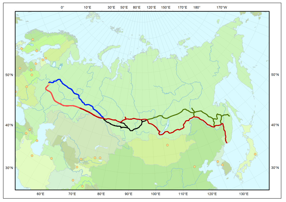
Map of Trans-Siberian railway
|
| 來源 | 自己的作品 |
| 作者 | User:Stefan Kühn |
| 授權許可 (重用此檔案) |
Public domain |

|
本檔案有多個向量版本。 請優先使用那個圖片而非本點陣圖片。 (理由:
English: Better quality and fix of errors. The new file is available without labels, with German labels and with labels in local language and English translation. Deutsch: Bessere Qualität und Fehlerbehebung. Die neue Datei ist ohne Beschriftung, mit deutschen Beschriftungen und mit Beschriftungen in Landessprache und englischer Übersetzung verfügbar. )File:Map Trans-Siberian railway.png →
更多資訊請參閱Help:SVG/zh。 |
   |
授權條款
[編輯]
| 我,此作品的版權所有人,釋出此作品至公共領域。此授權條款在全世界均適用。 這可能在某些國家不合法,如果是的話: 我授予任何人有權利使用此作品於任何用途,除受法律約束外,不受任何限制。 |
| 註解 | 該圖片含有註解:在維基媒體共享資源上查看註解 |
檔案歷史
點選日期/時間以檢視該時間的檔案版本。
| 日期/時間 | 縮圖 | 尺寸 | 用戶 | 備註 | |
|---|---|---|---|---|---|
| 目前 | 2012年8月5日 (日) 18:37 | | 1,000 × 707(288 KB) | Miass(對話 | 貢獻) | the real map of the Trans-Siberian railway line |
| 2012年8月5日 (日) 18:13 |  | 1,000 × 707(289 KB) | Miass(對話 | 貢獻) | the real map of the Trans-Siberian railway line | |
| 2011年1月26日 (三) 15:00 |  | 1,000 × 707(321 KB) | Oschtan(對話 | 貢獻) | Added the Southern branch line in Siberia, which, together with the historical path and the Baikal-Amur railway understudy Trans-Siberian Railway | |
| 2009年2月5日 (四) 17:48 |  | 1,000 × 707(323 KB) | Chriusha(對話 | 貢獻) | Historische Strecke zwischen Moskau und Omsk ergänzt. | |
| 2005年11月13日 (日) 08:49 |  | 1,000 × 707(292 KB) | Stefan Kühn(對話 | 貢獻) | Map of Trans-Siberian railway |
無法覆蓋此檔案。
檔案用途
沒有使用此檔案的頁面。
全域檔案使用狀況
以下其他 wiki 使用了這個檔案:
- af.wikipedia.org 的使用狀況
- ar.wikipedia.org 的使用狀況
- azb.wikipedia.org 的使用狀況
- bg.wikipedia.org 的使用狀況
- bn.wikipedia.org 的使用狀況
- bs.wikipedia.org 的使用狀況
- cu.wikipedia.org 的使用狀況
- cv.wikipedia.org 的使用狀況
- de.wikipedia.org 的使用狀況
- de.wikivoyage.org 的使用狀況
- de.wiktionary.org 的使用狀況
- el.wikipedia.org 的使用狀況
- el.wikivoyage.org 的使用狀況
- en.wikipedia.org 的使用狀況
- Chinese Eastern Railway
- Eurasian Land Bridge
- Portal:Trains/Did you know/May 2006
- User talk:Kelapstick/Archive 2
- Portal:Trains/Did you know/August 2008
- Wikipedia:Reference desk/Archives/Humanities/2012 July 3
- User:UBX/TransSiberian
- Ufa railway station
- User:HolyCrocsEmperor
- Wikipedia:Userboxes/Rail transport
- en.wikivoyage.org 的使用狀況
- es.wikipedia.org 的使用狀況
- et.wikipedia.org 的使用狀況
- eu.wikipedia.org 的使用狀況
- fa.wikipedia.org 的使用狀況
- fi.wikipedia.org 的使用狀況
- fr.wikipedia.org 的使用狀況
- ga.wikipedia.org 的使用狀況
- gl.wikipedia.org 的使用狀況
- he.wikipedia.org 的使用狀況
- hr.wikipedia.org 的使用狀況
檢視此檔案的更多全域使用狀況。