File:Map Water balance 1989 - Touring Club Italiano CART-TEM-013.jpg
Jump to navigation
Jump to search

Size of this preview: 800 × 524 pixels. Other resolutions: 320 × 209 pixels | 640 × 419 pixels | 1,024 × 670 pixels | 1,280 × 838 pixels | 2,560 × 1,676 pixels | 5,000 × 3,273 pixels.
Original file (5,000 × 3,273 pixels, file size: 3.1 MB, MIME type: image/jpeg)
Captions
Captions
Add a one-line explanation of what this file represents
Summary
[edit]| Title |
Water balance |
|
| Description |
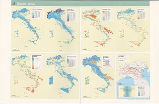
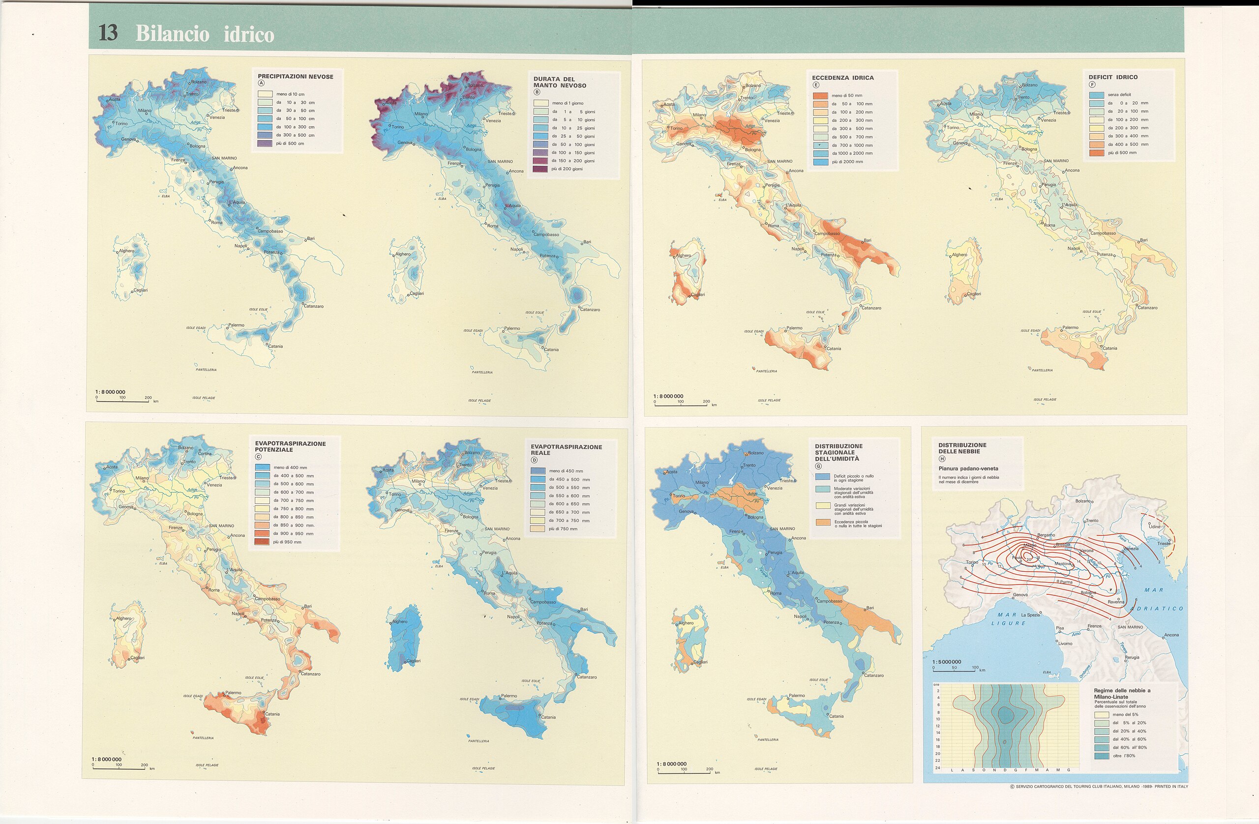
English: This table shows the water availability, which is the result of the sum of precipitation and restituion of water to the atmosphere, net of the amount of water detained by the soil or lost due to the evapotranspiration caused by the solar heat.More specifically: A) Snow precipitation. Scale: 1: 8 000 000; B) Snow cover period. Scale: 1: 8 000 000; C) Potential evapotranspiration. Scale: 1: 8 000 000; D) Actual evapotranspiration. Scale: 1: 8 000 000; E) Water surplus. Scale: 1: 8 000 000; F)Water deficit. Scale: 1: 8 000 000; G)Seasonal humidity distribution. Scale: 1: 8 000 000; H)Fog distribution. Scale: 1: 5 000 000. The table is part of the Tematic Atlas realized by the TCI Cartographic Office with CNR - Italian National Research Council (1989-1992) Italiano: La tavola mostra il bilancio idrico, risultante dalla somma algebrica della quantità di precipitazioni e di restituzione di acqua all'atmosfera, al netto di quanto immagazzinato dal suolo e di quanto perso per evapotraspirazione causata dal calore solare. Più nel dettaglio: A) Precipitazioni nevose. Scala: 1: 8 000 000; B)Durata del manto nevoso. Scala: 1: 8 000 000; C) Evapotraspirazione potenziale. Scala: 1: 8 000 000; D) Evapotraspirazione reale. Scala: 1: 8 000 000; E)Eccedenza idrica. Scala: 1: 8 000 000; F)Deficit idrico. Scala: 1: 8 000 000; G) Distribuzione stagionale dell'umidità. Scala: 1: 8 000 000; H) Distribuzione delle nebbie. Scala: 1: 5 000 000. La tavola è parte dell'Atlante Tematico realizzato dall'Ufficio Cartografico del TCI con il CNR - Consiglio Nazionale delle Ricerche (1989-1992) |
|
| Date | ||
| Source | Scan from the original work Archivio Storico del Touring Club Italiano | |
| Creator |
TCI Cartographic Office |
|
| Permission (Reusing this file) |
|
|
| Geotemporal data | ||
| Map location | Italy | |
| Map type | Hydrographic maps | |
| Scale | 1: 8 000 000; 1: 5 000 000 | |
| Georeferencing | If inappropriate please set warp_status = skip to hide. | |
| Bibliographic data | ||
| Part of the series | Thematic Atlas of Italy | |
| Language | Italian | |
| Place of publication | Milan | |
| Publisher |
TCI |
|
| Printed by |
TCI |
|
| Archival data | ||
| Collection | ||
| Accession number |
CART.TEM.013 |
|

Licensing
[edit]
File history
Click on a date/time to view the file as it appeared at that time.
| Date/Time | Thumbnail | Dimensions | User | Comment | |
|---|---|---|---|---|---|
| current | 09:12, 2 November 2022 | | 5,000 × 3,273 (3.1 MB) | Ilaria Parma (TCI) (talk | contribs) | pattypan 22.03 |
You cannot overwrite this file.
File usage on Commons
The following page uses this file: