File:Map ZST na uzemi Bratislavy JPN.png
Jump to navigation
Jump to search
Size of this preview: 606 × 599 pixels. Other resolutions: 243 × 240 pixels | 485 × 480 pixels | 776 × 768 pixels | 1,100 × 1,088 pixels.
Original file (1,100 × 1,088 pixels, file size: 295 KB, MIME type: image/png)
Captions
Captions
Add a one-line explanation of what this file represents
| Description |
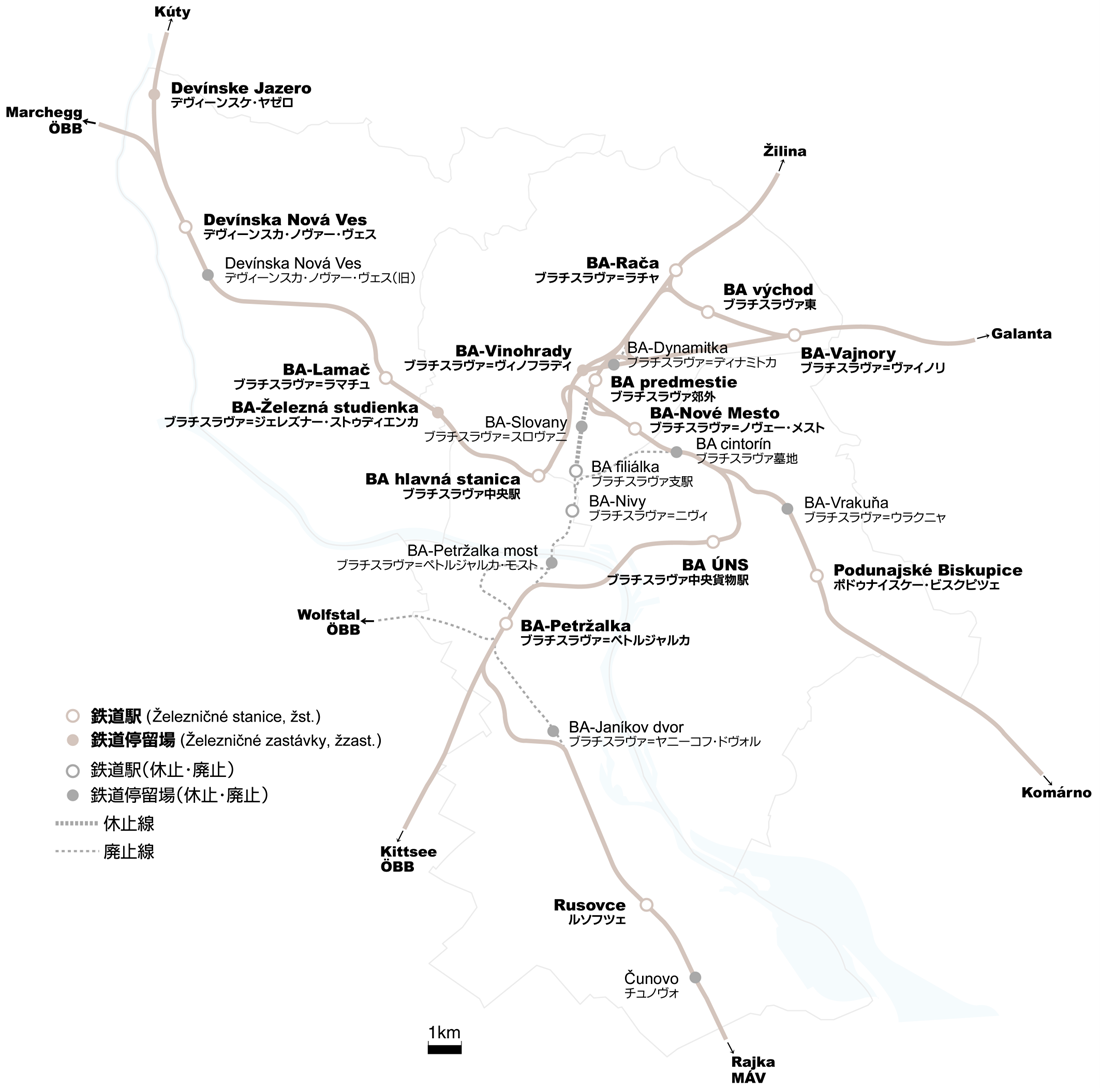
日本語: Location map of Železničná stanica and zastávky in Bratislava city area with Japanese language |
||
| Source | Own work | ||
| Author | ENG-N1 | ||
| Permission (Reusing this file) |
|
File history
Click on a date/time to view the file as it appeared at that time.
| Date/Time | Thumbnail | Dimensions | User | Comment | |
|---|---|---|---|---|---|
| current | 13:14, 11 October 2010 | | 1,100 × 1,088 (295 KB) | ENG-N1 (talk | contribs) | recorrected |
| 13:20, 10 October 2010 |  | 1,100 × 1,088 (295 KB) | ENG-N1 (talk | contribs) | Suppressed comment removed by FileImporter. | |
| 12:42, 10 October 2010 |  | 1,100 × 1,048 (274 KB) | ENG-N1 (talk | contribs) | Suppressed comment removed by FileImporter. | |
| 16:25, 9 October 2010 |  | 1,100 × 1,051 (227 KB) | ENG-N1 (talk | contribs) | corrected | |
| 15:02, 9 October 2010 |  | 1,100 × 1,173 (228 KB) | ENG-N1 (talk | contribs) | {{Information |Description= Location map of Železničná stanica and zastávky in Bratislava city area with Japanese language |Source= Self made |Date= |Author= ENG-N1 |Permission= {{PD-self}} |other_versions= }} |
You cannot overwrite this file.
File usage on Commons
There are no pages that use this file.