File:Map by nicolo zeno 1558.jpg
Jump to navigation
Jump to search

Size of this preview: 716 × 600 pixels. Other resolutions: 287 × 240 pixels | 573 × 480 pixels | 917 × 768 pixels | 1,024 × 858 pixels.
Original file (1,024 × 858 pixels, file size: 299 KB, MIME type: image/jpeg)
Captions
Captions
Add a one-line explanation of what this file represents
Summary[edit]
| Description | |
| Date | |
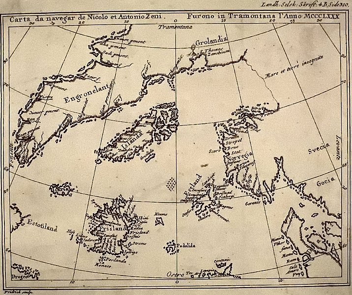
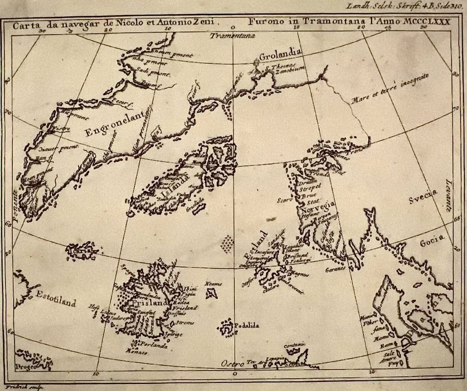
| Source | Henrich Peter von Eggers, Priisskrift om Grønlands Østerbygds sande Beliggenhed (1793) |
| Author | Nicolo Zeno |
Licensing[edit]
|
This work is in the public domain in its country of origin and other countries and areas where the copyright term is the author's life plus 100 years or fewer. This work is in the public domain in the United States because it was published (or registered with the U.S. Copyright Office) before January 1, 1929. | |
| This file has been identified as being free of known restrictions under copyright law, including all related and neighboring rights. | |
File history
Click on a date/time to view the file as it appeared at that time.
| Date/Time | Thumbnail | Dimensions | User | Comment | |
|---|---|---|---|---|---|
| current | 19:08, 22 September 2020 | | 1,024 × 858 (299 KB) | Hohum (talk | contribs) | Cleanup |
| 00:27, 11 May 2007 |  | 1,024 × 858 (167 KB) | Petri Krohn (talk | contribs) | Reverted to earlier revision | |
| 14:37, 12 May 2005 |  | 1,015 × 852 (289 KB) | Luestling~commonswiki (talk | contribs) | ||
| 00:18, 18 April 2005 |  | 1,024 × 858 (167 KB) | Simplicius (talk | contribs) | Map by Nicolo Zeno, 1558, published by Henrich Peter von Eggers 1793. {{pd-old}} |
You cannot overwrite this file.
File usage on Commons
The following 2 pages use this file:
File usage on other wikis
The following other wikis use this file:
- Usage on ar.wikipedia.org
- Usage on bn.wikipedia.org
- Usage on bs.wikipedia.org
- Usage on ca.wikipedia.org
- Usage on cs.wikipedia.org
- Usage on da.wikipedia.org
- Usage on de.wikipedia.org
- Usage on de.wiktionary.org
- Usage on en.wikipedia.org
- Usage on eo.wikipedia.org
- Usage on es.wikipedia.org
- Usage on fa.wikipedia.org
- Usage on fi.wikipedia.org
- Usage on fo.wikipedia.org
- Usage on fr.wikipedia.org
- Usage on fy.wikipedia.org
- Usage on he.wikipedia.org
- Usage on hi.wikipedia.org
- Usage on id.wikipedia.org
- Usage on it.wikipedia.org
View more global usage of this file.