File:Map northern new mexico 1867.jpg
Jump to navigation
Jump to search
Size of this preview: 785 × 600 pixels. Other resolutions: 314 × 240 pixels | 628 × 480 pixels | 852 × 651 pixels.
Original file (852 × 651 pixels, file size: 464 KB, MIME type: image/jpeg)
Captions
Captions
Add a one-line explanation of what this file represents
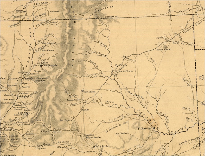
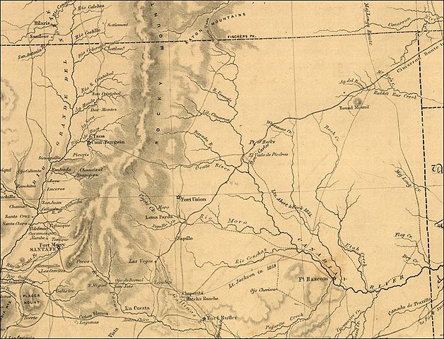
| Description | map of northern New Mexico, in 1867. With Santa Fe, Taos, Fort Union, a part of Santa Fe Trail. | ||||
| Date | |||||
| Source | National Park Service, originally Library of Congress, http://www.cr.nps.gov/nr/twhp/wwwlps/lessons/117glorietaraton/117images/117map3ch.jpg | ||||
| Author | |||||
| Permission (Reusing this file) |
|
||||
File history
Click on a date/time to view the file as it appeared at that time.
| Date/Time | Thumbnail | Dimensions | User | Comment | |
|---|---|---|---|---|---|
| current | 13:35, 24 October 2006 | | 852 × 651 (464 KB) | H-stt (talk | contribs) | {{Information |Description= map of northern New Mexico, in 1867. With Santa Fe, Taos, Fort Union, a part of Santa Fe Trail. |Source= National Park Service, originally Library of Congress, http://www.cr.nps.gov/nr/twhp/wwwlps/lessons/117glorietaraton/117im |
You cannot overwrite this file.
File usage on Commons
There are no pages that use this file.