File:Map of Afghanistan during the Safavid and Moghul Empire.jpg

原始文件 (2,532 × 1,736像素,文件大小:1.16 MB,MIME类型:image/jpeg)
说明
说明
摘要[编辑]
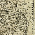
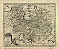
| 描述Map of Afghanistan during the Safavid and Moghul Empire.jpg | Map of Afghanistan during the Safavid and Mughal Empire, from the 16th century to 1747 when the current nation-state was created. Extracted from Bowen's A new & accurate map of Persia, with the adjacent countries. | ||
| 日期 | |||
| 来源 |
From: Bowen's A complete system of geography. London : Printed for W. Innys, R. Ware [etc.], 1747. Library of Congress Geography and Map Division, Call number G7620 1747 .B6
|
||
| 作者 | Bowen, Emanuel, d. 1767. | ||
| 其他版本 |
|
许可协议[编辑]
| Public domainPublic domainfalsefalse |
|
本作品在其来源国以及其他著作权期限是作者逝世后100年或以下的国家和地区属于公有领域。 | |
| 本文件已被确认为免除已知的著作权法限制(包括所有相关权利)。 | |
https://creativecommons.org/publicdomain/mark/1.0/PDMCreative Commons Public Domain Mark 1.0falsefalse
文件历史
点击某个日期/时间查看对应时刻的文件。
| 日期/时间 | 缩略图 | 大小 | 用户 | 备注 | |
|---|---|---|---|---|---|
| 当前 | 2011年3月2日 (三) 02:50 |  | 2,532 × 1,736(1.16 MB) | Officer(留言 | 贡献) | {{Information |Description= |Source= |Date= |Author= |Permission= |other_versions= }} |
| 2011年3月2日 (三) 02:42 |  | 2,342 × 1,682(1.04 MB) | Officer(留言 | 贡献) | {{Information |Description= |Source= |Date= |Author= |Permission= |other_versions= }} | |
| 2011年3月2日 (三) 02:32 |  | 2,402 × 1,599(1.02 MB) | Officer(留言 | 贡献) | {{Information |Description= |Source= |Date= |Author= |Permission= |other_versions= }} | |
| 2011年3月2日 (三) 01:37 |  | 2,064 × 1,607(856 KB) | Officer(留言 | 贡献) | {{Information |Description= |Source= |Date= |Author= |Permission= |other_versions= }} | |
| 2010年3月12日 (五) 14:39 |  | 1,810 × 1,810(915 KB) | Officer(留言 | 贡献) | {{Information |Description=Map of Afghanistan during the Safavid and Mughal Empire, from the 16th century to 1747 when the current nation-state was created. |Source=[http://memory.loc.gov/ The Library of Congress, American Memory] - [http://memory.loc.gov | |
| 2010年1月21日 (四) 03:48 |  | 2,056 × 1,574(983 KB) | Officer(留言 | 贡献) | {{Information |Description=Map of Afghanistan during the Safavid and Mughal Empire, from the 16th century to 1747 when the current nation-state was created. |Source=[http://memory.loc.gov/ The Library of Congress, American Memory] - [http://memory.loc.gov | |
| 2009年11月19日 (四) 01:29 |  | 1,679 × 1,678(790 KB) | Officer(留言 | 贡献) | {{Information |Description=Map of Afghanistan during the Safavid and Mughal Empire, from the 16th century to 1747 when the current nation-state was created. |Source=[http://memory.loc.gov/ The Library of Congress, American Memory] - [http://memory.loc.gov |
您不可以覆盖此文件。
文件用途
以下页面使用本文件:
全域文件用途
以下其他wiki使用此文件:
- ar.wikipedia.org上的用途
- azb.wikipedia.org上的用途
- az.wikipedia.org上的用途
- bn.wikipedia.org上的用途
- el.wikipedia.org上的用途
- en.wikipedia.org上的用途
- fa.wikipedia.org上的用途
- hi.wikipedia.org上的用途
- id.wikipedia.org上的用途
- it.wikipedia.org上的用途
- ja.wikipedia.org上的用途
- nl.wikipedia.org上的用途
- no.wikipedia.org上的用途
- pnb.wikipedia.org上的用途
- pt.wikipedia.org上的用途
- ru.wikipedia.org上的用途
- ta.wikipedia.org上的用途
- te.wikipedia.org上的用途
- tg.wikipedia.org上的用途
- uk.wikipedia.org上的用途
- ur.wikipedia.org上的用途
- www.wikidata.org上的用途
查看本文件的更多全域用途。
元数据
此文件中包含有额外的信息。这些信息可能是由数码相机或扫描仪在创建或数字化过程中所添加。
如果文件已从其原始状态修改,某些细节可能无法完全反映修改后的文件。
| 方位 | 标准 |
|---|---|
| 使用软件 | Microsoft Windows Live Photo Gallery14.0.8081.709 |
| 文件修改日期时间 | 2011年3月2日 (三) 07:48 |
| 黄色和洋红配置 | 居中 |
| Exif版本 | 2.2 |
| 修改时间厘秒数 | 796 |
| 唯一图像ID | 0C1EF52B50524269A9D1677B73A12A8D |

