File:Map of Arkansas NA.png
Spring til navigation
Spring til søgning

Størrelse af denne forhåndsvisning: 776 × 600 pixels. Andre opløsninger: 311 × 240 pixels | 621 × 480 pixels | 994 × 768 pixels | 1.280 × 989 pixels | 2.122 × 1.640 pixels.
Oprindelig fil (2.122 × 1.640 billedpunkter, filstørrelse: 2,78 MB, MIME-type: image/png)
Captions
Captions
Tilføj en kort forklaring på en enkelt linje om hvad filen viser
Beskrivelse[redigér]
| Beskrivelse | |
| Dato | |
| Kilde | |
| Forfatter | National Atlas of the United States |
| Tilladelse (Genbrug af denne fil) |
Public domain |
Licensering[redigér]
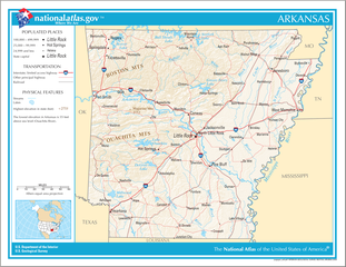
This map was obtained from an edition of the National Atlas of the United States. Like almost all works of the U.S. federal government, works from the National Atlas are in the public domain in the United States.
Online access: NationalAtlas.gov | 1970 print edition: Library of Congress, Perry-Castañeda Library
|
Filhistorik
Klik på en dato/tid for at se filen som den så ud på det tidspunkt.
| Dato/tid | Miniaturebillede | Dimensioner | Bruger | Kommentar | |
|---|---|---|---|---|---|
| nuværende | 14. aug. 2006, 20:16 | | 2.122 × 1.640 (2,78 MB) | Huebi~commonswiki (diskussion | bidrag) | {{Information| |Description=Map of Arkansas |Source=[http://www.nationalatlas.gov National Atlas] }} Category:Maps of the United States Category:Maps of Arkansas {{PD-USGov-Atlas}} |
Du kan ikke overskrive denne fil.
Filanvendelse
Der er ingen sider der bruger denne fil.
Global filanvendelse
Følgende andre wikier anvender denne fil:
- Anvendelser på ca.wikipedia.org
- Anvendelser på da.wikipedia.org
- Anvendelser på de.wikipedia.org
- Anvendelser på en.wikipedia.org
- Anvendelser på fa.wikipedia.org
- Anvendelser på hsb.wikipedia.org
- Anvendelser på hu.wikipedia.org
- Anvendelser på ilo.wikipedia.org
- Anvendelser på incubator.wikimedia.org
- Anvendelser på it.wikipedia.org
- Anvendelser på ja.wikipedia.org
- Anvendelser på kn.wikipedia.org
- Anvendelser på simple.wikipedia.org
- Anvendelser på si.wikipedia.org
- Anvendelser på sw.wikipedia.org
- Anvendelser på szl.wikipedia.org
- Anvendelser på uz.wikipedia.org
- Anvendelser på zea.wikipedia.org