File:Map of Arkansas highlighting Washington County.svg
Jump to navigation
Jump to search

Size of this PNG preview of this SVG file: 689 × 600 pixels. Other resolutions: 276 × 240 pixels | 551 × 480 pixels | 882 × 768 pixels | 1,176 × 1,024 pixels | 2,353 × 2,048 pixels | 4,474 × 3,895 pixels.
Original file (SVG file, nominally 4,474 × 3,895 pixels, file size: 102 KB)
Captions
Captions
Add a one-line explanation of what this file represents
Summary[edit]
| Description |
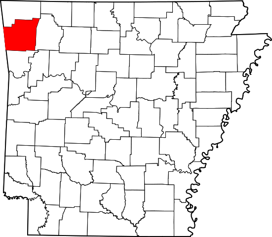
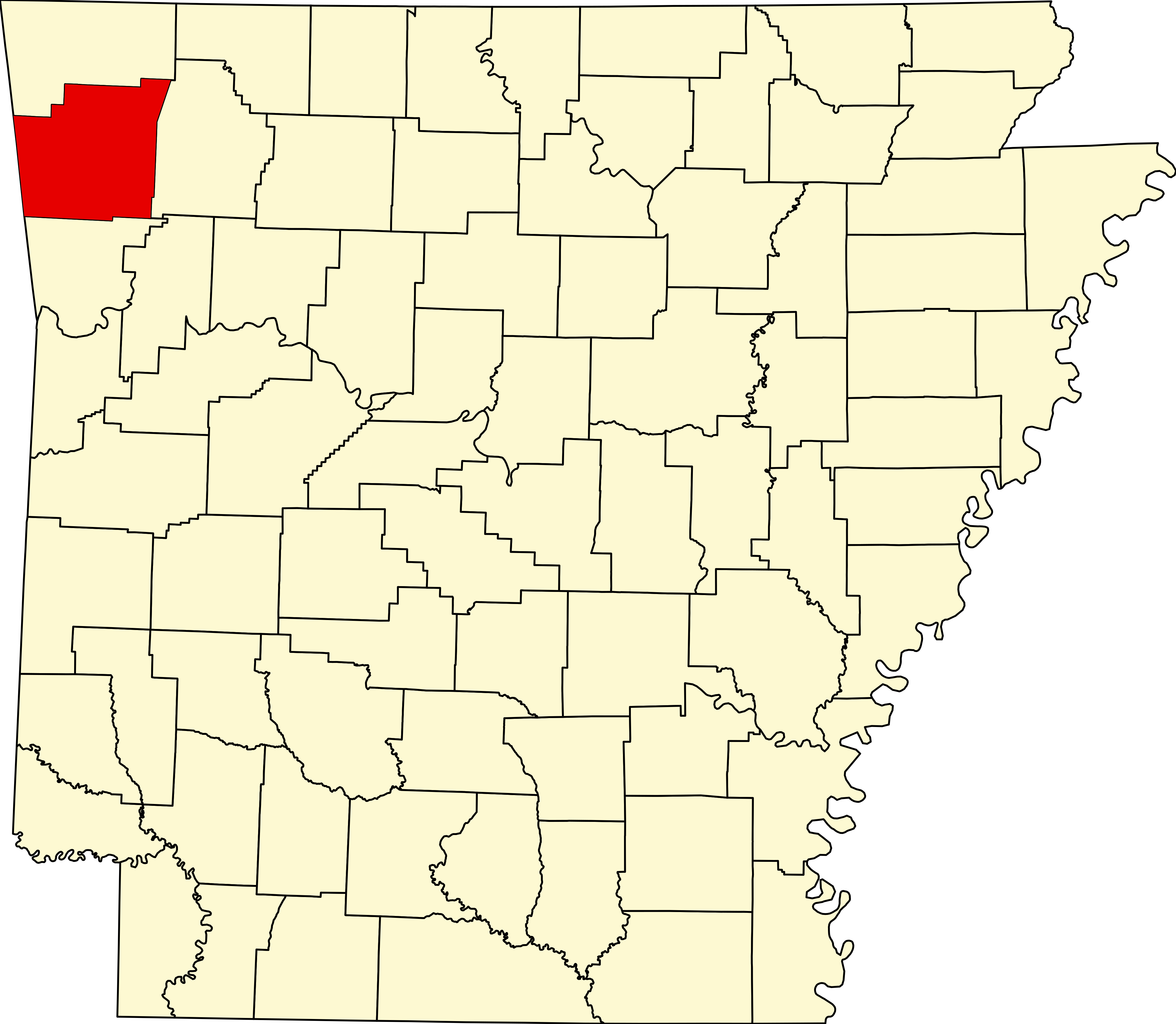
English: This is a locator map showing Washington County in Arkansas. For more information, see Commons:United States county locator maps. |
| Date | |
| Source |
Own work: English: The maps use data from nationalatlas.gov, specifically countyp020.tar.gz on the Raw Data Download page. The maps also use state outline data from statesp020.tar.gz. The Florida maps use hydrogm020.tar.gz to display Lake Okeechobee. |
| Author | David Benbennick |
Licensing[edit]
| I, the copyright holder of this work, release this work into the public domain. This applies worldwide. In some countries this may not be legally possible; if so: I grant anyone the right to use this work for any purpose, without any conditions, unless such conditions are required by law. |
File history
Click on a date/time to view the file as it appeared at that time.
| Date/Time | Thumbnail | Dimensions | User | Comment | |
|---|---|---|---|---|---|
| current | 10:11, 12 February 2006 | | 4,474 × 3,895 (102 KB) | David Benbennick (talk | contribs) | {{subst:User:Dbenbenn/clm|county=Washington County|state=Arkansas}} |
You cannot overwrite this file.
File usage
The following 6 pages use this file:
Global file usage
The following other wikis use this file:
- Usage on ar.wikipedia.org
- Usage on arz.wikipedia.org
- Usage on bg.wikipedia.org
- Usage on bpy.wikipedia.org
- Usage on cdo.wikipedia.org
- Usage on ceb.wikipedia.org
- Usage on ce.wikipedia.org
- Usage on cs.wikipedia.org
- Usage on cy.wikipedia.org
- Usage on de.wikipedia.org
- Usage on en.wikipedia.org
- List of counties in Arkansas
- Washington County, Arkansas
- Elm Springs, Arkansas
- Springdale, Arkansas
- Elkins, Arkansas
- Farmington, Arkansas
- Fayetteville, Arkansas
- Goshen, Arkansas
- Greenland, Arkansas
- Johnson, Arkansas
- Lincoln, Arkansas
- Prairie Grove, Arkansas
- Tontitown, Arkansas
- West Fork, Arkansas
- Winslow, Arkansas
- User:Krakrjak
- User:Presidentman/Ubx/Washington Co, AR
- Summers, Arkansas
- Canehill, Arkansas
- User:Presidentman/Ubx
- Template:Washington County, Arkansas
- User:Nyttend/County templates/AR
- Dutch Mills, Arkansas
- Durham, Arkansas
- National Register of Historic Places listings in Washington County, Arkansas
- Savoy, Arkansas
- Boston Township, Washington County, Arkansas
- Floss, Arkansas
- Odell, Arkansas
- Skylight, Arkansas
- Brush Creek Township, Washington County, Arkansas
- Blue Springs Village, Arkansas
- Pilgrim's Rest, Arkansas
- Spring Valley, Washington County, Arkansas
- War Eagle Cove, Arkansas
- Cane Hill Township, Washington County, Arkansas
View more global usage of this file.