File:Map of Central California Showing Power Plants and Transmission Lines of the Pacific Gas and Electric Company c 1912.png
Jump to navigation
Jump to search

Size of this preview: 440 × 599 pixels. Other resolutions: 176 × 240 pixels | 352 × 480 pixels | 564 × 768 pixels | 752 × 1,024 pixels | 1,394 × 1,898 pixels.
Original file (1,394 × 1,898 pixels, file size: 2.25 MB, MIME type: image/png)
Captions
Captions
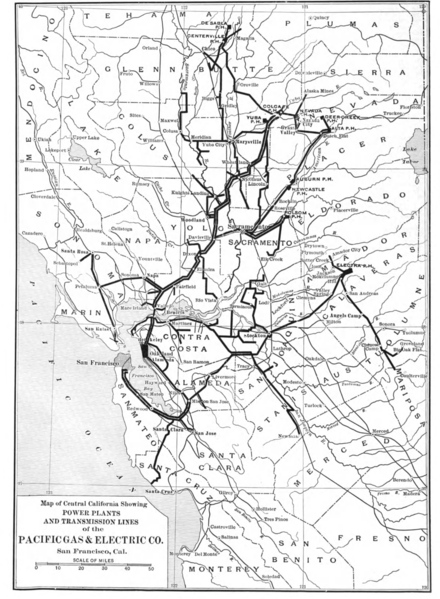
Map of Central California Showing Power Plants and Transmission Lines of the Pacific Gas and Electric Company c 1912
Summary
[edit]
| Description |
English: Map of Central California Showing Power Plants and Transmission Lines of the Pacific Gas and Electric Company c 1912 |
| Date | |
| Source |
McGraw Electric Railway Manual: Issued Annually in Connection with the Electric Railway Journal: 1912 http://hdl.handle.net/2027/mdp.39015089293073 - HathiTrust Google Digitized |
| Author | McGraw Electric Railway Manual |
Licensing
[edit]
This work is in the public domain in the United States because it was published (or registered with the U.S. Copyright Office) before January 1, 1929.
Public domain works must be out of copyright in both the United States and in the source country of the work in order to be hosted on the Commons. If the work is not a U.S. work, the file must have an additional copyright tag indicating the copyright status in the source country.
Note: This tag should not be used for sound recordings. |
File history
Click on a date/time to view the file as it appeared at that time.
| Date/Time | Thumbnail | Dimensions | User | Comment | |
|---|---|---|---|---|---|
| current | 20:53, 30 January 2023 | | 1,394 × 1,898 (2.25 MB) | DavidLevinson (talk | contribs) | Uploaded a work by McGraw Electric Railway Manual from McGraw Electric Railway Manual: Issued Annually in Connection with the Electric Railway Journal: 1912 http://hdl.handle.net/2027/mdp.39015089293073 - HathiTrust Google Digitized with UploadWizard |
You cannot overwrite this file.
File usage on Commons
There are no pages that use this file.
File usage on other wikis
The following other wikis use this file:
- Usage on en.wikipedia.org