File:Map of Horn Dome.jpg
Jump to navigation
Jump to search
Size of this preview: 800 × 573 pixels. Other resolutions: 320 × 229 pixels | 640 × 459 pixels | 1,024 × 734 pixels | 1,280 × 917 pixels | 2,560 × 1,835 pixels | 6,717 × 4,814 pixels.
Original file (6,717 × 4,814 pixels, file size: 4.89 MB, MIME type: image/jpeg)
Captions
Captions
Add a one-line explanation of what this file represents
Summary
[edit]
| Description |
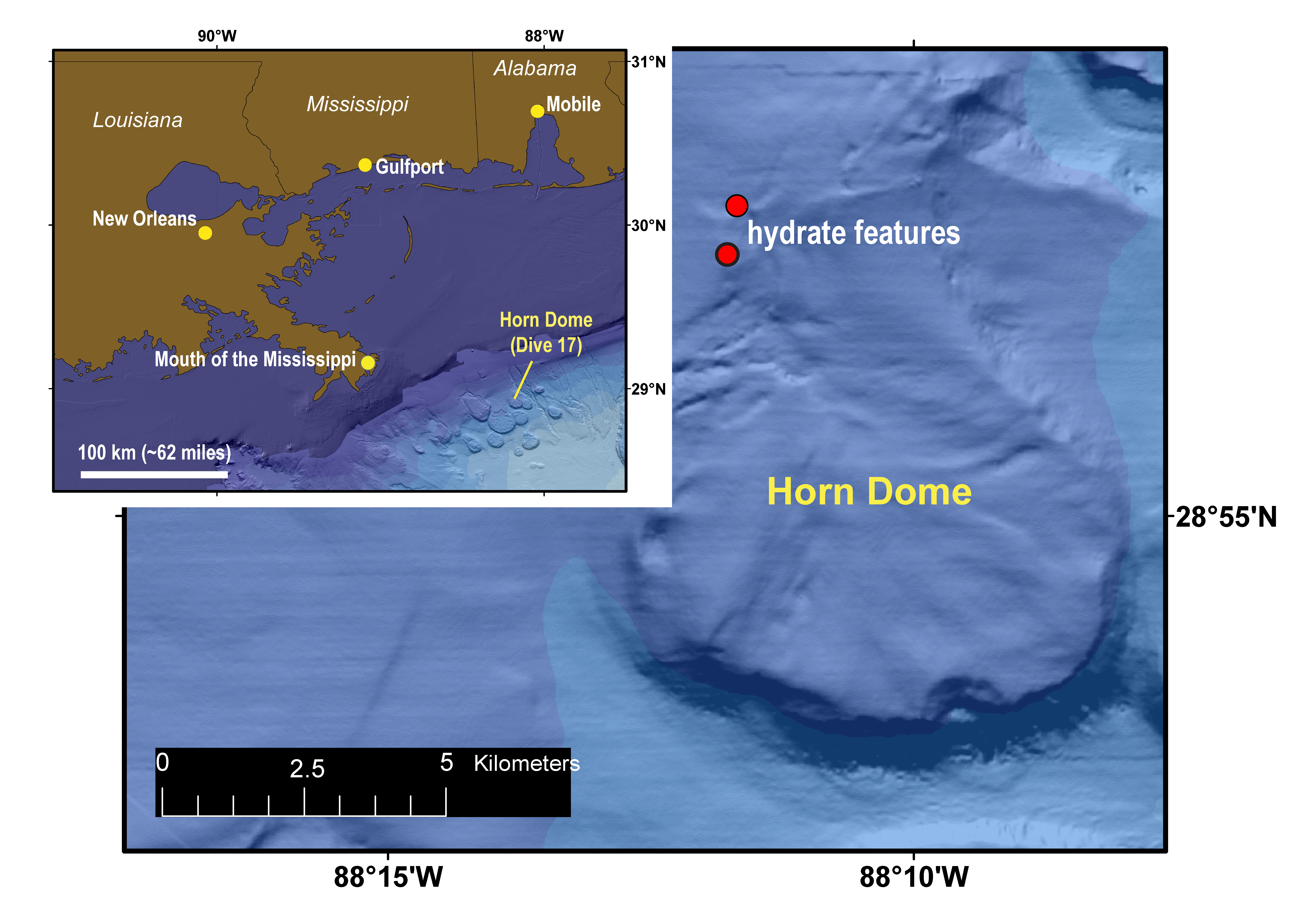
English: Dive 17 explored the northwest part of Horn Dome, a salt-cored bathymetric high that had been the focus of several previous remotely operated vehicle dives. Seafloor outcrops of gas hydrate were found at several locations during the dive. |
| Source | https://oceanexplorer.noaa.gov/okeanos/explorations/ex1711/logs/dec20/media/map.html |
| Author | Bathymetric data and shaded relief from the Bureau of Ocean Energy Management’s dataset. Map courtesy of the U.S. Geological Survey. |
Licensing
[edit]
This image is in the public domain because it contains materials that originally came from the U.S. National Oceanic and Atmospheric Administration, taken or made as part of an employee's official duties.
|
File history
Click on a date/time to view the file as it appeared at that time.
| Date/Time | Thumbnail | Dimensions | User | Comment | |
|---|---|---|---|---|---|
| current | 19:32, 28 June 2018 | | 6,717 × 4,814 (4.89 MB) | Ehershkovitz (talk | contribs) | Uploading a public-domain item using File Upload Wizard |
You cannot overwrite this file.
File usage on Commons
There are no pages that use this file.
File usage on other wikis
The following other wikis use this file:
- Usage on en.wikipedia.org