File:Map of Iraq, 1976.jpg
跳至導覽
跳至搜尋

預覽大小:621 × 599 像素。 其他解析度:249 × 240 像素 | 497 × 480 像素 | 796 × 768 像素 | 1,064 × 1,027 像素。
原始檔案 (1,064 × 1,027 像素,檔案大小:395 KB,MIME 類型:image/jpeg)
說明
說明
添加單行說明來描述出檔案所代表的內容
| 描述 |
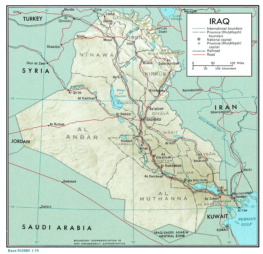
English: A map of Iraq, drawn in 1976. It shows the old province boundaries and other topographical detail. It is referred to here as a work of the CIA. |
|||
| 日期 | ||||
| 來源 | http://www.lib.utexas.edu/maps/middle_east_and_asia/iraq_rel_1976.jpg | |||
| 作者 | Employee(s) of the Central Intelligence Agency | |||
| 授權許可 (重用此檔案) |
|
|||
| 其他版本 |
File:Neutralzone.jpg, cropped section of Neutral Zone. File:Map of Iraq, 1976-ar.jpg, in Arabic |

檔案歷史
點選日期/時間以檢視該時間的檔案版本。
| 日期/時間 | 縮圖 | 尺寸 | 使用者 | 備註 | |
|---|---|---|---|---|---|
| 目前 | 2010年6月11日 (五) 13:03 | | 1,064 × 1,027(395 KB) | Jarry1250(留言 | 貢獻) | {{Information |Description={{en|1=A map of Iraq, drawn in 1976. It shows the old province boundaries and other topographical detail. It is referred to [http://www.lib.utexas.edu/maps/iraq.html here] as a work of the CIA.}} |Source=http://www.lib.utexas. |
無法覆蓋此檔案。
檔案用途
下列頁面有用到此檔案:
全域檔案使用狀況
以下其他 wiki 使用了這個檔案:
- ar.wikipedia.org 的使用狀況
- en.wikipedia.org 的使用狀況
- es.wikipedia.org 的使用狀況
- fa.wikipedia.org 的使用狀況
- zh.wikipedia.org 的使用狀況