File:Map of Lancaster County Pennsylvania School Districts.png
ナビゲーションに移動
検索に移動
高解像度版はありません。
Map_of_Lancaster_County_Pennsylvania_School_Districts.png (488 × 383 ピクセル、ファイルサイズ: 22キロバイト、MIME タイプ: image/png)
キャプション
キャプション
このファイルの内容を1行で記述してください
概要
[編集]
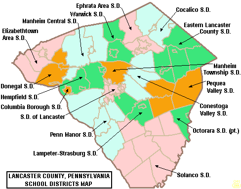
| 解説 | Map of Lancaster County, Pennsylvania, United States Public School Districts |
| 日付 | |
| 原典 | taken from US Census website [1] and modified by User:Ruhrfisch |
| 作者 | US Census, Ruhrfisch |
| 許可 (ファイルの再利用) |
US Census / US Government work is public domain, my modifications licensed under the GNU Free Documentation License |
ライセンス
[編集]

|
この文書は、フリーソフトウェア財団発行のGNUフリー文書利用許諾書 (GNU Free Documentation License) 1.2またはそれ以降のバージョンの規約に基づき、複製や再配布、改変が許可されます。不可変更部分、表紙、背表紙はありません。このライセンスの複製は、GNUフリー文書利用許諾書という章に含まれています。 |
| このファイルはクリエイティブ・コモンズ 表示-継承 3.0 非移植ライセンスのもとに利用を許諾されています。 | ||
| ||
| このライセンスのテンプレートは、GFDLのライセンス・アップデートによりこのファイルに追加されたものです。 |
ファイルの履歴
過去の版のファイルを表示するには、その版の日時をクリックしてください。
| 日付と時刻 | サムネイル | 寸法 | 利用者 | コメント | |
|---|---|---|---|---|---|
| 現在の版 | 2006年5月30日 (火) 01:00 | | 488 × 383 (22キロバイト) | Ruhrfisch (トーク | 投稿記録) | == Summary == {{Information| |Description= Map of Lancaster County, Pennsylvania, United States Public School Districts |Source= taken from US Census website [http://factfinder.census.gov/] and modified by User:Ruhrfisch |Date= May 2006 |Author= US |
| 2006年4月24日 (月) 14:58 |  | 489 × 384 (22キロバイト) | Ruhrfisch (トーク | 投稿記録) | {{Information| |Description= Map of Lancaster County, Pennsylvania, United States Public School Districts |Source= taken from US Census website [http://factfinder.census.gov/] and modified by User:Ruhrfisch |Date= April 2006 |Author= US Census, Ruhr | |
| 2006年4月20日 (木) 21:05 |  | 489 × 384 (23キロバイト) | Ruhrfisch (トーク | 投稿記録) | {{Information| |Description= Map of Lancaster County, Pennsylvania, United States Public School Districts |Source= taken from US Census website [http://factfinder.census.gov/] and modified by User:Ruhrfisch |Date= April 2006 |Author= US Census, Ruhr |
このファイルは上書きできません。
ファイルの使用状況
このファイルを使用しているページはありません。
グローバルなファイル使用状況
以下に挙げる他のウィキがこの画像を使っています:
- en.wikipedia.org での使用状況
- Lancaster County, Pennsylvania
- Lampeter-Strasburg School District
- Warwick School District
- Solanco School District
- Penn Manor High School
- Lancaster Catholic High School
- J. P. McCaskey High School
- Hempfield High School
- Lampeter-Strasburg High School
- Elizabethtown Area School District
- Lancaster Mennonite School
- Conrad Weiser Area School District
- Cocalico School District
- Columbia Borough School District
- Conestoga Valley School District
- Donegal School District
- Eastern Lancaster County School District
- Ephrata Area School District
- Manheim Township High School
- Manheim Township School District
- Hempfield School District
- School District of Lancaster
- Manheim Central School District
- Penn Manor School District
- Pequea Valley School District
- Talk:Christiana, Pennsylvania
- Garden Spot High School
- Saint Leo the Great School (Pennsylvania)
- Solanco High School
- Cocalico Senior High School
- Conestoga Christian School
- Conestoga Valley High School
- Ephrata High School (Pennsylvania)
- Warwick High School (Pennsylvania)
- Pequea Valley High School
- Manheim Central High School
- Octorara Area School District
- Octorara Junior-Senior High School
- Lancaster Country Day School
- Lancaster County Christian School
- File talk:Map of Lancaster County Pennsylvania School Districts.png
- Template:Lancaster County, Pennsylvania School Districts
- Linden Hall (school)
- User:Epoloch/Projects
- Dayspring Christian Academy
- Donegal High School
- ja.wikipedia.org での使用状況