File:Map of Maine highlighting Cumberland County.svg
Ir a la navegación
Ir a la búsqueda

Tamaño de esta previsualización PNG del archivo SVG: 400 × 600 píxeles. Otras resoluciones: 160 × 240 píxeles | 320 × 480 píxeles | 512 × 768 píxeles | 683 × 1024 píxeles | 1366 × 2048 píxeles | 3252 × 4876 píxeles.
Archivo original (archivo SVG, nominalmente 3252 × 4876 píxeles, tamaño de archivo: 131 kB)
Leyendas
Leyendas
Añade una explicación corta acerca de lo que representa este archivo
Resumen[editar]
| Descripción |
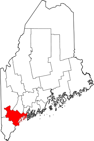
English: This is a locator map showing Cumberland County in Maine. For more information, see Commons:United States county locator maps. |
| Fecha | |
| Fuente |
Trabajo propio: English: The maps use data from nationalatlas.gov, specifically countyp020.tar.gz on the Raw Data Download page. The maps also use state outline data from statesp020.tar.gz. The Florida maps use hydrogm020.tar.gz to display Lake Okeechobee. |
| Autor | David Benbennick |
Licencia[editar]
| Yo, el titular de los derechos de autor de esta obra, lo libero al dominio público. Esto aplica en todo el mundo. En algunos países esto puede no ser legalmente factible; si ello ocurriese: Concedo a cualquier persona el derecho de usar este trabajo para cualquier propósito, sin ningún tipo de condición al menos que éstas sean requeridas por la ley. |
Historial del archivo
Haz clic sobre una fecha y hora para ver el archivo tal como apareció en ese momento.
| Fecha y hora | Miniatura | Dimensiones | Usuario | Comentario | |
|---|---|---|---|---|---|
| actual | 12:46 12 feb 2006 | | 3252 × 4876 (131 kB) | David Benbennick (discusión | contribs.) | {{subst:User:Dbenbenn/clm|county=Cumberland County|state=Maine|type=county}} |
No puedes sobrescribir este archivo.
Usos del archivo
Las siguientes páginas usan este archivo:
- Lighthouses in Maine
- Category:Births in Cumberland County, Maine
- Category:Cumberland County, Maine
- Category:Deaths in Cumberland County, Maine
- Category:Geography of Cumberland County, Maine
- Category:Maps of Cumberland County, Maine
- Category:People of Cumberland County, Maine
- Category:Populated places in Cumberland County, Maine
Uso global del archivo
Las wikis siguientes utilizan este archivo:
- Uso en ar.wikipedia.org
- بورتلاند (مين)
- مقاطعة كمبرلاند (مين)
- ساوث بورتلاند
- وستبروك
- كاب إليزابث (مين)
- كاسكو (مين)
- كومبرلاند (مين)
- فريبورت (مين)
- فراي أيلاند (مين)
- غورهام (مين)
- هاربسويل (مين)
- هاريسون (مين)
- نابلس (مين)
- نيو غلويسستر (مين)
- قائمة مقاطعات مين
- غراي (الولايات المتحدة)
- برونزويك (مين)
- نورث ويندهام (مين)
- كامبرلاند سنتر (مين)
- يارموث (مين)
- سكاربورو (مين)
- قالب:مقاطعة كمبرلاند (مين)
- Uso en be.wikipedia.org
- Uso en bg.wikipedia.org
- Uso en bpy.wikipedia.org
- Uso en ca.wikipedia.org
- Portland (Maine)
- Baldwin (Maine)
- Brunswick (Maine)
- Cape Elizabeth
- Casco (Maine)
- Cumberland (Maine)
- Falmouth (Maine)
- Freeport (Maine)
- Gorham (Maine)
- Gray (Maine)
- Harpswell
- Harrison (Maine)
- Long Island (Maine)
- Naples (Maine)
- New Gloucester
- North Yarmouth
- Pownal (Maine)
- Raymond (Maine)
- Scarborough (Maine)
- Sebago
- Standish (Maine)
- Westbrook (Maine)
- Windham (Maine)
Ver más uso global de este archivo.