File:Map of Mediaeval kingdoms of Wales X-XI ru.svg
Jump to navigation
Jump to search

Size of this PNG preview of this SVG file: 450 × 600 pixels. Other resolutions: 180 × 240 pixels | 360 × 480 pixels | 576 × 768 pixels | 768 × 1,024 pixels | 1,536 × 2,048 pixels | 720 × 960 pixels.
Original file (SVG file, nominally 720 × 960 pixels, file size: 92 KB)
Captions
Captions
Add a one-line explanation of what this file represents
| Description |
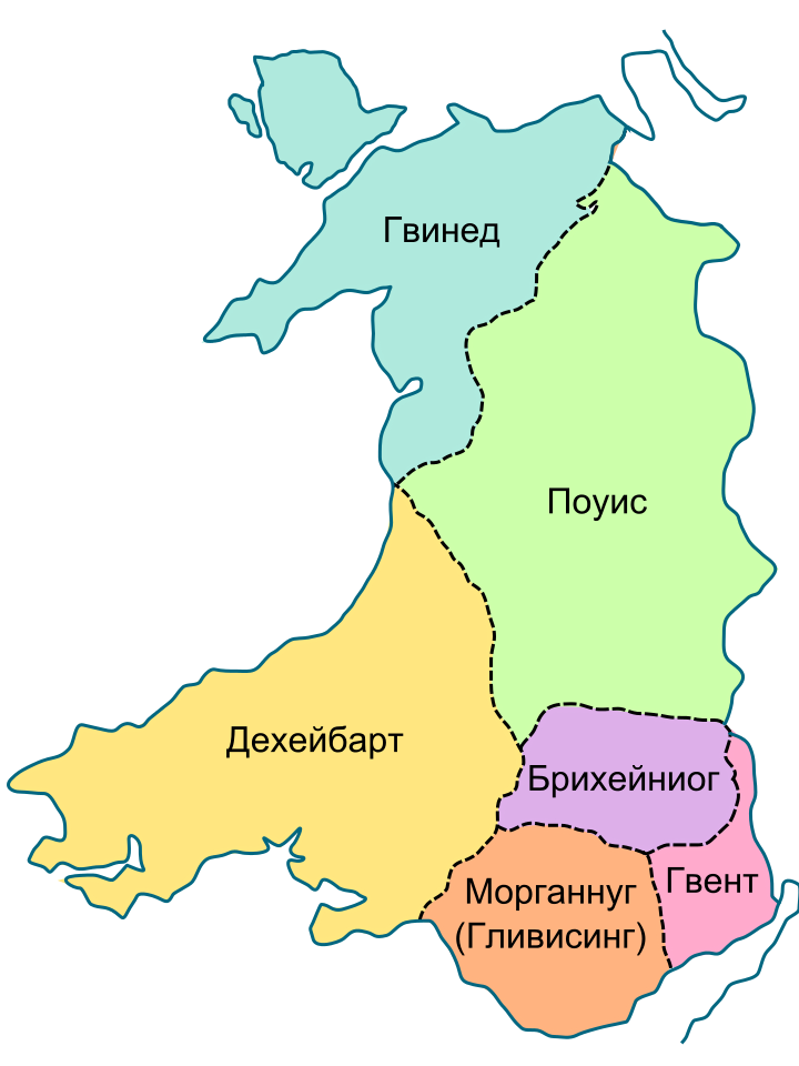
English: Map of Mediaeval kingdoms of Wales X-XI
Русский: Средневековые королевства Уэльса, X-XI века |
| Date | (UTC) |
| Source |
This file was derived from: Map of Mediaeval kingdoms of Wales 700-1000.svg by AlexD |
| Author |
| This is a retouched picture, which means that it has been digitally altered from its original version. Modifications: legend translate in Russian. The original can be viewed here: Map of Mediaeval kingdoms of Wales 700-1000.svg:
|
I, the copyright holder of this work, hereby publish it under the following licenses:
This file is licensed under the Creative Commons Attribution-Share Alike 3.0 Unported license.
- You are free:
- to share – to copy, distribute and transmit the work
- to remix – to adapt the work
- Under the following conditions:
- attribution – You must give appropriate credit, provide a link to the license, and indicate if changes were made. You may do so in any reasonable manner, but not in any way that suggests the licensor endorses you or your use.
- share alike – If you remix, transform, or build upon the material, you must distribute your contributions under the same or compatible license as the original.

|
Permission is granted to copy, distribute and/or modify this document under the terms of the GNU Free Documentation License, Version 1.2 or any later version published by the Free Software Foundation; with no Invariant Sections, no Front-Cover Texts, and no Back-Cover Texts. A copy of the license is included in the section entitled GNU Free Documentation License. |
You may select the license of your choice.
Original upload log
[edit]
This image is a derivative work of the following images:
- File:Map_of_Mediaeval_kingdoms_of_Wales_700-1000.svg licensed with Cc-by-sa-3.0, GFDL
- 2009-01-05T21:20:11Z Lencer 720x960 (100566 Bytes) Deheubath nach Deheubarth korrigiert
- 2008-12-15T04:12:49Z AlexD 720x960 (103012 Bytes) Reverted to version as of 04:12, 15 December 2008
- 2008-12-15T04:12:39Z AlexD 720x960 (106383 Bytes) Reverted to version as of 04:12, 15 December 2008
- 2008-12-15T04:12:27Z AlexD 720x960 (103012 Bytes) Reverted to version as of 04:11, 15 December 2008
- 2008-12-15T04:12:08Z AlexD 720x960 (106383 Bytes)
- 2008-12-15T04:11:36Z AlexD 720x960 (103012 Bytes)
- 2008-12-14T20:32:24Z AlexD 720x960 (106383 Bytes) {{Information |Description={{en|1=Map of Mediaeval kingdoms of Wales 700-1000}} |Source=Own work by uploader |Author=[[User:AlexD|AlexD]] |Date= |Permission= |other_versions=CymruMap.PNG }} [[Category:Maps of Wales]]
Uploaded with derivativeFX
File history
Click on a date/time to view the file as it appeared at that time.
| Date/Time | Thumbnail | Dimensions | User | Comment | |
|---|---|---|---|---|---|
| current | 16:04, 13 November 2010 | | 720 × 960 (92 KB) | Croaker (talk | contribs) | {{Information |Description={{en|1=Map of Mediaeval kingdoms of Wales X-XI}} {{ru|1=Средневековые королевства Уэльса, X-XI века}} |Source=*File:Map_of_Mediaeval_kingdoms_of_Wales_700-1000.svg |Date=2010-11-13 16:03 ( |
You cannot overwrite this file.
File usage on Commons
There are no pages that use this file.
File usage on other wikis
The following other wikis use this file:
- Usage on lt.wikipedia.org
- Usage on ru.wikipedia.org
- Usage on uk.wikipedia.org
- Usage on www.wikidata.org