File:Map of New Jersey municipalities.svg
跳至導覽
跳至搜尋

此 SVG 檔案的 PNG 預覽的大小:316 × 600 像素。 其他解析度:126 × 240 像素 | 253 × 480 像素 | 404 × 768 像素 | 539 × 1,024 像素 | 1,079 × 2,048 像素 | 791 × 1,501 像素。
原始檔案 (SVG 檔案,表面大小:791 × 1,501 像素,檔案大小:365 KB)
說明
說明
添加單行說明來描述出檔案所代表的內容
摘要
[編輯]
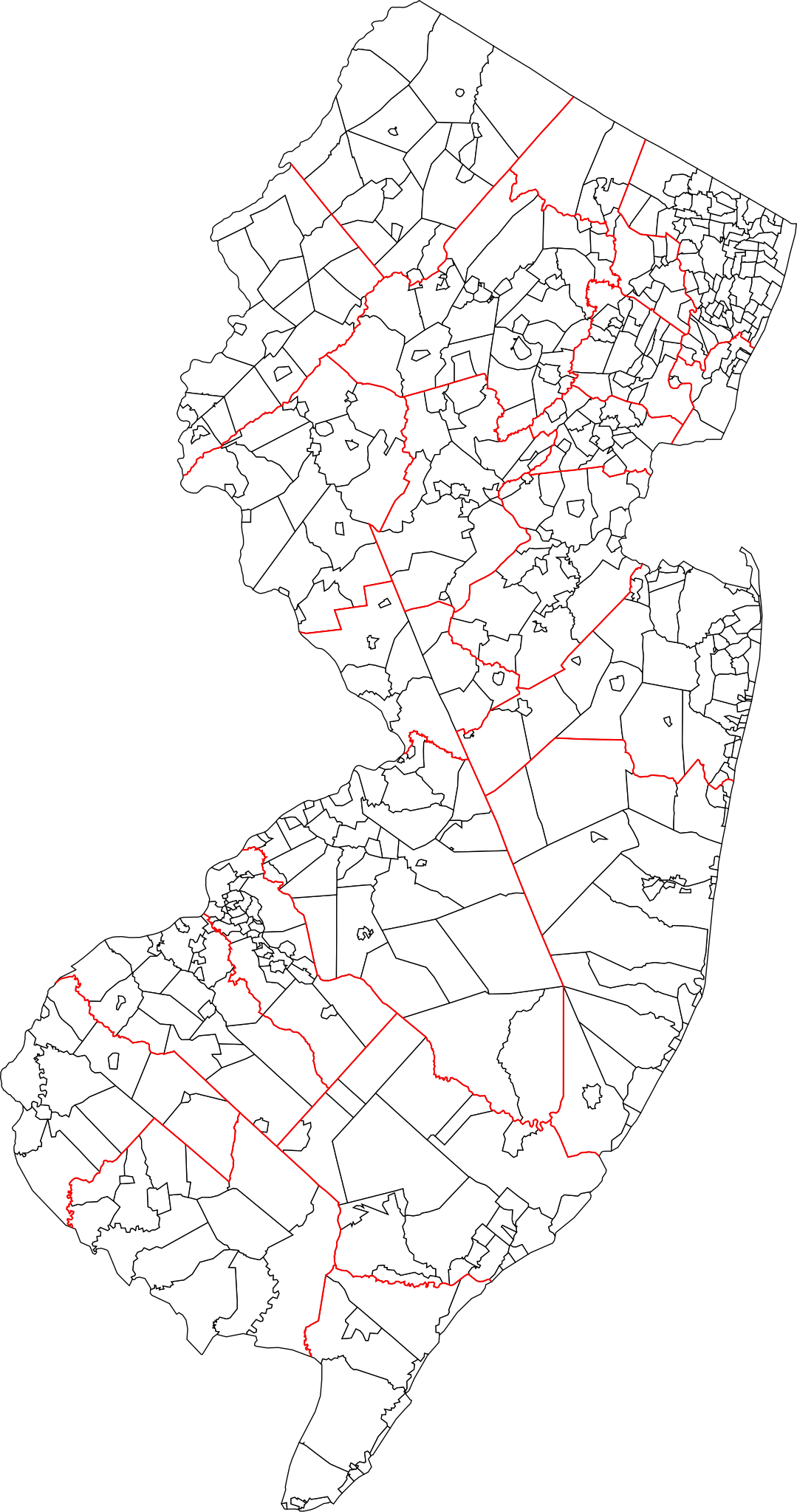
| 描述 | A blank map of all 564 New Jersey municipalities. Each of the objects' name in the svg is the name of the municipality. Red lines represent county borders |
| 日期 | |
| 來源 | Based on 1990 Cartographic Boundary Files, New Jersey County Subdivisions by the U.S. Census Bureau (public domain), modified to match current municipalities (merger of Pahaquarry and Hardwick townships, Princeton borough and township, Pine Hill and Pine Valley). |
| 作者 | Mr. Matté (if there is an issue with this image, contact me using this image's Commons talk page, my Commons user talk page, or my English Wikipedia user talk page; I'll know about it a lot faster) |
授權條款
[編輯]
| 我,此作品的版權所有人,釋出此作品至公共領域。此授權條款在全世界均適用。 這可能在某些國家不合法,如果是的話: 我授予任何人有權利使用此作品於任何用途,除受法律約束外,不受任何限制。 |
檔案歷史
點選日期/時間以檢視該時間的檔案版本。
| 日期/時間 | 縮圖 | 尺寸 | 用戶 | 備註 | |
|---|---|---|---|---|---|
| 目前 | 2022年1月29日 (六) 15:11 | | 791 × 1,501(365 KB) | Mr. Matté(對話 | 貢獻) | Updated map, now based on US Census boundary files/coordinates/NAVD datum, not traced from old map like old file |
| 2013年1月3日 (四) 00:10 |  | 1,495 × 2,770(2.04 MB) | Mr. Matté(對話 | 貢獻) | Update after consolidation of Princetons | |
| 2008年4月19日 (六) 14:39 |  | 1,496 × 2,770(2.13 MB) | Mr. Matté(對話 | 貢獻) | {{Information |Description=A blank map of all 566 New Jersey municipalities. Each of the objects' name in the svg is the name of the municipality. |Source=Based off of the various maps of indiv |
無法覆蓋此檔案。
檔案用途
下列頁面有用到此檔案:
全域檔案使用狀況
以下其他 wiki 使用了這個檔案:
- ar.wikipedia.org 的使用狀況
- en.wikipedia.org 的使用狀況
- es.wikipedia.org 的使用狀況
- fa.wikipedia.org 的使用狀況
- fr.wikipedia.org 的使用狀況
- simple.wikipedia.org 的使用狀況
- tr.wikipedia.org 的使用狀況
- zh.wikipedia.org 的使用狀況