File:Map of North Dakota highlighting McHenry County.svg
Jump to navigation
Jump to search

Size of this PNG preview of this SVG file: 800 × 476 pixels. Other resolutions: 320 × 191 pixels | 640 × 381 pixels | 1,024 × 610 pixels | 1,280 × 762 pixels | 2,560 × 1,524 pixels | 5,804 × 3,456 pixels.
Original file (SVG file, nominally 5,804 × 3,456 pixels, file size: 56 KB)
Captions
Captions
Add a one-line explanation of what this file represents
Summary[edit]
| Description |
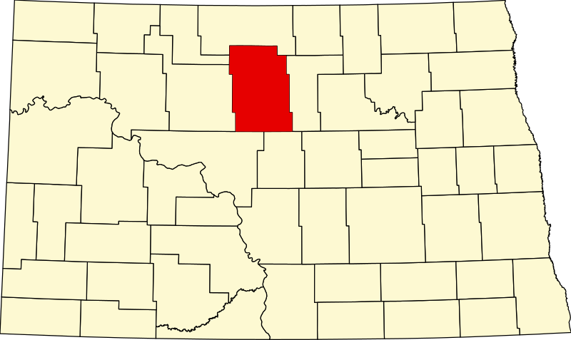
English: This is a locator map showing McHenry County in North Dakota. For more information, see Commons:United States county locator maps. |
| Date | |
| Source |
Own work: English: The maps use data from nationalatlas.gov, specifically countyp020.tar.gz on the Raw Data Download page. The maps also use state outline data from statesp020.tar.gz. The Florida maps use hydrogm020.tar.gz to display Lake Okeechobee. |
| Author | David Benbennick |
Licensing[edit]
| I, the copyright holder of this work, release this work into the public domain. This applies worldwide. In some countries this may not be legally possible; if so: I grant anyone the right to use this work for any purpose, without any conditions, unless such conditions are required by law. |
File history
Click on a date/time to view the file as it appeared at that time.
| Date/Time | Thumbnail | Dimensions | User | Comment | |
|---|---|---|---|---|---|
| current | 16:04, 12 February 2006 | | 5,804 × 3,456 (56 KB) | David Benbennick (talk | contribs) | {{subst:User:Dbenbenn/clm|county=McHenry County|state=North Dakota|type=county}} |
You cannot overwrite this file.
File usage
The following 2 pages use this file:
Global file usage
The following other wikis use this file:
- Usage on ar.wikipedia.org
- مقاطعة ماكهنري (داكوتا الشمالية)
- أناموس
- بلفور (داكوتا الشمالية)
- بانتري
- بيرغن (داكوتا الشمالية)
- ديرينغ (داكوتا الشمالية)
- دريك (داكوتا الشمالية)
- غرانفيل (داكوتا الشمالية)
- كارلسروه (داكوتا الشمالية)
- كيف (داكوتا الشمالية)
- تاونر
- أبهام (داكوتا الشمالية)
- فيلفا
- فولتير (داكوتا الشمالية)
- محمية جبل السلاحف الهندية
- قالب:مقاطعة ماكهنري (داكوتا الشمالية)
- Usage on bg.wikipedia.org
- Usage on bpy.wikipedia.org
- Usage on cdo.wikipedia.org
- Usage on ceb.wikipedia.org
- Usage on cy.wikipedia.org
- Usage on de.wikipedia.org
- Usage on en.wikipedia.org
- Anamoose, North Dakota
- List of counties in North Dakota
- McHenry County, North Dakota
- Balfour, North Dakota
- Bantry, North Dakota
- Bergen, North Dakota
- Deering, North Dakota
- Drake, North Dakota
- Granville, North Dakota
- Karlsruhe, North Dakota
- Kief, North Dakota
- Towner, North Dakota
- Upham, North Dakota
- Velva, North Dakota
- Voltaire, North Dakota
- Denbigh Experimental Forest
- Turtle Mountain Indian Reservation
- Template:McHenry County, North Dakota
- Norwich, North Dakota
- User:Nyttend/County templates/ND
- Verendrye, North Dakota
- National Register of Historic Places listings in McHenry County, North Dakota
- Land Township, McHenry County, North Dakota
View more global usage of this file.