File:Map of Rohingya people in Rakhine State.png
Salta a la navegació
Salta a la cerca
Mida d'aquesta previsualització: 345 × 600 píxels. Altres resolucions: 138 × 240 píxels | 276 × 480 píxels | 651 × 1.132 píxels.
Fitxer original (651 × 1.132 píxels, mida del fitxer: 61 Ko, tipus MIME: image/png)
Llegendes
Llegendes
Afegeix una explicació d'una línia del que representa aquest fitxer
Resum
[modifica]
| Descripció |
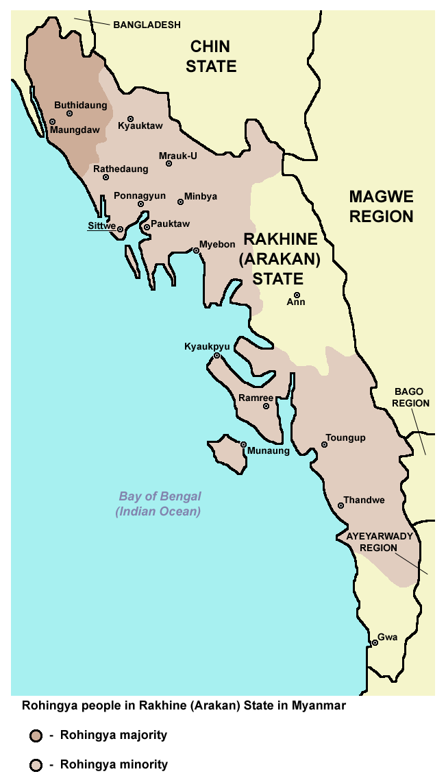
English: Rohingya people in Rakhine (Arakan) State in Myanmar. |
| Data | |
| Font | Treball propi |
| Autor | PANONIAN |
Llicència
[modifica]
Jo, el titular dels drets d'autor d'aquest treball, el public sota la següent llicència:
| L'ús d'aquest fitxer és regulat sota les condicions de Creative Commons de CC0 1.0 lliurament al domini públic universal. | |
| La persona que ha associat un treball amb aquest document ha dedicat l'obra domini públic, renunciant en tot el món a tots els seus drets de d'autor i a tots els drets legals relacionats que tenia en l'obra, en la mesura permesa per la llei. Podeu copiar, modificar, distribuir i modificar l'obra, fins i tot amb fins comercials, tot sense demanar permís.
|
References
[modifica]
Demographic data:
- http://reliefweb.int/report/myanmar/humanitarian-crisis-deepens-arakan-state ("This is in contrast to Buthidaung and Maungdaw townships which have a large Rohingya majority.")
- http://csis.org/publication/separating-fact-fiction-about-myanmars-rohingya ("Most of this population lives in the townships of Maungdaw and Buthidaung, where Rohingya are the majority")
- http://sometimemaybe.blogspot.com/2009/07/burma-ii.html ("Fear is said to reign not only in Rakhine towns and villages but also areas with Rohingya majorities—including Maungdaw Township, where more than 90 percent of the 493,000 inhabitants are Rohingya."..."One other township in Arakan State has a large Rohingya majority—Buthidaung, where more than 80 percent of the 279,000 inhabitants are Rohingya.")
- http://library.islamweb.net/emainpage/articles/180009/mass-graves-for-myanmars-rohingya ("or even the local busses that run Buthidaung to Maungdaw, two Rohingya-majority states.")
- http://www.aljazeera.com/indepth/features/2012/08/201288114724103607.html ("or even the local busses that run from Buthidaung to Maungdaw, two Rohingya-majority states.")
- https://www.hrw.org/news/2012/11/17/burma-satellite-images-show-widespread-attacks-rohingya ("All four districts of Arakan State – Sittwe, Maungdaw, Kyauk Pyu, and Thandwe – have experienced violence since June 2012. Violence between Arakanese Buddhists and Rohingya Muslims reignited on October 21 and continued to some extent all week in 9 of the state’s 17 townships: Pauktaw, Mrauk-U, Myebon, Kyauk Pyu, Ramree, Kyauktaw, Minbya, Rathedaung, and Thandwe. Four other townships experienced serious violence in June and thereafter: Sittwe, Maungdaw, Buthidaung, and Toungop.")
- http://www.restlessbeings.org/projects/rohingya/burmese-army-allow-further-2300-rohingya-to-become-displaced ("This second round of violence that began on the 21st of October were targeted at more remote villages where, whilst Rohingya villages were found, the townships were largely Rakhine populated. In Minbya, Mrauk Oo, Pauk Taw, Kyauk Taw, Kyauk Pyu and Rathedaung.")
- http://hlaoo1980.blogspot.com/2012/06/bengali-cleansing-in-arrakan.html ("There are 17 townships in the Arrakan State. Except the Bengali-free Taunggup, Ann, and Gwa townships Bengali immigrants from the extremely-crowded Bangladesh across the border inhabit the 14 townships together with the native Buddhist Yakhines.")
- http://loveandntolerance.blogspot.com/2012/10/the-concrete-solution-for-rohingya.html ("Nearly one million Rohingyas in 14 townships of Arakan State")
- https://rohingyaonlinenewsgroup.wordpress.com/2012/10/28/president-thein-sein-ready-to-declare-a-new-rule-of-law-in-rakhine-state/ ("Before and since the timely establishment of the RNDP party, its ultimate goal has been to drive out Rohingya Muslims from all 14 townships of Rakhine state and then to establish The Great Rakhine Union State")
- https://www.usatoday.com/story/news/world/2013/03/30/myanmar-govt-religious-riots/2037853/ ("It said there were 163 incidents of violence in 15 townships in the country")
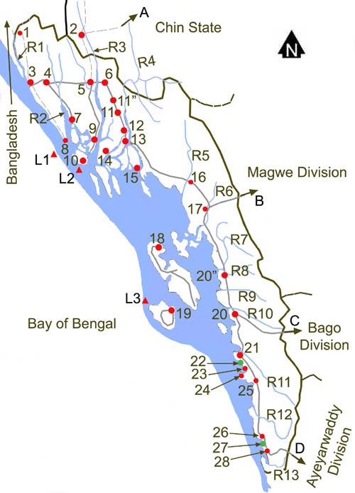
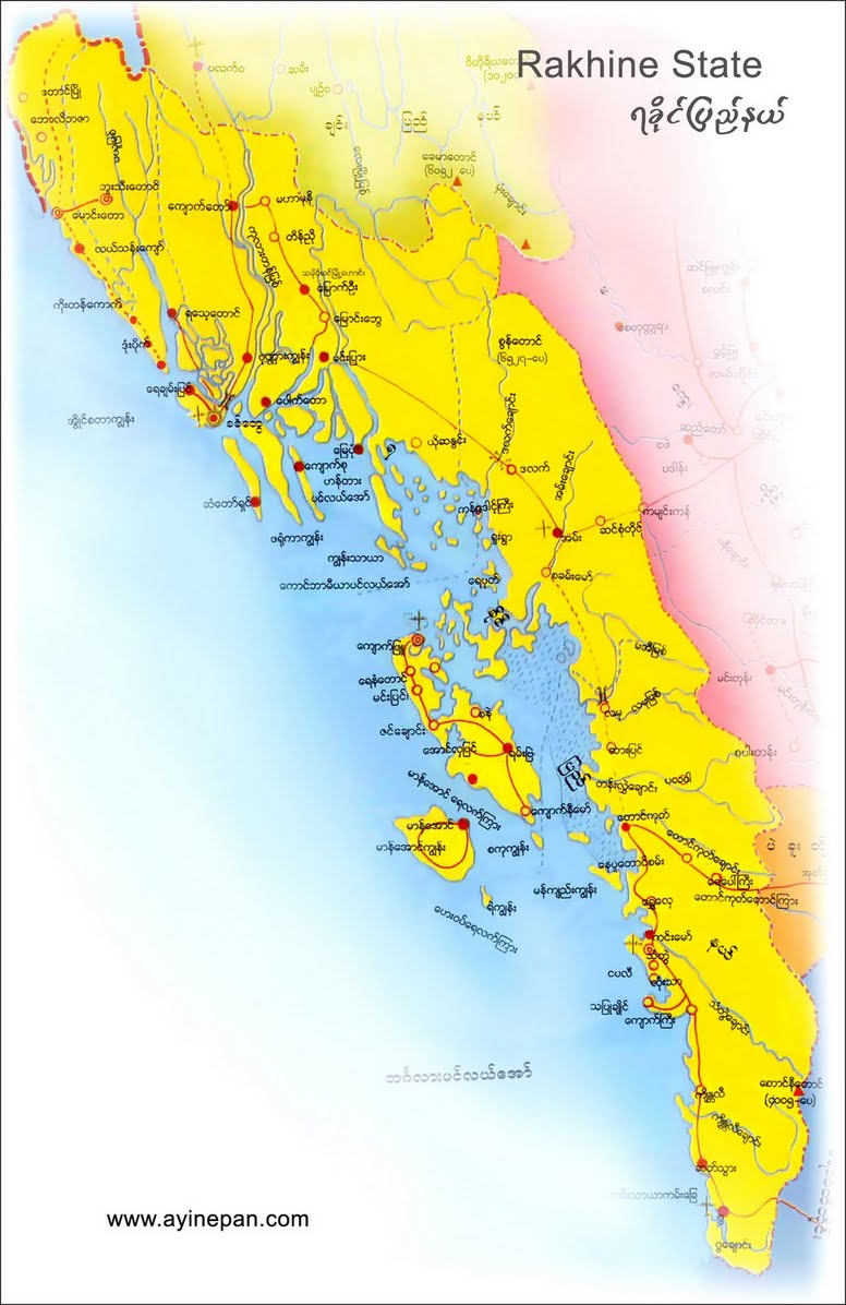
Maps of Rakhine State:
- http://www.myanmars.net/myanmar-map/rakhine.jpg
- http://www.edenhilltravels.com/wp-content/uploads/2013/08/rakhine-modified.jpg
- http://www.rfa.org/english/news/myanmar/violence-10252012182913.html/rakhine-map-new-390.jpg
- http://www.asterism.info/states/7/map.jpg
- http://www.allthingsburmese.com/images/Rakhine%20State%20Map.gif
- http://www.guideformyanmar.com/images/touristplace/rakhine_state.jpg
- https://arakanindobhasa.files.wordpress.com/2009/11/12.jpg
- http://reliefweb.int/sites/reliefweb.int/files/resources/map_2466.pdf
- http://maps.maphill.com/burma/arakan-rakhine/maps/savanna-style-map/savanna-style-map-of-arakan-rakhine.jpg
- http://maps.maphill.com/burma/arakan-rakhine/maps/satellite-map/cropped-outside/satellite-map-of-arakan-rakhine-cropped-outside.jpg
- http://maps.maphill.com/burma/arakan-rakhine/maps/shaded-relief-map/shaded-relief-map-of-arakan-rakhine.jpg
- http://www.burmalibrary.org/docs08/HRDU_YB-2008/multimedia/maps/townships.jpg
Historial del fitxer
Cliqueu una data/hora per veure el fitxer tal com era aleshores.
| Data/hora | Miniatura | Dimensions | Usuari/a | Comentari | |
|---|---|---|---|---|---|
| actual | 16:42, 16 abr 2017 | | 651 × 1.132 (61 Ko) | PANONIAN (discussió | contribucions) | Reverted to version as of 12:27, 4 July 2015 (UTC) - pointless change, not an improvement, please explain on talk page why image with no border would be better |
| 00:22, 14 abr 2017 |  | 620 × 1.000 (59 Ko) | Haffaz (discussió | contribucions) | Made legend clearer | |
| 07:09, 11 abr 2017 |  | 619 × 1.117 (32 Ko) | Haffaz (discussió | contribucions) | removed white space and centered legend | |
| 12:27, 4 jul 2015 |  | 651 × 1.132 (61 Ko) | PANONIAN (discussió | contribucions) | {{Information |Description ={{en|1=Rohingya people in Rakhine (Arakan) State in Myanmar.}} |Source ={{own}} |Author =PANONIAN |Date =2015 |Permission = |other_versions = }} |
No podeu sobreescriure aquest fitxer.
Ús del fitxer
Les 2 pàgines següents utilitzen aquest fitxer:
.png)
Ús global del fitxer
Utilització d'aquest fitxer en altres wikis:
- Utilització a af.wikipedia.org
- Utilització a azb.wikipedia.org
- Utilització a bn.wikipedia.org
- Utilització a ca.wikipedia.org
- Utilització a de.wikipedia.org
- Utilització a diq.wikipedia.org
- Utilització a en.wikipedia.org
- Utilització a es.wikipedia.org
- Utilització a ga.wikipedia.org
- Utilització a hr.wikipedia.org
- Utilització a hu.wikipedia.org
- Utilització a id.wikipedia.org
- Utilització a is.wikipedia.org
- Utilització a lt.wikipedia.org
- Utilització a mk.wikipedia.org
- Utilització a mnw.wikipedia.org
- Utilització a pa.wikipedia.org
- Utilització a pnb.wikipedia.org
- Utilització a ru.wikipedia.org
- Utilització a sh.wikipedia.org
- Utilització a sr.wikipedia.org
- Utilització a tl.wikipedia.org
- Utilització a tr.wikipedia.org
- Utilització a uk.wikipedia.org
- Utilització a ur.wikipedia.org
- Utilització a vi.wikipedia.org
- Utilització a zh.wikipedia.org