File:Map of Russia - Sverdlovsk Oblast.svg
Jump to navigation
Jump to search

Size of this PNG preview of this SVG file: 800 × 440 pixels. Other resolutions: 320 × 176 pixels | 640 × 352 pixels | 1,024 × 563 pixels | 1,280 × 704 pixels | 2,560 × 1,407 pixels | 1,541 × 847 pixels.
Original file (SVG file, nominally 1,541 × 847 pixels, file size: 6.56 MB)
Captions
Captions
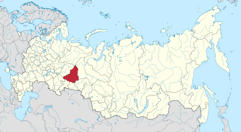
Map of Sverdlovsk oblast within Russia.

|
The boundaries on this map show the de facto situation. This is just one of several different views on the subject (see COM:NPOV). |
Summary[edit]
| Description |
Русский: Свердловская область на карте России |
| Date | |
| Source | Own work |
| Author | Stasyan117 |
Licensing[edit]
I, the copyright holder of this work, hereby publish it under the following license:
This file is licensed under the Creative Commons Attribution-Share Alike 4.0 International license.
- You are free:
- to share – to copy, distribute and transmit the work
- to remix – to adapt the work
- Under the following conditions:
- attribution – You must give appropriate credit, provide a link to the license, and indicate if changes were made. You may do so in any reasonable manner, but not in any way that suggests the licensor endorses you or your use.
- share alike – If you remix, transform, or build upon the material, you must distribute your contributions under the same or compatible license as the original.
File history
Click on a date/time to view the file as it appeared at that time.
| Date/Time | Thumbnail | Dimensions | User | Comment | |
|---|---|---|---|---|---|
| current | 13:49, 28 April 2015 | | 1,541 × 847 (6.56 MB) | Stasyan117 (talk | contribs) | User created page with UploadWizard |
You cannot overwrite this file.
File usage
There are no pages that use this file.
Global file usage
The following other wikis use this file:
- Usage on ba.wikipedia.org
- Usage on cdo.wikipedia.org
- Usage on ceb.wikipedia.org
- Usage on cs.wikipedia.org
- Jekatěrinburg
- Nižnij Tagil
- Serov
- Volčansk
- Kačkanar
- Kamensk-Uralskij
- Kušva
- Verchňaja Pyšma
- Bogdanovič
- Nižňaja Tura
- Lesnoj
- Rež (město)
- Krasnoturjinsk
- Revda (město)
- Krasnoufimsk
- Berjozovskij (město v Sverdlovské oblasti)
- Tavda (město)
- Novouralsk
- Polevskoj
- Irbit (město)
- Suchoj Log
- Severouralsk
- Karpinsk
- Krasnouralsk
- Věrchoturje
- Ivděl
- Turinsk
- Děgťarsk
- Seznam hymen subjektů Ruské federace
- Usage on da.wikipedia.org
- Usage on en.wikipedia.org
- Usage on frr.wikipedia.org
- Usage on fy.wikipedia.org
- Usage on incubator.wikimedia.org
- Usage on io.wikipedia.org
- Usage on ja.wikipedia.org
- Usage on kaa.wikipedia.org
- Usage on kk.wikipedia.org
- Usage on mhr.wikipedia.org
View more global usage of this file.