File:Map of Siamese Kingdom in 1916.jpg
Jump to navigation
Jump to search

Size of this preview: 400 × 600 pixels. Other resolutions: 160 × 240 pixels | 320 × 480 pixels | 512 × 768 pixels | 682 × 1,024 pixels | 1,365 × 2,048 pixels | 10,000 × 15,000 pixels.
Original file (10,000 × 15,000 pixels, file size: 5.52 MB, MIME type: image/jpeg)
Captions
Captions
Add a one-line explanation of what this file represents
Summary[edit]
| Description |
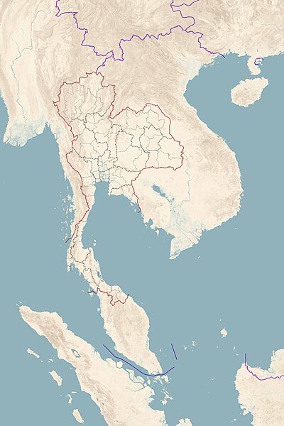
English: This is a map depicting the provinces of Siam.
Credits: Shuranattha Ashvajayajita - Designer Tim Plintron - Researcher |
| Date | |
| Source | Own work |
| Author | Shuuranattha "Caphtaain" Ashvajayajita |
Licensing[edit]
I, the copyright holder of this work, hereby publish it under the following license:
This file is licensed under the Creative Commons Attribution-Share Alike 4.0 International license.
- You are free:
- to share – to copy, distribute and transmit the work
- to remix – to adapt the work
- Under the following conditions:
- attribution – You must give appropriate credit, provide a link to the license, and indicate if changes were made. You may do so in any reasonable manner, but not in any way that suggests the licensor endorses you or your use.
- share alike – If you remix, transform, or build upon the material, you must distribute your contributions under the same or compatible license as the original.
File history
Click on a date/time to view the file as it appeared at that time.
| Date/Time | Thumbnail | Dimensions | User | Comment | |
|---|---|---|---|---|---|
| current | 08:57, 29 January 2023 | | 10,000 × 15,000 (5.52 MB) | Nicolaus Alden Ashvashchandr (talk | contribs) | international borders |
| 16:25, 27 January 2023 |  | 10,000 × 15,000 (5.43 MB) | Nicolaus Alden Ashvashchandr (talk | contribs) | songkhla update | |
| 04:09, 13 January 2023 |  | 10,000 × 15,000 (6.53 MB) | Nicolaus Alden Ashvashchandr (talk | contribs) | Uploaded own work with UploadWizard |
You cannot overwrite this file.
File usage on Commons
The following 3 pages use this file:
File usage on other wikis
The following other wikis use this file:
- Usage on en.wikipedia.org
- Usage on th.wikipedia.org
- Usage on tr.wikipedia.org
- Usage on zh.wikipedia.org