File:Map of Tabasco independent in 1841.png
Jump to navigation
Jump to search
No higher resolution available.
Map_of_Tabasco_independent_in_1841.png (658 × 600 pixels, file size: 46 KB, MIME type: image/png)
Captions
Captions
Add a one-line explanation of what this file represents
Summary
[edit]
| Description |
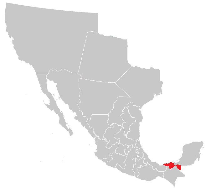
Español: Mapa de Tabasco durante su separación de México en 1841. Tabasco decretó su separaci{on de México el 13 de febrero de 1841 en protesta por la implantaci{on de la República Centralista y por las sanciones impuestas al estado por el Presidente Anastasio Bustamante. Reincorporándose oficialmente a M{exico el 2 de diciembre de 1842. |
| Date | |
| Source | Own work |
| Author | Alfonsobouchot |
Licensing
[edit]
I, the copyright holder of this work, hereby publish it under the following license:
This file is licensed under the Creative Commons Attribution-Share Alike 3.0 Unported license.
- You are free:
- to share – to copy, distribute and transmit the work
- to remix – to adapt the work
- Under the following conditions:
- attribution – You must give appropriate credit, provide a link to the license, and indicate if changes were made. You may do so in any reasonable manner, but not in any way that suggests the licensor endorses you or your use.
- share alike – If you remix, transform, or build upon the material, you must distribute your contributions under the same or compatible license as the original.
File history
Click on a date/time to view the file as it appeared at that time.
| Date/Time | Thumbnail | Dimensions | User | Comment | |
|---|---|---|---|---|---|
| current | 22:14, 14 November 2012 | | 658 × 600 (46 KB) | Alfonsobouchot (talk | contribs) | Ajustes. Quitando el Cantón de Huimanguillo. |
| 19:43, 11 November 2012 |  | 658 × 600 (46 KB) | Alfonsobouchot (talk | contribs) | User created page with UploadWizard |
You cannot overwrite this file.
File usage on Commons
There are no pages that use this file.
File usage on other wikis
The following other wikis use this file: