File:Map of USA with county outlines.png
跳转到导航
跳转到搜索

本预览的尺寸:800 × 520像素。 其他分辨率:320 × 208像素 | 640 × 416像素 | 1,024 × 665像素 | 1,513 × 983像素。
原始文件 (1,513 × 983像素,文件大小:581 KB,MIME类型:image/png)
说明
说明
添加一行文字以描述该文件所表现的内容

|
此locator map图片可使用矢量图形重新创建为SVG文件。这具有很多好处;更多信息请参见共享资源:待清理媒体。如果存在此图片的SVG格式,请将其上传,然后将此模板替换为
{{vector version available|新图片名称}}。
建议您将SVG命名为“Map of USA with county outlines.svg”,这样在使用Vector version available(或Vva)模板时就不需要填写新图片名称参数。 |
摘要
[编辑]
| 描述 |
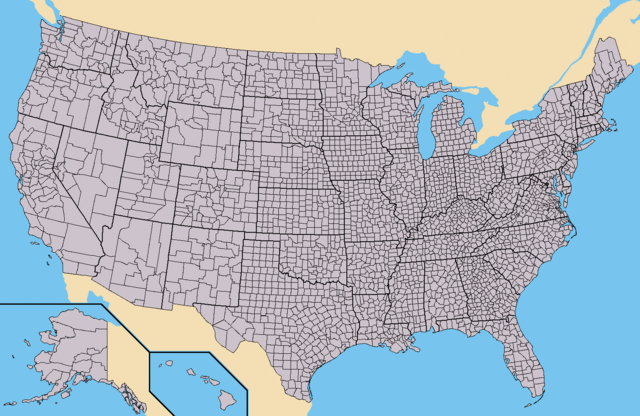
Deutsch: Karte der Vereinigten Staaten mit den Staats- und Kreisgrenzen.
English: Map of the USA showing borders of states and counties. Colored version of adapted one by Wapcaplet from a public-domain map courtesy of the U.S. Census Bureau website first published in English language version of Wikipedia.
Español: Mapa de los es:Estados Unidos mostrando los los límites de estados miembros y sus condados. Versión a colores de la adaptación hecha por Wapcaplet del mapa de dominio público del sitio web de la Oficina de Censo de los EE.UU.. |
| 日期 | |
| 来源 | https://www.census.gov |
| 作者 | |
| 其他版本 | 此文件衍生的作品: Emancipation Proclamation.PNG |
许可协议
[编辑]

|
已授权您依据自由软件基金会发行的无固定段落及封面封底文字(Invariant Sections, Front-Cover Texts, and Back-Cover Texts)的GNU自由文件许可协议1.2版或任意后续版本的条款,复制、传播和/或修改本文件。该协议的副本请见“GNU Free Documentation License”。 |
| 本文件采用知识共享署名-相同方式共享 3.0 未本地化版本许可协议授权。 | ||
| ||
| 本许可协议标签作为GFDL许可协议更新的组成部分被添加至本文件。 |
文件历史
点击某个日期/时间查看对应时刻的文件。
| 日期/时间 | 缩略图 | 大小 | 用户 | 备注 | |
|---|---|---|---|---|---|
| 当前 | 2015年5月31日 (日) 16:25 | | 1,513 × 983(581 KB) | Cmdrjameson(留言 | 贡献) | Compressed with pngout. Reduced by 484kB (45% decrease). |
| 2010年9月21日 (二) 14:02 |  | 1,513 × 983(1.04 MB) | Kmusser(留言 | 贡献) | fix Pamlico Sound | |
| 2009年11月25日 (三) 23:31 |  | 1,513 × 983(166 KB) | Reywas92(留言 | 贡献) | Make borders more visible. | |
| 2008年1月23日 (三) 04:41 |  | 1,513 × 983(98 KB) | Speight(留言 | 贡献) | Fix San Francisco Bay and Puget Sound | |
| 2006年11月23日 (四) 22:53 |  | 1,513 × 983(165 KB) | Ibagli(留言 | 贡献) | more fixes | |
| 2006年11月23日 (四) 22:53 |  | 1,513 × 983(165 KB) | Ibagli(留言 | 贡献) | Reverted to earlier revision | |
| 2006年11月23日 (四) 22:52 |  | 1,513 × 983(180 KB) | Ibagli(留言 | 贡献) | more fixes | |
| 2006年11月23日 (四) 02:16 |  | 1,513 × 983(165 KB) | Ibagli(留言 | 贡献) | fix lake St. Clair | |
| 2005年8月28日 (日) 20:57 |  | 1,513 × 983(165 KB) | Huhsunqu(留言 | 贡献) | *{{es}} Mapa de los Estados Unidos de América mostrando los los límites de estados miembros y sus condados. Versión a colores de la adaptación hecha por Wapcaplet del mapa de dominio público del [http://www.census.gov/ sitio |
您不可以覆盖此文件。
文件用途
以下8个页面使用本文件:
- Top 200 locator map images that should use vector graphics
- Top 200 map images that should use vector graphics
- United States
- File:Emancipation Proclamation.PNG
- File:Map of USA counties with domestic partnerships etc-2009-05.PNG
- File:PSKGrowth1910.gif
- File:Sport franchises in the usa.PNG
- Category:Counties of the United States
全域文件用途
以下其他wiki使用此文件:
- ang.wikipedia.org上的用途
- az.wikipedia.org上的用途
- bg.wikipedia.org上的用途
- ca.wikipedia.org上的用途
- cs.wikipedia.org上的用途
- de.wikipedia.org上的用途
- en.wikipedia.org上的用途
- Talk:Bigfoot/Archive 5
- Talk:Manhattan
- Talk:Los Angeles County, California
- Talk:List of counties in Nevada
- Talk:Louisville, Kentucky
- Wikipedia:WikiProject U.S. counties
- Wikipedia talk:WikiProject U.S. counties
- Talk:Lancaster County, Pennsylvania
- Talk:Frederick County, Maryland
- Talk:Franklin County, Tennessee
- Talk:Trumbull County, Ohio
- Talk:Tuscarawas County, Ohio
- Talk:Union County, Ohio
- Talk:Van Wert County, Ohio
- Talk:Vinton County, Ohio
- Talk:Warren County, Ohio
- Talk:Washington County, Ohio
- Talk:Wayne County, Ohio
- Talk:Williams County, Ohio
- Talk:Wood County, Ohio
- Talk:Wyandot County, Ohio
- Talk:Adair County, Oklahoma
- Talk:Alfalfa County, Oklahoma
- Talk:Atoka County, Oklahoma
- Talk:Blaine County, Oklahoma
- Talk:Bryan County, Oklahoma
- Talk:Caddo County, Oklahoma
- Talk:Carter County, Oklahoma
- Talk:Cherokee County, Oklahoma
- Talk:Nantucket
- Talk:Potter County, South Dakota
- Talk:Weston County, Wyoming
- Talk:Washakie County, Wyoming
- Talk:Uinta County, Wyoming
- Talk:Teton County, Wyoming
- Talk:Sweetwater County, Wyoming
- Talk:Sublette County, Wyoming
- Talk:Sheridan County, Wyoming
查看此文件的更多全域用途。