File:Map of USA with state names fa.svg
پرش به ناوبری
پرش به جستجو

حجم پیشنمایش PNG این SVG file:۸۰۰ × ۴۹۵ پیکسل کیفیتهای دیگر: ۳۲۰ × ۱۹۸ پیکسل | ۶۴۰ × ۳۹۶ پیکسل | ۱٬۰۲۴ × ۶۳۳ پیکسل | ۱٬۲۸۰ × ۷۹۱ پیکسل | ۲٬۵۶۰ × ۱٬۵۸۳ پیکسل | ۹۵۹ × ۵۹۳ پیکسل.
پروندهٔ اصلی (پروندهٔ اسویجی، با ابعاد ۹۵۹ × ۵۹۳ پیکسل، اندازهٔ پرونده: ۳۳۲ کیلوبایت)
گزینهها
عنوان
شرحی یکخطی از محتوای این فایل اضافه کنید


.svg)


| این یک عکس دستکاری شده است به این معنی که به صورت دیجیتالی از نسخهٔ اصلی تغییر یافتهاست. تغییرها: Persian version. اصل آن را میتوان در اینجا مشاهده کرد: Map of USA with state names.svg. تغییرها توسط Ladsgroup انجام شدهاست.
|

|
اجازهٔ کپی، پخش و/یا تغییر این سند تحت شرایط مجوز مستندات آزاد گنو، نسخهٔ ۱٫۲ یا هر نسخهٔ بعدتری که توسط بنیاد نرمافزار آزاد منتشر شده؛ بدون بخشهای ناوردا (نامتغیر)، متون روی جلد، و متون پشت جلد، اعطا میشود. یک کپی از مجوز در بخشی تحت عنوان مجوز مستندات آزاد گنو ضمیمه شده است. |
| این پرونده با اجازهنامهٔ کریتیو کامانز Attribution-Share Alike 3.0 سازگار نشده منتشر شدهاست. | ||
| ||
| این برچسب مجوز بهعنوان بخشی از روزآمدسازی مجوز GFDL، به این پرونده افزوده شد. |
سیاهه بارگذاری اصلی[ویرایش]
This image is a derivative work of the following images:
- File:Map_of_USA_with_state_names.svg licensed with Cc-by-sa-3.0,2.5,2.0,1.0, GFDL
- 2007-06-11T13:23:48Z Andrew c 959x593 (339488 Bytes)
- 2007-04-17T06:15:06Z Andrew c 959x593 (336711 Bytes)
- 2005-12-28T18:36:54Z Dbenbenn 959x593 (317355 Bytes) fix error in
- 2005-10-09T22:14:30Z Dbenbenn 959x593 (339217 Bytes) fixed by [[User:Ed g2s]] (removed tag), and me (removed undisplayed shapes: rivers, lakes, capitals, highways. Cropped. Fixed typos.)
- 2005-10-09T22:12:53Z Dbenbenn 990x855 (978926 Bytes) original version from [[w:Image:Map of USA with state names.svg]] by [[w:User:Wapcaplet]], cc-by-2.0
Uploaded with derivativeFX
تاریخچهٔ پرونده
روی تاریخ/زمانها کلیک کنید تا نسخهٔ مربوط به آن هنگام را ببینید.
| تاریخ/زمان | بندانگشتی | ابعاد | کاربر | توضیح | |
|---|---|---|---|---|---|
| کنونی | ۲۷ سپتامبر ۲۰۱۱، ساعت ۱۷:۴۵ | | ۹۵۹ در ۵۹۳ (۳۳۲ کیلوبایت) | Ladsgroup (بحث | مشارکتها) | revert+correction of carolina |
| ۲۷ سپتامبر ۲۰۱۱، ساعت ۱۷:۴۰ |  | ۹۵۹ در ۵۹۳ (۲۶۴ کیلوبایت) | Ladsgroup (بحث | مشارکتها) | some minor correction | |
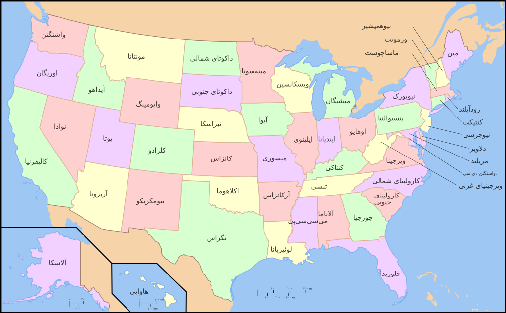
| ۱۴ آوریل ۲۰۰۹، ساعت ۱۹:۲۷ |  | ۹۵۹ در ۵۹۳ (۳۳۲ کیلوبایت) | Ladsgroup (بحث | مشارکتها) | {{Information |Description=A compass of the United States, with state names. The original was edited by User:Andrew c to include Nova Scotia, PEI, Bahamas, and scale key. It was originally uploaded to the English Wikipedia with the same title by |
شما نمیتوانید این پرونده را رونویسی کنید.
کاربرد پرونده
صفحههای زیر از این تصویر استفاده میکنند:
- File:EstatsEUA.png
- File:Map of USA showing state names in Persian.jpg
- File:Map of USA with state names.svg
- File:Map of USA with state names ar.svg
- File:Map of USA with state names as.svg
- File:Map of USA with state names bg.svg
- File:Map of USA with state names bn.svg
- File:Map of USA with state names bpy.svg
- File:Map of USA with state names bs.svg
- File:Map of USA with state names ce.svg
- File:Map of USA with state names chr.svg
- File:Map of USA with state names el.svg
- File:Map of USA with state names eo.svg
- File:Map of USA with state names es.svg
- File:Map of USA with state names et.svg
- File:Map of USA with state names eu.svg
- File:Map of USA with state names fa.svg
- File:Map of USA with state names fr.svg
- File:Map of USA with state names gl.svg
- File:Map of USA with state names grc.png
- File:Map of USA with state names haw.svg
- File:Map of USA with state names he.svg
- File:Map of USA with state names hi.png
- File:Map of USA with state names hi.svg
- File:Map of USA with state names hr.svg
- File:Map of USA with state names it.svg
- File:Map of USA with state names ka.png
- File:Map of USA with state names kk.png
- File:Map of USA with state names mk.svg
- File:Map of USA with state names mr.svg
- File:Map of USA with state names nv.svg
- File:Map of USA with state names pt.svg
- File:Map of USA with state names ru(2).svg
- File:Map of USA with state names ru.svg
- File:Map of USA with state names sco.svg
- File:Map of USA with state names sk.svg
- File:Map of USA with state names sr.svg
- File:Map of USA with state names sv.svg
- File:Map of USA with state names th.svg
- File:Map of USA with state names uk.svg
- File:Map of USA with state names ur.svg
- File:Map of USA with state names zh-hans.svg
- File:Map of USA with state names zh-hant.svg
- File:Ovtâstum staatâi uásistaatah smn.svg
- File:USA map with state names pl.svg
- File:USA map with state names szl.svg
- File:Yhdysvaltain osavaltiot.svg
- Template:Other versions/Map of USA with state names
کاربرد سراسری پرونده
ویکیهای دیگر زیر از این پرونده استفاده میکنند:
- کاربرد در azb.wikipedia.org
- کاربرد در fa.wikipedia.org
- کاربرد در mzn.wikipedia.org