File:Map of Viatka Governorate, 1835.gif
Jump to navigation
Jump to search
Size of this preview: 712 × 600 pixels. Other resolutions: 285 × 240 pixels | 570 × 480 pixels | 912 × 768 pixels | 1,216 × 1,024 pixels | 1,830 × 1,541 pixels.
Original file (1,830 × 1,541 pixels, file size: 519 KB, MIME type: image/gif)
Captions
Captions
Add a one-line explanation of what this file represents
Summary[edit]
| Description |
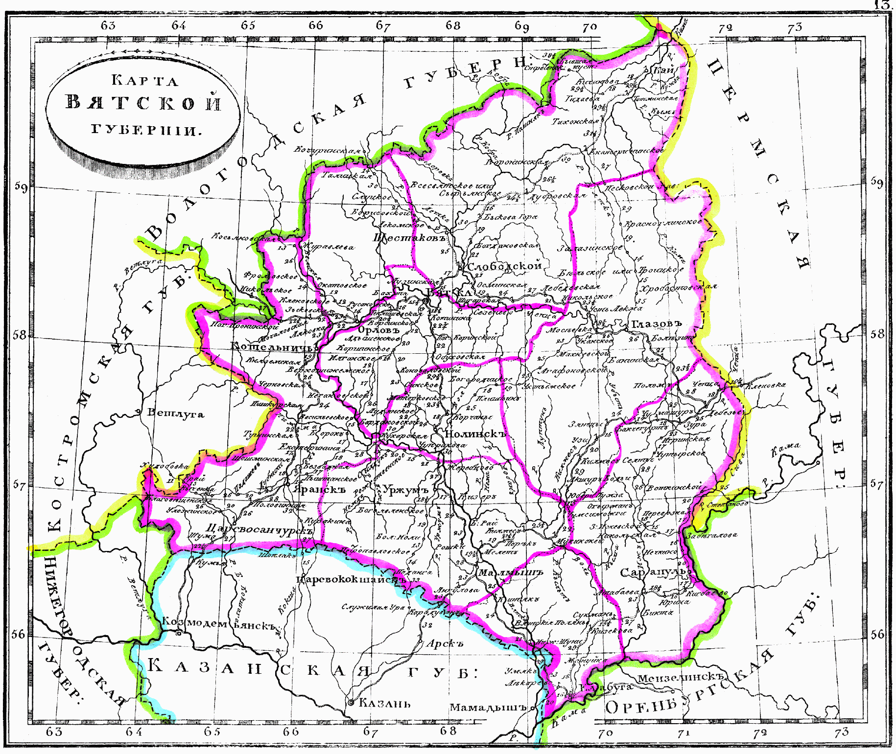
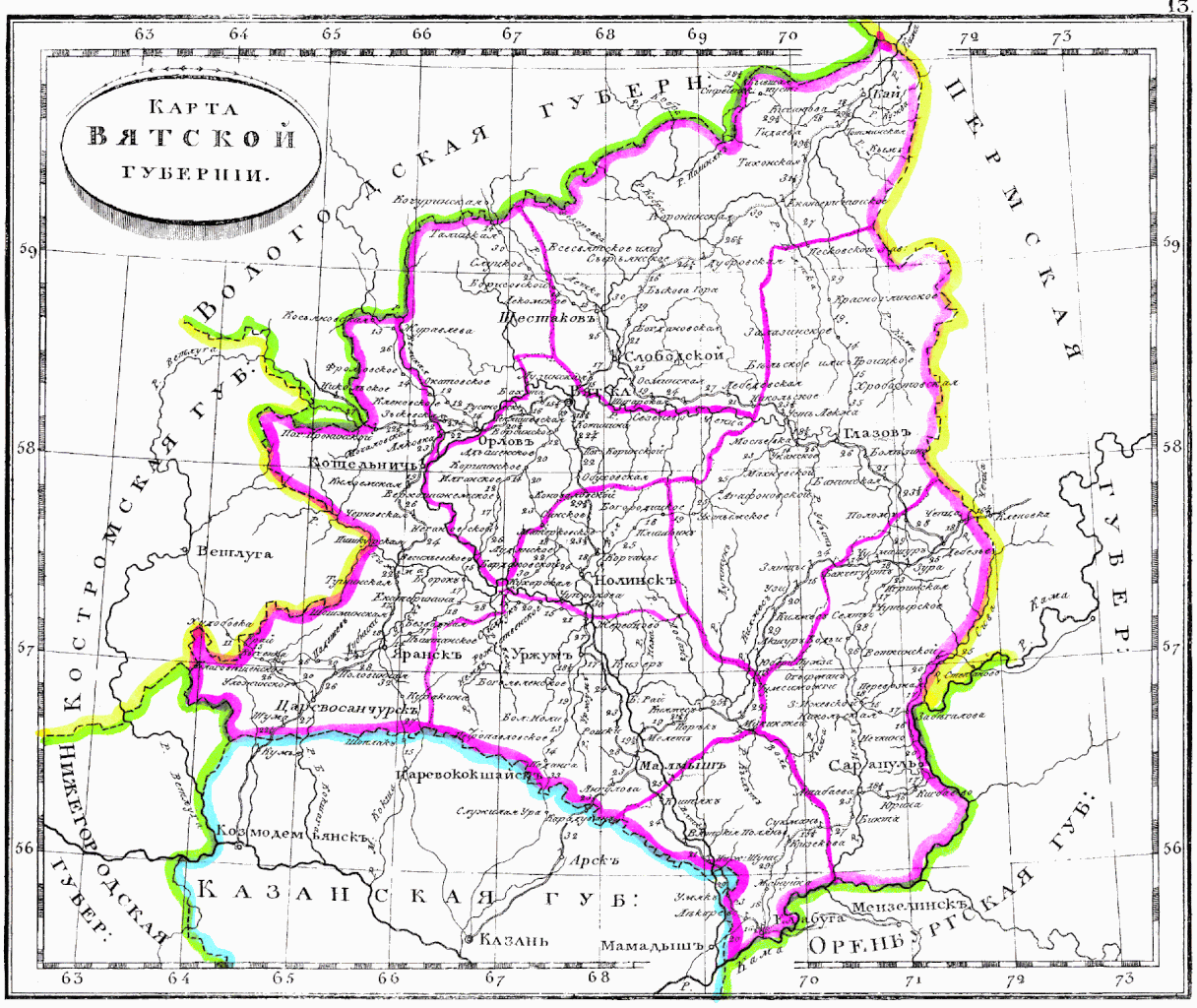
Русский: Карта Вятской губернии, 1835
English: Map of Viatka Governorate, 1835 |
| Date | |
| Source | Атлас Российской Империи, содержащий в себе 51 губернию, 4 области, Царство Польское и Княжество Финляндское. — Санкт-Петербург: Военнотипографическое депо, 1835. — 68 с. |
| Author | Военнотипографическое депо |
Licensing[edit]
|
This work is in the public domain in its country of origin and other countries and areas where the copyright term is the author's life plus 100 years or fewer. This work is in the public domain in the United States because it was published (or registered with the U.S. Copyright Office) before January 1, 1929. | |
| This file has been identified as being free of known restrictions under copyright law, including all related and neighboring rights. | |
File history
Click on a date/time to view the file as it appeared at that time.
| Date/Time | Thumbnail | Dimensions | User | Comment | |
|---|---|---|---|---|---|
| current | 15:16, 18 December 2017 | | 1,830 × 1,541 (519 KB) | Михаил Семёнов (talk | contribs) | User created page with UploadWizard |
You cannot overwrite this file.
File usage on Commons
There are no pages that use this file.
File usage on other wikis
The following other wikis use this file:
- Usage on es.wikipedia.org