File:Map of the Armenian highland and Caucasus mountains 12 122846.jpg
Jump to navigation
Jump to search
Size of this preview: 757 × 599 pixels. Other resolutions: 303 × 240 pixels | 606 × 480 pixels | 970 × 768 pixels | 1,280 × 1,013 pixels | 2,400 × 1,900 pixels.
Original file (2,400 × 1,900 pixels, file size: 1.94 MB, MIME type: image/jpeg)
Captions
Captions
Add a one-line explanation of what this file represents
Summary
[edit]
| Description |
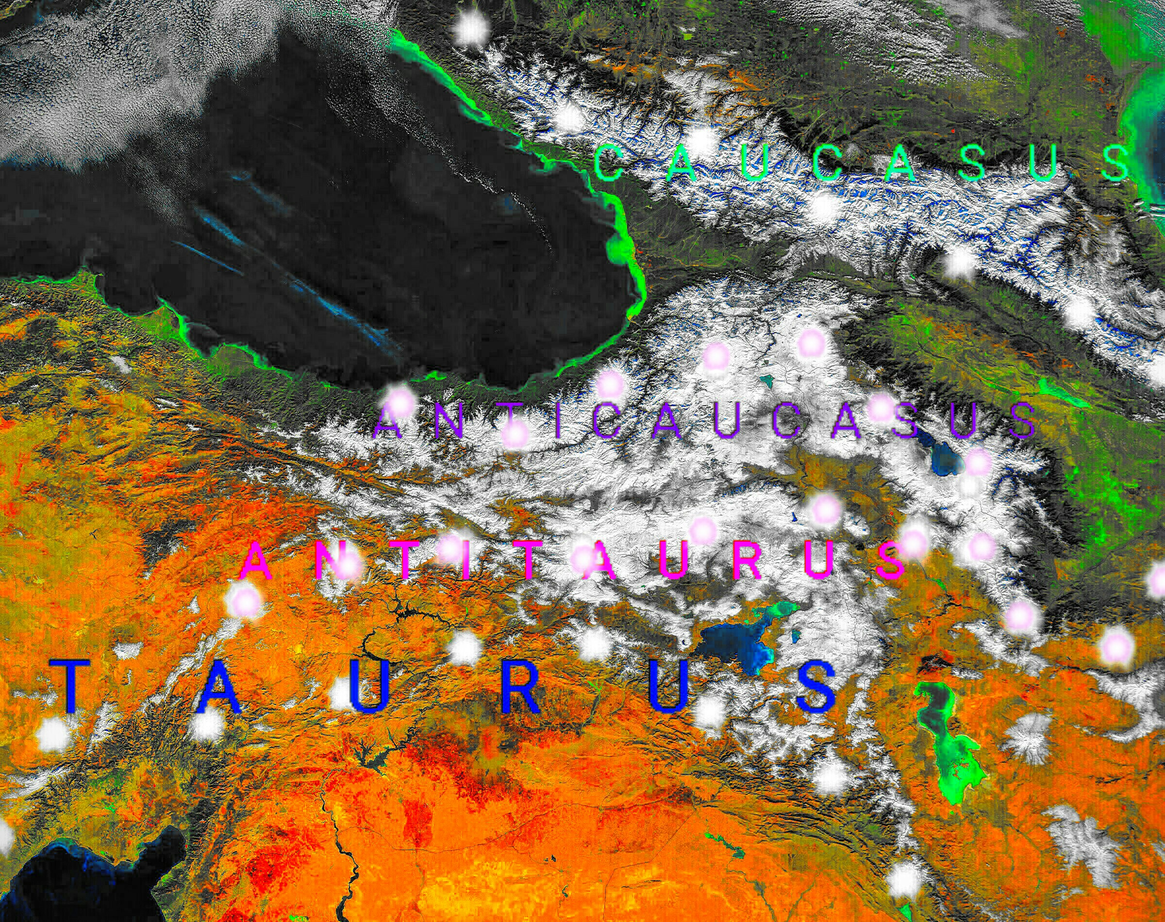
English: NASA's space satellite photo image of the Armenian highland and Caucasus mountains, which turned into map with descriptions of the geographical areas of this region. |
| Date | |
| Source | Own work using: Monts du Caucase.jpg |
| Author | Казбек Эльбрусович |
NASA's space satellite photo image of the Armenian highland and Caucasus mountains, which turned into map with descriptions of the geographical areas of this region.
Licensing
[edit]
| This file is in the public domain in the United States because it was solely created by NASA. NASA copyright policy states that "NASA material is not protected by copyright unless noted". (See Template:PD-USGov, NASA copyright policy page or JPL Image Use Policy.) | ||
 |
Warnings:
|
File history
Click on a date/time to view the file as it appeared at that time.
| Date/Time | Thumbnail | Dimensions | User | Comment | |
|---|---|---|---|---|---|
| current | 01:39, 14 April 2018 | | 2,400 × 1,900 (1.94 MB) | Казбек Эльбрусович (talk | contribs) | Cross-wiki upload from ru.wikipedia.org |
You cannot overwrite this file.
File usage on Commons
There are no pages that use this file.
File usage on other wikis
The following other wikis use this file:
- Usage on en.wikipedia.org
- Usage on es.wikipedia.org
- Usage on fa.wikipedia.org
- Usage on fr.wikipedia.org
- Usage on it.wikipedia.org
- Usage on ru.wikipedia.org
- Usage on zh.wikipedia.org