File:Map of the Canary Islands-smn.svg
Jump to navigation
Jump to search

Size of this PNG preview of this SVG file: 800 × 355 pixels. Other resolutions: 320 × 142 pixels | 640 × 284 pixels | 1,024 × 455 pixels | 1,280 × 569 pixels | 2,560 × 1,137 pixels | 3,152 × 1,400 pixels.
Original file (SVG file, nominally 3,152 × 1,400 pixels, file size: 829 KB)
Captions
Captions
Add a one-line explanation of what this file represents
Summary[edit]
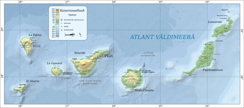
| Description |
Anarâškielâ: Kanariasuollui kárttá anarâškielân Deutsch: Karte der Kanarischen Inseln auf Inarisamische English: Map of the Canary Islands in Inari Saami. |
| Date | |
| Source | made by Mysid with Inkscape. Based on SRTM data as edited by CGIAR-CSI. Place names based on the Open Streetmap. |
| Author | Oona Räisänen (Mysid), translated from French into Inari Saami by Kimberli Mäkäräinen |
| Other versions |
|


Licensing[edit]
| This work has been released into the public domain by its author, Mysid at English Wikipedia. This applies worldwide. In some countries this may not be legally possible; if so: Mysid grants anyone the right to use this work for any purpose, without any conditions, unless such conditions are required by law. |
| This work has been released into the public domain by its author, Yupik. This applies worldwide. In some countries this may not be legally possible; if so: Yupik grants anyone the right to use this work for any purpose, without any conditions, unless such conditions are required by law. |
File history
Click on a date/time to view the file as it appeared at that time.
| Date/Time | Thumbnail | Dimensions | User | Comment | |
|---|---|---|---|---|---|
| current | 13:05, 10 December 2022 | | 3,152 × 1,400 (829 KB) | Yupik (talk | contribs) | Uploaded own work with UploadWizard |
You cannot overwrite this file.
File usage on Commons
The following 2 pages use this file:
File usage on other wikis
The following other wikis use this file:
- Usage on smn.wikipedia.org