File:Map of the Eden district with local municipalities labelled (2011).svg
Jump to navigation
Jump to search

Size of this PNG preview of this SVG file: 800 × 362 pixels. Other resolutions: 320 × 145 pixels | 640 × 289 pixels | 1,024 × 463 pixels | 1,280 × 578 pixels | 2,560 × 1,157 pixels | 1,133 × 512 pixels.
Original file (SVG file, nominally 1,133 × 512 pixels, file size: 227 KB)
Captions
Captions
Add a one-line explanation of what this file represents
Summary
[edit].svg&action=edit§ion=1)
| Description |
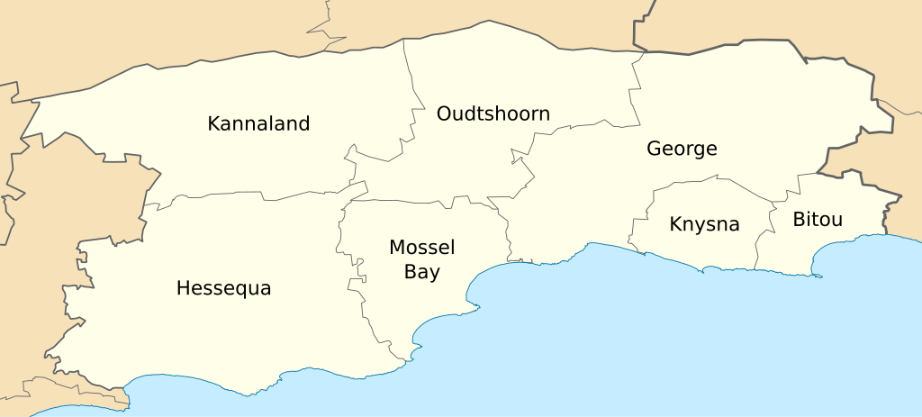
English: Map of the Eden District Municipality as of the municipal elections of 18 May 2011, with the constituent local municipalities labelled. |
| Date | |
| Source | Own work |
| Author | Htonl |
Licensing
[edit].svg&action=edit§ion=2)
I, the copyright holder of this work, hereby publish it under the following licenses:

|
Permission is granted to copy, distribute and/or modify this document under the terms of the GNU Free Documentation License, Version 1.2 or any later version published by the Free Software Foundation; with no Invariant Sections, no Front-Cover Texts, and no Back-Cover Texts. A copy of the license is included in the section entitled GNU Free Documentation License. |
This file is licensed under the Creative Commons Attribution-Share Alike 4.0 International, 3.0 Unported, 2.5 Generic, 2.0 Generic and 1.0 Generic license.
- You are free:
- to share – to copy, distribute and transmit the work
- to remix – to adapt the work
- Under the following conditions:
- attribution – You must give appropriate credit, provide a link to the license, and indicate if changes were made. You may do so in any reasonable manner, but not in any way that suggests the licensor endorses you or your use.
- share alike – If you remix, transform, or build upon the material, you must distribute your contributions under the same or compatible license as the original.
You may select the license of your choice.
File history
Click on a date/time to view the file as it appeared at that time.
| Date/Time | Thumbnail | Dimensions | User | Comment | |
|---|---|---|---|---|---|
| current | 20:48, 14 May 2011 | | 1,133 × 512 (227 KB) | Htonl (talk | contribs) | tweak |
| 22:42, 2 May 2011 |  | 1,133 × 512 (246 KB) | Htonl (talk | contribs) | == Summary == {{Information |Description ={{en|1=Map of the w:Eden District Municipality as of the municipal elections of 18 May 2011, with the constituent local municipalities labelled.}} |Source |
You cannot overwrite this file.
File usage on Commons
The following 2 pages use this file:
- File:Map of the Eden district with local municipalities labelled.svg (file redirect)
- File:Map of the local municipalities in the Eden district.svg (file redirect)
File usage on other wikis
The following other wikis use this file:
- Usage on af.wikipedia.org
- Usage on en.wikipedia.org
- Usage on es.wikipedia.org
- Usage on fr.wikipedia.org
- Usage on nso.wikipedia.org
.svg&oldid=450042986)