File:Mapa No. 32. Provincia de Llanquihue-7930039 (cropped).jpg
Jump to navigation
Jump to search

Size of this preview: 429 × 600 pixels. Other resolutions: 171 × 240 pixels | 343 × 480 pixels | 549 × 768 pixels | 732 × 1,024 pixels | 1,464 × 2,048 pixels | 3,146 × 4,400 pixels.
Original file (3,146 × 4,400 pixels, file size: 2.57 MB, MIME type: image/jpeg)
Captions
Captions
Add a one-line explanation of what this file represents
Summary[edit]
| Description |
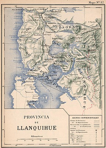
Español: Atlas de Chile Arreglado para la Jeografia Descriptiva de la Republica de Chile por Enrique Espinoza. |
| Date | |
| Source | http://www.davidrumsey.com/luna/servlet/view/search?sort=Pub_List_No_InitialSort%2CPub_Date%2CPub_List_No%2CSeries_No&q=espinoza+chile&search=Go |
| Author | Dibujado por F.A Fuentes L. para Atlas de Chile Arreglado para la Jeografia Descriptiva de la Republica de Chile por Enrique Espinoza. |
| Other versions |

.jpg&action=edit§ion=1)
Licensing[edit]
.jpg&action=edit§ion=2)
|
This work is in the public domain in its country of origin and other countries and areas where the copyright term is the author's life plus 70 years or fewer. This work is in the public domain in the United States because it was published (or registered with the U.S. Copyright Office) before January 1, 1929. | |
| This file has been identified as being free of known restrictions under copyright law, including all related and neighboring rights. | |
File history
Click on a date/time to view the file as it appeared at that time.
| Date/Time | Thumbnail | Dimensions | User | Comment | |
|---|---|---|---|---|---|
| current | 06:55, 8 July 2019 | | 3,146 × 4,400 (2.57 MB) | User-duck (talk | contribs) | File:Mapa No. 32. Provincia de Llanquihue-7930039.jpg cropped 17 % horizontally, 13 % vertically using CropTool with lossless mode. |
You cannot overwrite this file.
File usage on Commons
The following page uses this file:
File usage on other wikis
The following other wikis use this file:
- Usage on en.wikipedia.org
- Usage on es.wikipedia.org
.jpg&oldid=793929944)