File:Mapa Pucka i okolic - panoramio.jpg
Jump to navigation
Jump to search
Size of this preview: 401 × 600 pixels. Other resolutions: 160 × 240 pixels | 321 × 480 pixels | 513 × 768 pixels | 685 × 1,024 pixels | 1,712 × 2,560 pixels.
Original file (1,712 × 2,560 pixels, file size: 814 KB, MIME type: image/jpeg)
Captions
Captions
Add a one-line explanation of what this file represents
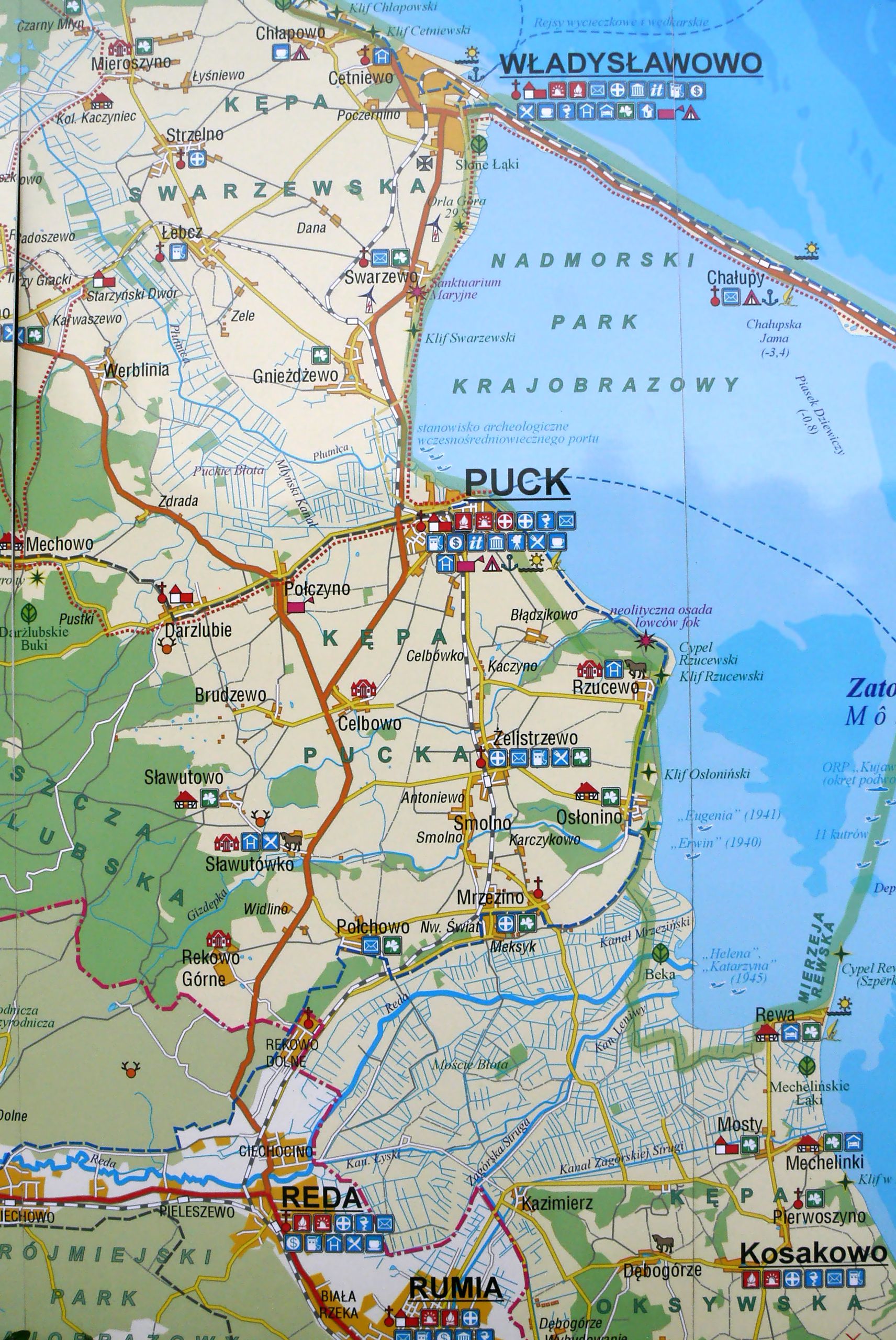
| Description | Mapa Pucka i okolic | ||
| Date | Taken on 13 July 2008 | ||
| Source | https://web.archive.org/web/20161012083325/http://www.panoramio.com/photo/13434086 | ||
| Author | Oscar Arky | ||
| Permission (Reusing this file) |
This file is licensed under the Creative Commons Attribution 3.0 Unported license. Attribution: Oscar Arky
|
| Camera location | | View this and other nearby images on: OpenStreetMap |
|---|
File history
Click on a date/time to view the file as it appeared at that time.
| Date/Time | Thumbnail | Dimensions | User | Comment | |
|---|---|---|---|---|---|
| current | 06:45, 20 June 2016 | | 1,712 × 2,560 (814 KB) | Panoramio upload bot (talk | contribs) | {{Information |description=Mapa Pucka i okolic |date={{Taken on|2008-07-13}} |source=http://www.panoramio.com/photo/13434086 |author=[http://www.panoramio.com/user/2169625?with_photo_id=13434086 Oscar Arky] |permission={{cc-by-3.0|Oscar Arky}} {{Panora... |
You cannot overwrite this file.
File usage on Commons
There are no pages that use this file.