File:Mapa Wejherowa.png

Original file (2,344 × 1,648 pixels, file size: 3.05 MB, MIME type: image/png)
Captions
Captions
Summary[edit]
| Description |
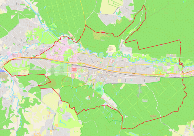
Polski: Mapa Wejherowa |
| Date | |
| Source | OpenStreetMap |
| Author | OpenStreetMap contributors |
| Description |
Polski: Mapa Wejherowa, Polska
English: Map of Wejherowo, Poland |
|||||||||
| Date | ||||||||||
| Source | You may find a page on the OpenStreetMap wiki page for Wejherowo | |||||||||
| Creator |
OpenStreetMap contributors OpenStreetMap contributors |
|||||||||
| Permission (Reusing this file) |
OpenStreetMap data is available under the Open Database License (details). Standard style map tiles are licensed as ODbL Produced Works.
|
|||||||||
| Geotemporal data | ||||||||||
| Bounding box |
|
|||||||||
| Georeferencing | If inappropriate please set warp_status = skip to hide. | |||||||||
Licensing[edit]
| This work contains information from OpenStreetMap, which is made available under the Open Database License (ODbL).
The ODbL does not require any particular license for maps produced from ODbL data. Prior to 1 August 2020, map tiles produced by the OpenStreetMap Foundation were licensed under the CC-BY-SA-2.0 license. Maps produced by other people may be subject to other licences. |
File history
Click on a date/time to view the file as it appeared at that time.
| Date/Time | Thumbnail | Dimensions | User | Comment | |
|---|---|---|---|---|---|
| current | 17:22, 30 November 2023 | | 2,344 × 1,648 (3.05 MB) | Smat (talk | contribs) | new |
| 19:26, 23 January 2013 |  | 973 × 939 (421 KB) | Bostary (talk | contribs) | User created page with UploadWizard |
You cannot overwrite this file.
File usage on Commons
The following page uses this file:
File usage on other wikis
The following other wikis use this file:
- Usage on pl.wikipedia.org
- Kalwaria Wejherowska
- Kościół św. Anny w Wejherowie
- Śmiechowo
- Wejherowo Nanice
- Wejherowo (stacja kolejowa)
- Parafia Najświętszej Maryi Panny Królowej Polski w Wejherowie
- Parafia Chrystusa Króla w Wejherowie
- Wejherowo Śmiechowo
- Synagoga w Wejherowie
- Nanice
- Plac Jakuba Wejhera w Wejherowie
- Cementownia (Wejherowo)
- Zamek (Wejherowo)
- Kaszubsko-Pomorska Szkoła Wyższa w Wejherowie
- Kolegiata Świętej Trójcy w Wejherowie
- Ratusz w Wejherowie
- Ulica Jana III Sobieskiego w Wejherowie
- Parafia Świętej Trójcy w Wejherowie
- Parafia św. Leona Wielkiego w Wejherowie
- Klasztor Franciszkanów w Wejherowie
- Kościół św. Leona Wielkiego i św. Stanisława Kostki w Wejherowie
- Parafia św. Anny w Wejherowie
- I Liceum Ogólnokształcące im. Króla Jana III Sobieskiego w Wejherowie
- Parafia wojskowa św. Wojciecha w Wejherowie
- Wspólnota Kościoła Chrześcijan Baptystów w Wejherowie
- Lądowisko Wejherowo
- Parafia św. Karola Boromeusza w Wejherowie
- Kościół Najświętszej Maryi Panny Królowej Polski w Wejherowie
- Pałac Przebendowskich w Wejherowie
- Wejherowskie Centrum Kultury
- Szpital Psychiatryczny w Wejherowie
- Muzeum Piaśnickie w Wejherowie
- Moduł:Mapa/dane/Wejherowo
- Wikipedysta:Dawid Schwann/Hufiec ZHP Wejherowo
- Wikipedysta:Wololo19/brudnopis
- Stary Cmentarz w Wejherowie
- Stadion WKS Gryf Wejherowo
- Bramy miejskie Wejherowa
- Pomnik Jakuba Wejhera w Wejherowie
- Czołg w Wejherowie
- Usage on pl.wikibooks.org