File:Mapa da OFC.png
Jump to navigation
Jump to search
No higher resolution available.
Mapa_da_OFC.png (164 × 143 pixels, file size: 6 KB, MIME type: image/png)
Captions
Captions
Add a one-line explanation of what this file represents
Summary
[edit]
| Description |
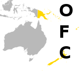
Português: Mapa com os países associados à OFC |
| Date | |
| Source | Versão de OFC-Map.png mostrando só a Oceania. |
| Author | Lennar |
Licensing
[edit]
| I, the copyright holder of this work, release this work into the public domain. This applies worldwide. In some countries this may not be legally possible; if so: I grant anyone the right to use this work for any purpose, without any conditions, unless such conditions are required by law. |
File history
Click on a date/time to view the file as it appeared at that time.
| Date/Time | Thumbnail | Dimensions | User | Comment | |
|---|---|---|---|---|---|
| current | 22:23, 22 November 2010 | | 164 × 143 (6 KB) | Lennar (talk | contribs) | {{Information |Description={{pt-br|1=Mapa com os países associados à OFC}} |Source=Versão de OFC-Map.png mostrando só a Oceania. |Author=Lennar |Date=22 de novembro de 2010 |Permission= |other_version |
You cannot overwrite this file.
File usage on Commons
There are no pages that use this file.
File usage on other wikis
The following other wikis use this file:
- Usage on pt.wikipedia.org
- Confederação de Futebol da Oceania
- Seleção Salomonense de Futebol
- Seleção Neozelandesa de Futebol
- Seleção Taitiana de Futebol
- Seleção Neocaledônia de Futebol
- Seleção Tonganesa de Futebol
- Seleção Cookense de Futebol
- Seleção Vanuatuense de Futebol
- Seleção Fijiana de Futebol
- Seleção Papuásia de Futebol
- Seleção Samoana de Futebol
- Seleção da Samoa Americana de Futebol
- Seleção da Samoa Americana de Futebol Feminino
- Seleção Cookense de Futebol Feminino
- Seleção Fijiana de Futebol Feminino
- Seleção Neocaledônia de Futebol Feminino
- Seleção Neozelandesa de Futebol Feminino
- Seleção Papuásia de Futebol Feminino
- Seleção Salomonense de Futebol Feminino
- Seleção Taitiana de Futebol Feminino
- Seleção Tonganesa de Futebol Feminino
- Seleção Vanuatuense de Futebol Feminino
- Seleção Quiribatiana de Futebol
- Seleção Nauruana de Futebol
- Seleção Palauana de Futebol
- Seleção Micronésia de Futebol
- Seleção Tuvaluana de Futebol
- Seleção Samoana de Futebol Feminino
- Federação de Futebol de Samoa
- Associação de Futebol da Papua-Nova Guiné
- Seleção Wallisense de Futebol
- Seleção Niueana de Futebol
- Campeonato Neozelandês de Futebol
- Usuário:Robertogilnei/Predefinições criadas
- Predefinição:Confederações da OFC
- Campeonato da Oceania de Futebol Feminino de 2007
- Federação de Futebol de Vanuatu
- Associação de Futebol das Ilhas Cook
- Associação de Futebol de Fiji
- Associação de Futebol das Ilhas Kiribati
- Associação de Futebol dos Estados Federados da Micronésia
- Associação de Futebol da Ilha de Niue
- Federação Neocaledônia de Futebol
- New Zealand Football
- Associação de Futebol de Palau
- Federação de Futebol das Ilhas Salomão
- Federação de Futebol da Samoa Americana
- Federação Taitiana de Futebol
- Associação de Futebol de Tonga
- Associação de Futebol das Ilhas Tuvalu
View more global usage of this file.