File:Mapa das zonas eleitorais de SP (2004).svg
Jump to navigation
Jump to search

Size of this PNG preview of this SVG file: 388 × 598 pixels. Other resolutions: 155 × 240 pixels | 311 × 480 pixels | 498 × 768 pixels | 664 × 1,024 pixels | 1,328 × 2,048 pixels | 400 × 617 pixels.
Original file (SVG file, nominally 400 × 617 pixels, file size: 534 KB)
Captions
Captions
Add a one-line explanation of what this file represents
Summary[edit]
.svg&action=edit§ion=1)
| Description |
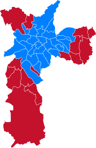
Português: Mapa das zonas eleitorais da cidade de São Paulo na eleição municipal de 2004 |
| Date | |
| Source | Own work/https://fotografia.folha.uol.com.br/galerias/10580-vencedores-por-zona-eleitoral-em-sp |
| Author | MatheusAlmeidadosSantos |
Licensing[edit]
.svg&action=edit§ion=2)
I, the copyright holder of this work, hereby publish it under the following license:
This file is licensed under the Creative Commons Attribution-Share Alike 4.0 International license.
- You are free:
- to share – to copy, distribute and transmit the work
- to remix – to adapt the work
- Under the following conditions:
- attribution – You must give appropriate credit, provide a link to the license, and indicate if changes were made. You may do so in any reasonable manner, but not in any way that suggests the licensor endorses you or your use.
- share alike – If you remix, transform, or build upon the material, you must distribute your contributions under the same or compatible license as the original.
File history
Click on a date/time to view the file as it appeared at that time.
| Date/Time | Thumbnail | Dimensions | User | Comment | |
|---|---|---|---|---|---|
| current | 20:53, 20 January 2021 | | 400 × 617 (534 KB) | MatheusAlmeidadosSantos (talk | contribs) | versão com zonas eleitorais correspondentes à época |
| 00:37, 7 January 2021 |  | 400 × 617 (600 KB) | MatheusAlmeidadosSantos (talk | contribs) | Cross-wiki upload from pt.wikipedia.org |
You cannot overwrite this file.
File usage on Commons
There are no pages that use this file.
File usage on other wikis
The following other wikis use this file:
- Usage on en.wikipedia.org
- Usage on pt.wikipedia.org
.svg&oldid=623048489)