File:Mapa de Chile.svg
跳至導覽
跳至搜尋

此 SVG 檔案的 PNG 預覽的大小:120 × 600 像素。 其他解析度:48 × 240 像素 | 96 × 480 像素 | 153 × 768 像素 | 204 × 1,024 像素 | 409 × 2,048 像素 | 400 × 2,000 像素。
原始檔案 (SVG 檔案,表面大小:400 × 2,000 像素,檔案大小:2.84 MB)
說明
說明
添加單行說明來描述出檔案所代表的內容
| 描述 |
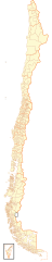
Español: Mapa contemporáneo de Chile, dividido en regiones y comunas. |
| 日期 | |
| 來源 | 自己的作品 |
| 作者 | B1mbo |
| 授權許可 (重用此檔案) |
我,本作品的著作權持有者,決定用以下授權條款發佈本作品: 此檔案採用創用CC 姓名標示-相同方式分享 2.5 通用版授權條款。
|
| SVG開發 |
| Legal disclaimer
The edition and circulation of maps, geographic charts and other documents about the boundaries and frontiers of Chile, don't have any relation with the Republic of Chile, according to the Article 2 g) of DFL Nº83 of 1979 of the Ministery of Foreign Affairs. |
我,本作品的著作權持有者,決定用以下授權條款發佈本作品:

|
已授權您依據自由軟體基金會發行的無固定段落、封面文字和封底文字GNU自由文件授權條款1.2版或任意後續版本,對本檔進行複製、傳播和/或修改。該協議的副本列在GNU自由文件授權條款中。 |
This file is licensed under the Creative Commons Attribution-Share Alike Attribution-Share Alike 4.0 International, 3.0 Unported, 2.5 Generic, 2.0 Generic and 1.0 Generic license.
- 您可以自由:
- 分享 – 複製、發佈和傳播本作品
- 重新修改 – 創作演繹作品
- 惟需遵照下列條件:
- 姓名標示 – 您必須指名出正確的製作者,和提供授權條款的連結,以及表示是否有對內容上做出變更。您可以用任何合理的方式來行動,但不得以任何方式表明授權條款是對您許可或是由您所使用。
- 相同方式分享 – 如果您利用本素材進行再混合、轉換或創作,您必須基於如同原先的相同或兼容的條款,來分布您的貢獻成品。
您可以選擇您需要的授權條款。
檔案歷史
點選日期/時間以檢視該時間的檔案版本。
| 日期/時間 | 縮圖 | 尺寸 | 使用者 | 備註 | |
|---|---|---|---|---|---|
| 目前 | 2021年1月29日 (五) 19:56 | 400 × 2,000(2.84 MB) | James2813(留言 | 貢獻) | Reverted to version as of 22:52, 5 September 2018 (UTC) El rectángulo corresponde al Acuerdo de 1998. | |
| 2020年3月14日 (六) 20:43 | 400 × 2,000(2.84 MB) | CarlosArturoAcosta(留言 | 貢獻) | Retiro rectángulo con relleno blanco en la parte inferior del mapa | ||
| 2018年9月5日 (三) 22:52 | 400 × 2,000(2.84 MB) | Janitoalevic(留言 | 貢獻) | Ñuble Region | ||
| 2009年1月16日 (五) 12:12 | 400 × 2,000(2.71 MB) | Gvf(留言 | 貢獻) | |||
| 2007年10月3日 (三) 03:13 | 400 × 2,000(2.71 MB) | B1mbo(留言 | 貢獻) | {{Information |Description= {{es|Mapa de Chile, dividido en regiones y comunas.}} |Source=own work |Date=2 de octubre de 2007 |Author=B1mbo |Permission={{self|cc-by-sa-2.5}} |other_versions= }} {{Chilean map|User:B1mbo}} [[Category:SVG |
無法覆蓋此檔案。
檔案用途
下列13個頁面有用到此檔案:
- File:COVID-19 pandemic by commune, density (2020-05-29).svg
- File:División electoral de Chile (1989-2013).svg
- File:División electoral de Chile (2017).svg
- File:Estados de excepción constitucional en Chile (octubre 2019).svg
- File:Mapa de Chile (1928).svg
- File:Mapa de Chile (1928, provincias).svg
- File:Mapa de Chile (1929).svg
- File:Mapa de Chile (1929, provincias).svg
- File:Mapa de Chile (provincias).svg
- File:Mapa de Chile (regiones).svg
- File:Mapa rhinella arunco.svg
- File:Resultados Plebiscito 1988 por comuna.svg
- Template:División política de Chile
.svg)
.svg)
.svg)
.svg)
.svg)
.svg)
.svg)
.svg)
.svg)
.svg)
全域檔案使用狀況
以下其他 wiki 使用了這個檔案:
- es.wikipedia.org 的使用狀況
- Organización territorial de Chile
- Comunas de Chile
- Wikiproyecto Discusión:Chile/Archivo/2007/01
- Elección presidencial de Chile de 2009-2010
- Elecciones municipales de Chile de 2008
- Anexo:Elecciones parlamentarias en la Región del Biobío de 2009
- Anexo:Elecciones parlamentarias en la Región de Arica y Parinacota de 2009
- Anexo:Elecciones parlamentarias en la Región de O'Higgins de 2009
- Anexo:Elecciones parlamentarias en la Región de Magallanes de 2009
- Anexo:Elecciones parlamentarias en la Región de Coquimbo de 2009
- no.wikipedia.org 的使用狀況
- pt.wikipedia.org 的使用狀況
- ro.wikipedia.org 的使用狀況
- sco.wikipedia.org 的使用狀況
- zh.wikipedia.org 的使用狀況