File:Mapa de Etiopia, 1850-es.svg
Jump to navigation
Jump to search

Size of this PNG preview of this SVG file: 651 × 596 pixels. Other resolutions: 262 × 240 pixels | 524 × 480 pixels | 839 × 768 pixels | 1,119 × 1,024 pixels | 2,237 × 2,048 pixels.
Original file (SVG file, nominally 651 × 596 pixels, file size: 1.61 MB)
Captions
Captions
Add a one-line explanation of what this file represents
Summary[edit]
| Description |
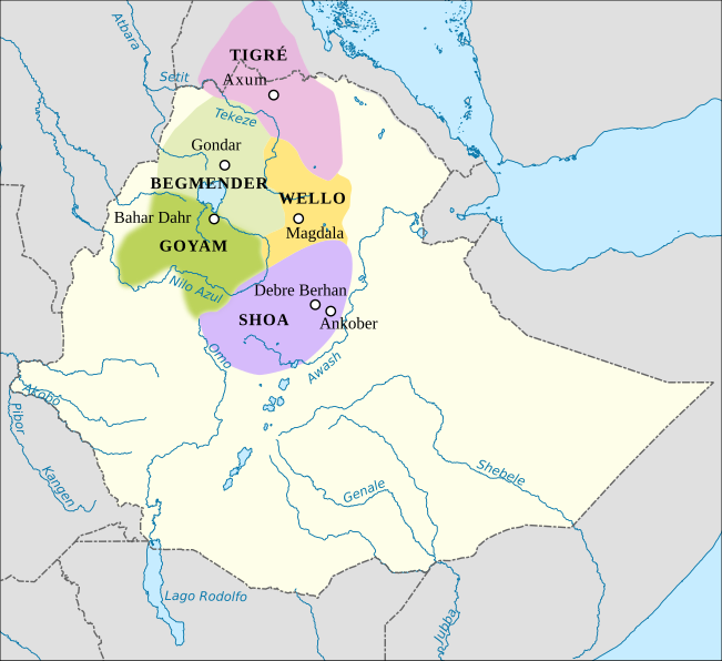
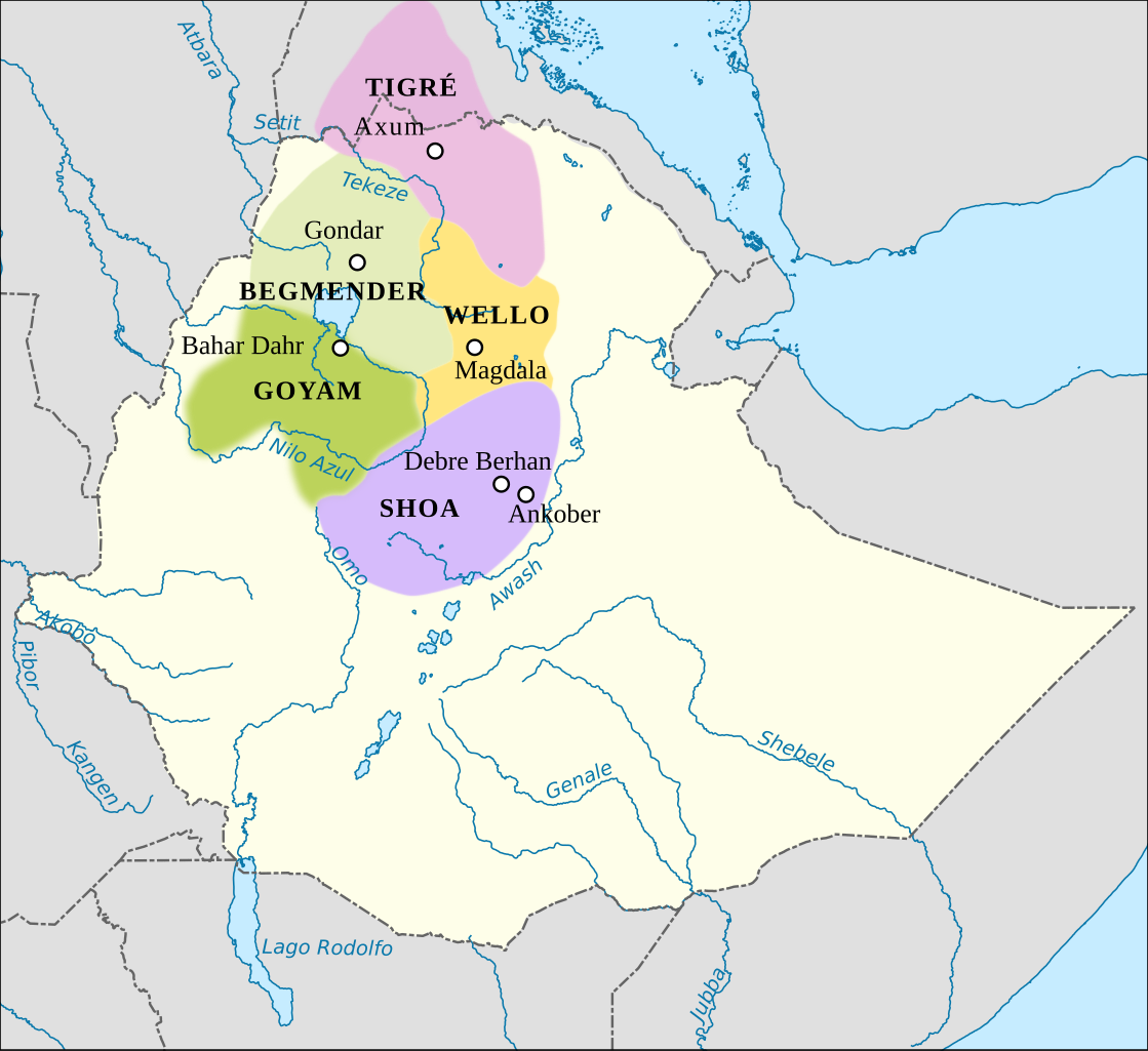
English: Ethiopia around 1850 |
| Date | 18 July 2018 (original upload date) |
| Source |
(Original text : EPSG: 4326
|
| Author | Rowanwindwhistler |
| Permission (Reusing this file) |
File:Ethiopia_Map-1850.jpg |
Licensing[edit]
This file is licensed under the Creative Commons Attribution-Share Alike 4.0 International license.
- You are free:
- to share – to copy, distribute and transmit the work
- to remix – to adapt the work
- Under the following conditions:
- attribution – You must give appropriate credit, provide a link to the license, and indicate if changes were made. You may do so in any reasonable manner, but not in any way that suggests the licensor endorses you or your use.
- share alike – If you remix, transform, or build upon the material, you must distribute your contributions under the same or compatible license as the original.
Original upload log[edit]
The original description page was here. All following user names refer to en.wikipedia.
| Date/Time | Dimensions | User | Comment |
|---|---|---|---|
| 2018-07-18 11:39 | 651×596× (1691977 bytes) | Rowanwindwhistler | Uploading a file from a free published source using [[Wikipedia:File_Upload_Wizard|File Upload Wizard]] |
File history
Click on a date/time to view the file as it appeared at that time.
| Date/Time | Thumbnail | Dimensions | User | Comment | |
|---|---|---|---|---|---|
| current | 13:54, 25 July 2018 | | 651 × 596 (1.61 MB) | Althair (talk | contribs) | Transferred from en.wikipedia via #commonshelper |
You cannot overwrite this file.
File usage on Commons
There are no pages that use this file.
File usage on other wikis
The following other wikis use this file:
- Usage on de.wikipedia.org
- Usage on es.wikipedia.org