File:Mapa proposto gesni.jpg
Jump to navigation
Jump to search
No higher resolution available.
Mapa_proposto_gesni.jpg (604 × 557 pixels, file size: 163 KB, MIME type: image/jpeg)
Captions
Captions
Add a one-line explanation of what this file represents
Summary
[edit]
| Description |
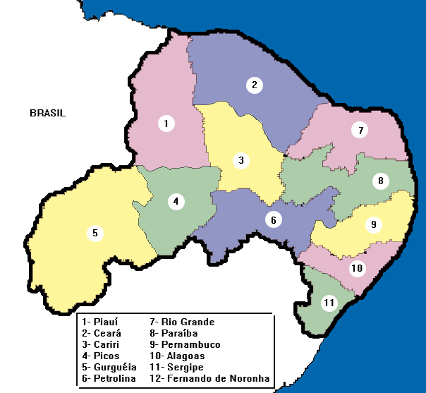
English: Map proposed by Prof. Dr. Jacques Ribemboim for an independent country formed by northeast states of Brazil.
Português: Mapa proposto pelo Prof. Dr. Jacques Ribemboim para um país independente formado por estados do nordeste do Brasil. |
| Source | Own work |
| Author | Gesni |
Licensing
[edit]
| I, the copyright holder of this work, release this work into the public domain. This applies worldwide. In some countries this may not be legally possible; if so: I grant anyone the right to use this work for any purpose, without any conditions, unless such conditions are required by law. |
File history
Click on a date/time to view the file as it appeared at that time.
| Date/Time | Thumbnail | Dimensions | User | Comment | |
|---|---|---|---|---|---|
| current | 19:50, 6 June 2011 | | 604 × 557 (163 KB) | Gesni (talk | contribs) | {{Information |Description ={{en|1=Map proposed by Prof. Dr. Jacques Ribemboim for an independent country formed by northeast states of Brazil.}} {{pt|1=Mapa proposto pelo Prof. Dr. Jacques Ribemboim para um país independente formado por estados do no |
You cannot overwrite this file.
File usage on Commons
There are no pages that use this file.
File usage on other wikis
The following other wikis use this file:
- Usage on pt.wikipedia.org